 |
      |
| Home > Oregon > Diamond Mill |
Diamond Mill OHV Area
Tuesday, March 5, 2024
| Other Names | Jordan Cr. & Diamond Mill, Jordan Creek, Jordan Creek OHV Area, Tillamook State Forest, North Fork Wilson River, Jones Creek, Runyon Creek, Cobmaster, Deerfence, Elk Wallow Rd, Smith Homestead Day Use Area |
| Last Known Status | Open |
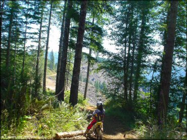
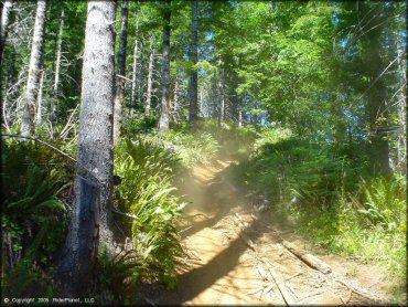
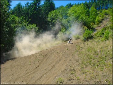
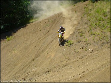
From the novice play ride area surrounding the campground, to the logging runs to the peak with great views, to the deep woods single track, to the steepest crustiest climbs in Tillamook, this area has something for everyone.
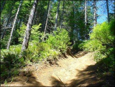
The upper trails are narrow and difficult with very few chances to turn around. Motorized trails are marked and rated on trail maps and kiosks, but not necessarily on the trails themselves, and regions of the area close with changing fire, logging, and ecological conditions, so pay attention.
The most inviting swimming hole you'll ever see sits in the back right corner of staging area (under the wooden arch bridge) with crystal clear water, smooth rocks, and natural stone steps. There are more swimming areas in the surrounding park as well.
This area gets busy on weekends and only a couple of the camping sites have picnic tables and shade, but you can have the whole place to yourself mid-week. With cheap camping, a wide range of difficulty, and new trails being added periodically, this park is an all around winner for the family.
REGULATIONS
| Permit Required | Yes | Oregon ATV Permit stickers required |
| Dates Open | Year-Round except during fire season (riding is discouraged during rainy season - call (503) 815-7024 for trail conditions). | |
| Other ATV Stickers Accepted | Yes | An operating permit issued for another state will be honored, but only if the issuing state also honors Oregon operating permits. (As of October 1, 2021, Oregon no longer honors stickers from Washington.) (AZ, CA, ID, IN, MO, NV, PA, SC, UT, VT) |
| Spark Arrestor | Yes | A spark arresting exhaust silencer or end cap is required for all vehicles. |
| Noise Limit | Yes (99 dB) | Oregon ATV noise limits apply (all vehicles limit 99 dB) |
| Whip Flags | Not Required | |
| Maximum Vehicle Width | ||
 Motorcycles & Dirt Bikes Motorcycles & Dirt Bikes | Permitted | |
 ATVs ATVs | Permitted | Not Recommended trails are narrow |
 UTV & SXS UTV & SXS | Permitted | Not Recommended trails are narrow |
 4x4 & Jeeps (registered) 4x4 & Jeeps (registered) | Some Areas | Not Recommended most trails are too narrow for 4x4 |
| Dune Buggy & Sand Rail 4x4 (unregistered) | Some Areas | Oregon ATV Permit stickers required |
| 2 Stroke Engines | No Restriction | |
| MX Helmet Required | Youth Only | required for persons under 18 by state law (RiderPlanet strongly recommends helmets for all riders.) |
 Camping Camping | Some Areas | (camp in developed sites only) |
 Campfires Campfires | Some Areas | (permitted in developed campsites only) |
| Night Riding | No | quiet hours 10p.m. |
| Trail Blazing | Prohibited | keep on designated trails |
| Alcohol | No Restriction | |
| Rule Enforcement | Few/Periodic | Jeep/SUV Patrol |
TERRAIN
| Approx Size | 19,840 acres (31 sq mi) | |
| Miles Of Trail | 100 | |
| Climate Type | Forest | |
| Elevation | 1500 to 2700 ft. | |
| Trail Maintenance | Not Marked, Not Rated, Not Maintained | |
| Loose Dirt |  Some Some | |
| Hard Pack | Some | |
| Sand |  None None | |
| Mud |  Little Little | |
| Dust | Little | |
| Rocks | Some | |
| Trees |  All All | |
| Steep Hills |  Many Many | |
| Water Crossings | None | |
| Small Jumps |  Few Few | |
| Large Jumps | Few | |
| Berms | Some | |
| Sand/Gravel Pits | Few | |
| Single Track | Some | |
| Roads | Few | |
| Intersections | Few | |
| Rider Traffic | Few | |
| Shade | Many | trails are shady, only a few of the campsites have good shade |
| Ranges/Gunfire | Few | |
| Hazards | Some | (hazards not marked) steep & narrow trails, some logging activity |
 Novice Novice | Little | |
 Amateur Amateur | Some | |
 Expert Expert |  Mostly Mostly | |
| Comment | Most trails are steep and narrow, dirt bikes only. Trails that are around the staging area are easy and perfect for ATV use. | |
TYPE OF AREA
| Area | Motorized Trails |
| Land | State Forest |
GPS POINTS


KEY SERVICES
 Gasoline Gasoline | 20-30 Miles (W) | Tillamook Shell & Grocery (503) 842-5555 |
| Diesel | 20-30 Miles (W) | Tillamook Shell & Grocery (503) 842-5555 |
 Water Water | On Site | non-potable water nearby creek offers clean water, non-potable |
 RV Hookup RV Hookup | 20-30 Miles (W) | Pacific Campground & RV Park (503) 842-5201 |
 RV Disposal RV Disposal | 20-30 Miles (W) | Pacific Campground & RV Park (503) 842-5201 |
| Campground | On Site | |
 Conv Store Conv Store | 20-30 Miles (W) | Center Market (503) 842-6581 |
FEES & PASSES
| Parking | (None) |
| Entry | (None) |
| Riding | (None) |
| Camping | Yes Tent: $5.00 RV: $5.00 Addtl. Vehicle: $5.00 Camping fee is $5/night/vehicle. Group Sites are $50/night. |
| Comment | Contact Tillamook State Forest for current campground fees - (503) 357-2191. |
RATINGS
| Pros | technical single track trails, great swimming holes that are next to staging area, crystal clear water, easy atv trails that surround campground |
| Cons | only a few sites have a picnic tables and shade, crowded on weekends |
| Our Rating |  Very Good Very Good |
| Recommended Stay | 1-2 Days |
| Comments | (Scroll Down For Rider Reviews & Comments) |
DRIVING DIRECTIONS
| Nearest City | Tillamook, OR | ||
| Address | N Fork Wilson River Road, Tillamook, OR 97141 | ||
| From: Portland, OR
1) 26 west to 6 west 2) Continue on 6 west to mile post 22.8 3) Turn north on North Fork Road 4) Follow signs to Diamond Mill staging area. |


OFFICIAL CONTACTS
| Contact Info | Oregon Department of Forestry - Tillamook District 5005 3rd Street Tillamook, OR 97141 (503) 842-2545 (503) 842-2548 awhite@odf.state.or.us kskinner@odf.state.or.us www.oregon.gov |
| Contact Info | Oregon ATV Safety Education Card (877) 772-3359 atv.info@state.or.us www.oregon.gov |
| Contact Info | Oregon State Parks Online Store 725 Summer Street NE, Suite C Salem, OR 97301 (800) 551-6949 park.info@oregon.gov store.oregonstateparks.org |
Diamond Mill Trail Photo
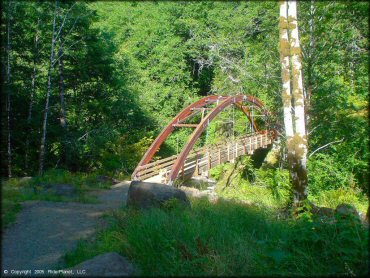
This bridge leads from the staging area over a natural swimming hole to a non-motorized, but scenic hiking trail.
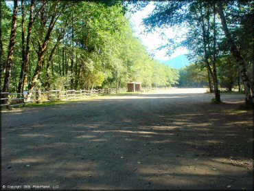
Diamond Mill Trail Photo
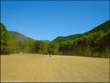
Main staging area.
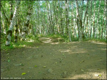
Diamond Mill Trail Photo
Diamond Mill Trail Photo
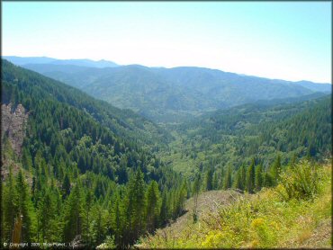
Diamond Mill Trail Photo
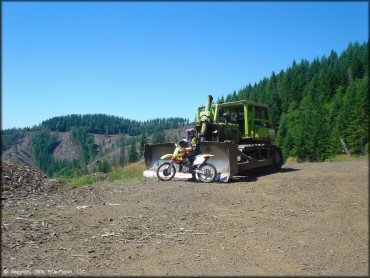
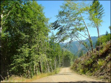
Logging activity is still common here; watch out for oncoming trucks and bulldozers.
Diamond Mill Trail Photo
Diamond Mill Trail Photo
Diamond Mill Trail Photo
Diamond Mill Trail Photo
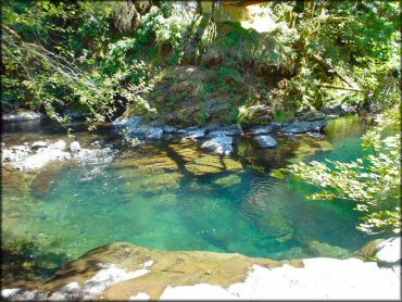
The swimming hole.
Diamond Mill Trail Photo
Diamond Mill Trail Photo
Diamond Mill Trail Photo
Diamond Mill Trail Photo
Diamond Mill Trail Photo
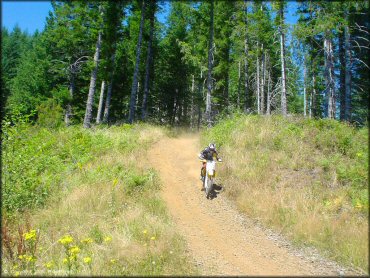
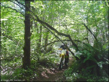
Diamond Mill Trail Photo
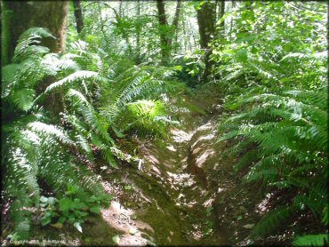
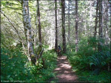
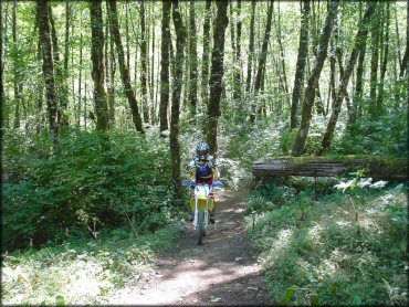
Tight and technical single track is plentiful in this ride area.
Diamond Mill Trail Photo
Diamond Mill Trail Photo
Diamond Mill Trail Photo
RIDER COMMENTS & REVIEWS