 |
      |
| Home > Oregon > Huckleberry Flats |
Huckleberry Flats OHV Trails
Monday, August 18, 2025
| Other Names | Huckleberry Mountain, Salal Creek, Eighth Creek, Huckleberry Creek, Willamette River, Tumble Creek, Vista Hill, Powell's Hill, Doug's Downhill |
| Last Known Status | Open |
About 30 miles of marked and rated ATV trails can be found here in the center of a beautiful and dense conifer forest. There are a few motorcycle-only trails that are designed to be one way.
Camping is not permitted at the main staging but dispersed camping is allowed. The staging area has leveled gravel parking with picnic tables, a vault toliet and information kiosk.
Trails are open year-round but may close temporarily during fire season, which generally begins around July through late August. Exact dates vary so check with the Middle Fork Ranger District before heading out.
REGULATIONS
| Permit Required | Yes | Oregon ATV Permit stickers required |
| Dates Open | Open daily except during fire season. | |
| Other ATV Stickers Accepted | Yes | An operating permit issued for another state will be honored, but only if the issuing state also honors Oregon operating permits. (As of October 1, 2021, Oregon no longer honors stickers from Washington.) (AZ, CA, ID, IN, MO, NV, PA, SC, UT, VT) |
| Spark Arrestor | Yes | A spark arresting exhaust silencer or end cap is required for all vehicles. |
| Noise Limit | Yes (99 dB) | |
| Whip Flags | Not Required | |
| Maximum Vehicle Width | Yes (65 inches) | narrow terrain UTVs under 1800lbs dry weight and 65 inches wide permitted |
 Motorcycles & Dirt Bikes Motorcycles & Dirt Bikes | Permitted | |
 ATVs ATVs | Permitted | |
 UTV & SXS UTV & SXS | Some Areas | (maximum width 65 inches) UTVs permitted on designated trails |
 4x4 & Jeeps (registered) 4x4 & Jeeps (registered) | Prohibited | |
| Dune Buggy & Sand Rail 4x4 (unregistered) | Prohibited | Oregon ATV Permit stickers required |
| 2 Stroke Engines | No Restriction | |
| MX Helmet Required | Youth Only | required for persons under 18 by state law (RiderPlanet strongly recommends helmets for all riders.) |
 Camping Camping | Prohibited | Main staging area is day use only. |
 Campfires Campfires | ||
| Night Riding | Yes | |
| Trail Blazing | Prohibited | keep vehicle on trail |
| Rule Enforcement |
TERRAIN
| Approx Size | 7,040 acres (11 sq mi) | |
| Miles Of Trail | 30 | |
| Climate Type | Forest | |
| Elevation | 2400 to 2700 ft. | |
| Trail Maintenance | Marked, Rated, Heavily Maintained | |
| Loose Dirt |  Mostly Mostly | |
| Hard Pack |  Little Little | |
| Sand |  None None | |
| Mud |  Some Some | |
| Dust | Little | |
| Rocks | Little | |
| Trees |  All All | |
| Steep Hills | Some | |
| Water Crossings | None | |
| Small Jumps | None | |
| Large Jumps | None | |
| Berms | Some | |
| Sand/Gravel Pits | None | |
| Single Track | Some | |
| Roads | Some | |
| Shade | All | |
| Hazards |  Few Few | (hazards assumed marked but use caution) |
 Novice Novice | Some | |
 Amateur Amateur | Mostly | |
 Expert Expert | Little |
TYPE OF AREA
| Area | Motorized Trails |
| Land | National Forest |


KEY SERVICES
 Gasoline Gasoline | 5-20 Miles (SW) | Shell (541) 782-3909 |
| Diesel | 5-20 Miles (SW) | Shell (541) 782-3909 |
 Water Water | 5-20 Miles (SW) | Oakridge RV Park (541) 782-2611 |
 RV Hookup RV Hookup | 5-20 Miles (SW) | Oakridge RV Park (541) 782-2611 |
 RV Disposal RV Disposal | 5-20 Miles (SW) | Oakridge RV Park (541) 782-2611 |
| Campground | 5-20 Miles (S) | Packard Creek Campground (541) 782-2283 |
 Conv Store Conv Store | 5-20 Miles (SW) | Ed Staub & Sons Oak Ridge Convenient Store (541) 782-1885 |
FEES & PASSES
| Parking | (None) |
| Entry | (None) |
| Riding | (None) |
| Camping | (None) |
RATINGS
| Our Rating |  Good Good |
| Recommended Stay | Full Day |
| Comments | (Scroll Down For Rider Reviews & Comments) |
DRIVING DIRECTIONS
| Nearest City | Oakridge, OR | ||
| From: Springfield, OR
1) Take I-5 South to Exit 188A 2) Continue straight off the exit ramp on SR-58 east, continue about 35 miles 3) Turn left (north) on Crestview Street, continue .2 miles 4) Turn right (east) on E. 1st Street, continue .4 miles 5) Turn left (north) on Oak Street, continue 1 block 6) Turn right on E. 2nd Street, continue 1 block 7) Veer left on Westoak Road, continue about 10 miles (Westoak Road eventually turns into High Prairie Road) 8) Staging area is on the left. |


OFFICIAL CONTACTS
| Contact Info | Willamette National Forest - Middle Fork Ranger District 46375 Highway 58 Westfir, OR 97492 (541) 782-2283 sm.fs.mf@usda.gov www.fs.usda.gov |
| Contact Info | Oregon ATV Safety Education Card (877) 772-3359 atv.info@state.or.us www.oregon.gov |
| Contact Info | Emerald Trail Riders Association, Inc. P.O. Box 41617 Eugene, OR 97404 jared@etra.net |
| Contact Info | Oregon State Parks Online Store 725 Summer Street NE, Suite C Salem, OR 97301 (800) 551-6949 park.info@oregon.gov store.oregonstateparks.org |
Huckleberry Flats Trail Photo
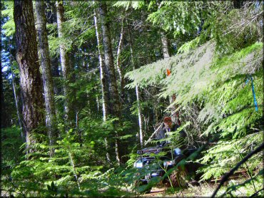
Photo Submitted 5/29/2012 (Thanks!)
Huckleberry Flats Trail Photo
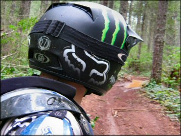
Photo Submitted 4/25/2012 (Thanks!)
Huckleberry Flats Trail Photo

Photo Submitted 8/22/2012 (Thanks!)
Huckleberry Flats Trail Photo
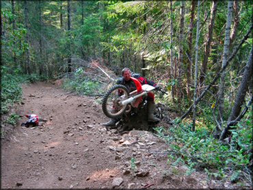
Photo Submitted 9/22/2012 (Thanks!)
RIDER COMMENTS & REVIEWS