 |
      |
| Home > Oregon > John's Peak |
John's Peak OHV Area
Saturday, December 23, 2023
| Other Names | Cane Creek Road, Jackson Creek, Jacksonville Reservoir, MRA, Boise Cascade, Johns Peak, Timber Mountain OHV Area |
| Last Known Status | Open |
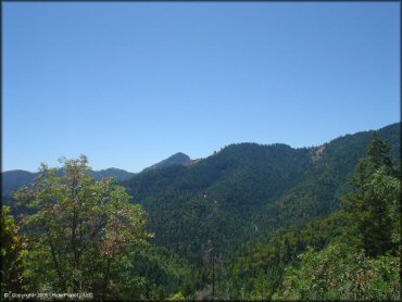
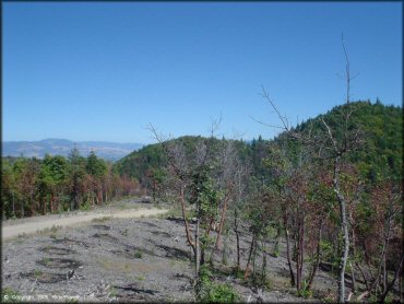
This system of trails offers over 16,000 acres of motorcycle loops of varying degrees of difficulty. With lots of single track, and very little traffic, this secluded area offers some decent scenery. Recent improvements include new vault toilets added to the upper staging area and a helicopter landing pad for emergencies. Keep your eye out for hidden log cabins, abandoned mines, old lumbermills, deer, coyote, bears, and cougars. Be sure to thank the Motorcycle Riders Association for maintaining and adding new trails.
REGULATIONS
| Permit Required | Yes | Oregon ATV Permit stickers required |
| Dates Open | Daily except during fire season (July through August). Exact dates vary. | |
| Other ATV Stickers Accepted | Yes | An operating permit issued for another state will be honored, but only if the issuing state also honors Oregon operating permits. (As of October 1, 2021, Oregon no longer honors stickers from Washington.) (AZ, CA, ID, IN, MO, NV, PA, SC, UT, VT) |
| Spark Arrestor | Yes | A spark arresting exhaust silencer or end cap is required for all vehicles. |
| Noise Limit | Yes (99 dB) | Oregon ATV noise limits apply (all vehicles limit 99 dB) |
| Whip Flags | Not Required | |
| Maximum Vehicle Width | ||
 Motorcycles & Dirt Bikes Motorcycles & Dirt Bikes | Permitted | |
 ATVs ATVs | Permitted | Not Recommended |
 UTV & SXS UTV & SXS | Some Areas | Not Recommended |
 4x4 & Jeeps (registered) 4x4 & Jeeps (registered) | Some Areas | Not Recommended |
| Dune Buggy & Sand Rail 4x4 (unregistered) | Prohibited | Oregon ATV Permit stickers required |
| 2 Stroke Engines | No Restriction | |
| MX Helmet Required | Youth Only | required for persons under 18 by state law (RiderPlanet strongly recommends helmets for all riders.) |
 Camping Camping | No Restriction | (camp anywhere) |
 Campfires Campfires | No Restriction | |
| Night Riding | Unknown | Not Recommended trails are very narrow and have a lot of ruts |
| Trail Blazing | Prohibited | stay on designated trails |
| Alcohol | No Restriction | |
| Rule Enforcement | None |
TERRAIN
| Approx Size | 16,375 acres (26 sq mi) | |
| Miles Of Trail | 600 | |
| Climate Type | Forest | |
| Elevation | 2000 to 4350 ft. | |
| Trail Maintenance | Not Marked, Not Rated, Lightly Maintained | |
| Loose Dirt |  Some Some | |
| Hard Pack | Some | |
| Sand |  Little Little | |
| Mud |  Mostly Mostly | lots & lots of ruts - must get muddy there |
| Dust | Little | |
| Rocks | Little | |
| Trees |  Many Many | |
| Steep Hills | Some | |
| Water Crossings |  Few Few | |
| Small Jumps | Some | |
| Large Jumps | Few | |
| Berms | Few | |
| Sand/Gravel Pits | Few | |
| Single Track | Many | |
| Roads | Few | |
| Intersections | Few | |
| Rider Traffic | Few | |
| Shade | Many | |
| Ranges/Gunfire | Few | |
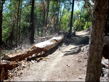
| Hazards | Few | (hazards not marked) narrow trails, deep ruts |
 Novice Novice | Some | |
 Amateur Amateur | Mostly | |
 Expert Expert | Some | |
| Comment | many deep ruts, narrow trails | |
TYPE OF AREA
| Area | Motorized Trails |
| Land | BLM, Private |


KEY SERVICES
 Gasoline Gasoline | 1-5 Miles (E) | Jacksonville Shell Food Mart (541) 899-7761 |
| Diesel | 1-5 Miles (E) | Jacksonville Shell Food Mart (541) 899-7761 |
 Water Water | 1-5 Miles (E) | potable water Covered Wagon Trailer Park (541) 899-1022 |
 RV Hookup RV Hookup | 1-5 Miles (E) | Covered Wagon Trailer Park (541) 899-1022 |
 RV Disposal RV Disposal | 1-5 Miles (E) | Covered Wagon Trailer Park (541) 899-1022 |
| Campground | On Site | primitive onsite camping, nearby: Covered Wagon Trailer Park |
 Conv Store Conv Store | 1-5 Miles (E) | Jacksonville Shell Food Mart (541) 899-7761 |
FEES & PASSES
| Parking | (None) |
| Entry | (None) |
| Riding | (None) |
| Camping | (None) |
RATINGS
| Pros | lots of trails, much single track on narrow stuff, little traffic, secluded, decent scenery |
| Cons | dry & hard in many spots, huge ruts, no signs to lead you to staging area |
| Our Rating |  Very Good Very Good |
| Recommended Stay | Full Day |
| Comments | (Scroll Down For Rider Reviews & Comments) |
DRIVING DIRECTIONS
| Nearest City | Jacksonville, OR | ||
| From: Medford, OR
1) Take 238 west to Jacksonville 2) After passing through downtown area, turn right on Jacksonville Reservoir Road (same intersection as "Pair A Dice Road", except take the dirt road that runs diagonally) 3) Follow the road (bear right at any forks) about 3 miles to staging/parking. |


OFFICIAL CONTACTS
| Contact Info | BLM - Medford Office 3040 Biddle Road Medford, OR 97504 (541) 618-2200 medford_mail@blm.gov www.blm.gov |
| Contact Info | Motorcycle Riders Association of Medford, Oregon P.O. Box 1471 Medford, OR 97501 www.motorcycleridersassociation.org |
| Contact Info | Oregon ATV Safety Education Card (877) 772-3359 atv.info@state.or.us www.oregon.gov |
| Contact Info | Oregon Motorcycle Riders Association P.O. Box 2984 Tualatin, OR 97062 (503) 572-1400 admin@omraoffroad.com www.omraoffroad.com |
| Contact Info | Oregon State Parks Online Store 725 Summer Street NE, Suite C Salem, OR 97301 (800) 551-6949 park.info@oregon.gov store.oregonstateparks.org |
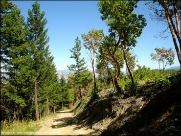
John's Peak Trail Photo
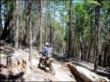
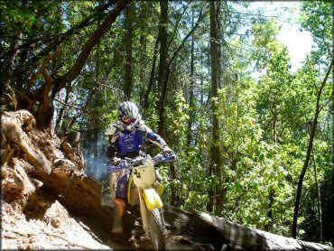
There are a few steep sections, but since most trails form a loop you don't have to go back up the same way.
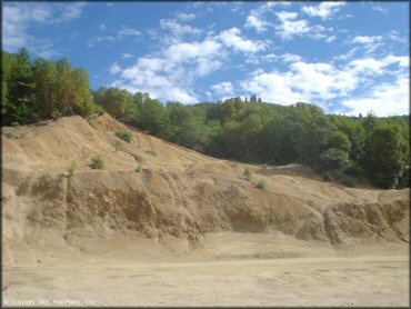
John's Peak Trail Photo
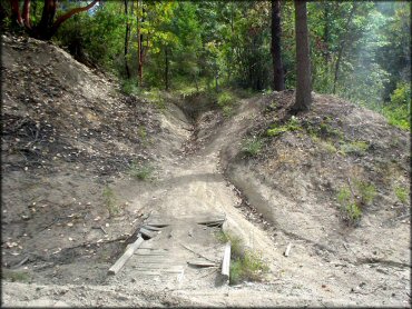
John's Peak Trail Photo
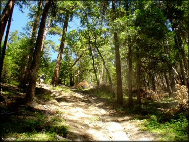
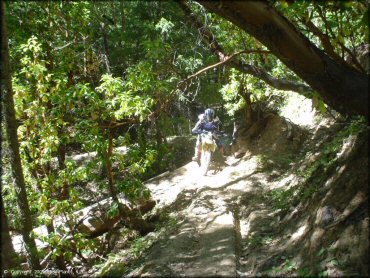
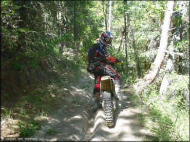
Most of the single track is very tight and narrow.
John's Peak Trail Photo
Most of the single track is very tight and narrow.
John's Peak Trail Photo
John's Peak Trail Photo
John's Peak Trail Photo
John's Peak Trail Photo
John's Peak Trail Photo
John's Peak Trail Photo
John's Peak Trail Photo
RIDER COMMENTS & REVIEWS