 |
      |
| Home > Oregon > Crooked Finger |
Crooked Finger OHV Trails
Saturday, May 10, 2025
| Other Names | Scotts Mills OHV Area, Camp Dakota, Santiam State Forest |
| Last Known Status | Open |
This property has about six miles of ATV trails that form several loops. Most of the trails are rated as moderately challenging due rugged and steep climbs but there are some flat gravel roads for beginners to explore. The trails are open year-round but may temporarily close during fire season.
Primitive camping is permitted at the staging area and there is pleny of room for camping but no amenities so come prepared. Nearby Camp Dakota is about one mile north which features RV hookups, teepees, yurts, bungalows, and tent sites. Amenities include hot showers and a general store with basic supplies as well as numerous activities such as zip lines, disc golf, paint ball, gold panning and electric car racing. Call before you haul.
REGULATIONS
| Permit Required | Yes | Oregon ATV Permit stickers required |
| Dates Open | Year-Round except during fire season. | |
| Other ATV Stickers Accepted | Yes | An operating permit issued for another state will be honored, but only if the issuing state also honors Oregon operating permits. (As of October 1, 2021, Oregon no longer honors stickers from Washington.) (AZ, CA, ID, IN, MO, NV, PA, SC, UT, VT) |
| Spark Arrestor | Yes | A spark arresting exhaust silencer or end cap is required for all vehicles. |
| Noise Limit | Yes (99 dB) | |
| Whip Flags | Not Required | |
| Maximum Vehicle Width | Yes (50 inches) | |
 Motorcycles & Dirt Bikes Motorcycles & Dirt Bikes | Permitted | |
 ATVs ATVs | Permitted | (maximum width 50 inches) |
 UTV & SXS UTV & SXS | Prohibited | |
 4x4 & Jeeps (registered) 4x4 & Jeeps (registered) | Prohibited | |
| Dune Buggy & Sand Rail 4x4 (unregistered) | Prohibited | Oregon ATV Permit stickers required |
| 2 Stroke Engines | No Restriction | |
| MX Helmet Required | Youth Only | required for persons under 18 by state law (RiderPlanet strongly recommends helmets for all riders.) |
 Camping Camping | Some Areas | (camp in developed sites only) |
 Campfires Campfires | ||
| Night Riding | Unknown | |
| Trail Blazing | Prohibited | keep vehicle on trail |
| Rule Enforcement |
TERRAIN
| Approx Size | 600 acres (1 sq mi) | |
| Miles Of Trail | 6 | |
| Climate Type | Forest | |
| Elevation | 1900 to 2400 ft. | |
| Trail Maintenance | Marked, Not Rated, Lightly Maintained | |
| Loose Dirt |  Mostly Mostly | |
| Hard Pack |  Some Some | |
| Sand |  None None | |
| Mud | Some | |
| Dust |  Little Little | |
| Rocks | Little | |
| Trees |  All All | |
| Steep Hills | Some | |
| Water Crossings | None | |
| Small Jumps | None | |
| Large Jumps | None | |
| Berms |  Few Few | |
| Sand/Gravel Pits | None | |
| Hazards | Few | (hazards assumed marked but use caution) |
 Novice Novice | Some | |
 Amateur Amateur | Mostly | |
 Expert Expert | Little |
TYPE OF AREA
| Area | Motorized Trails |
| Land | State Forest, Private |


KEY SERVICES
 Gasoline Gasoline | 5-20 Miles (NW) | Shell (503) 873-8012 |
| Diesel | 5-20 Miles (NW) | Shell (503) 873-8012 |
 Water Water | On Site | |
 RV Hookup RV Hookup | On Site | |
 RV Disposal RV Disposal | On Site | |
| Campground | On Site | |
 Conv Store Conv Store | 5-20 Miles (NW) | Shell (503) 873-8012 |
FEES & PASSES
| Parking | (None) |
| Entry | (None) |
| Riding | (None) |
| Camping | (None) |
RATINGS
| Our Rating |  Good Good |
| Recommended Stay | Full Day |
| Comments | (Scroll Down For Rider Reviews & Comments) |
DRIVING DIRECTIONS
| Nearest City | Scotts Mills, OR | ||
| Address | Crooked Finger Road, Scotts Mills, OR 97375 | ||
| From: Portland, OR
1) Take SR-213 South about 23 miles 2) Turn left (south-east) on South Nowlens Bridge Road, continue 2.5 miles 3) Turn left (south) on Crooked Fingers Road, continue 4.5 miles 4) Turn right (south) to stay on Crooked Fingers Road, continue 6.3 miles 5) Turn right (west) onto CR 300 Road, continue about 1 mile 6) Staging area is on the right (north). |


OFFICIAL CONTACTS
| Contact Info | Santiam State Forest 22965 North Fork Road SE Lyons, OR 97538 (503) 859-2151 forestryinformation@oregon.gov www.oregon.gov |
| Contact Info | Camp Dakota 1843 Crooked Finger Road Scotts Mills, OR 97375 (503) 873-7432 john@campdakota.com www.campdakota.com |
| Contact Info | Oregon ATV Safety Education Card (877) 772-3359 atv.info@state.or.us www.oregon.gov |
| Contact Info | Oregon State Parks Online Store 725 Summer Street NE, Suite C Salem, OR 97301 (800) 551-6949 park.info@oregon.gov store.oregonstateparks.org |
Crooked Finger Trail Photo
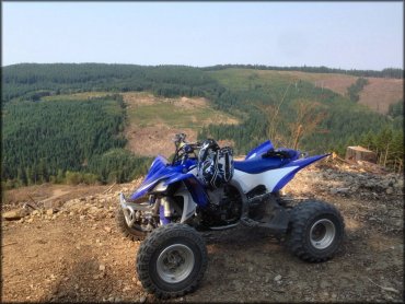
Photo Submitted 9/15/2014 (Thanks!)
Crooked Finger Trail Photo
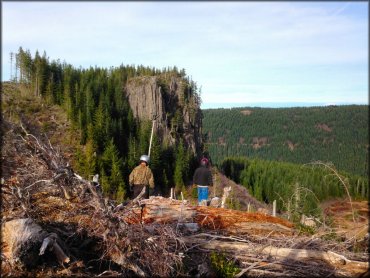
Photo Submitted 9/15/2014 (Thanks!)
Crooked Finger Trail Photo
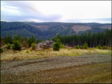
Photo Submitted 2/12/2013 (Thanks!)
Crooked Finger Trail Photo
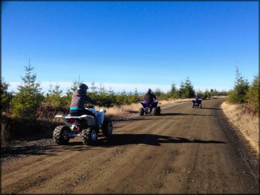
Photo Submitted 10/7/2014 (Thanks!)
Crooked Finger Trail Photo
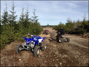
Photo Submitted 10/7/2014 (Thanks!)
Crooked Finger Trail Photo
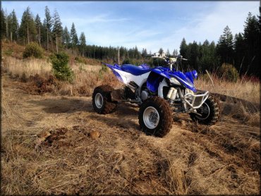
Photo Submitted 9/15/2014 (Thanks!)
RIDER COMMENTS & REVIEWS