 |
      |
| Home > Pennsylvania > Haneyville |
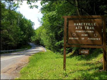
Haneyville ATV Trails
Tuesday, April 28, 2026
| Other Names | Tiadaghton State Forest, Browns Run, Upper Pine Bottom Run, Zinok Fork Road, Plantation Loop, Duncan's Demise, Confusion Corner, Turkey Leg Loop, Spruce Lane, Furnace Trail, Francis Trail, Pipeline Trail, Siltzer's Trail, Mollys Meander, Lycoming County |
| Last Known Status | Closed For Season |
This area offers about 17 miles of ATV trails that consist of old logging roads that wind though deep hardwood forest vegetation. The trails are marked and most form long, easy loops but there are a couple trails set aside that are rated as very difficult. A small play pit can be found at the northern part of the trail system.
There is no fee charged for camping but a permit is required which can be obtained by contacting the Tiadaghton State Forest. There are no services so come prepared.
This trail system is only open to ATVs and UTVs that are 58 inches or less in width. ATVs must be registered and have proof of liability insurance. Dirt bikes and motorcycles are not permitted.
Nearby Little Pine State Park offers additional camping, boating and swimming opportunities.
REGULATIONS
| Permit Required | No | ATVs must be registered and have proof of liability insurance. |
| Dates Open | Friday before Memorial Day through last full weekend in September; re-opens day after deer hunting season through April 1 | |
| Other ATV Stickers Accepted | Yes | (AR, AZ, CA, CO, CT, DE, IA, ID, IN, LA, MA, ME, MI, MN, MO, MT, ND, NH, NJ, NM, NY, OH, OK, RI, UT, VT, WA, WI) |
| Spark Arrestor | Yes | A spark arresting exhaust silencer or end cap is required for all vehicles. |
| Noise Limit | Yes (99 dB) | |
| Whip Flags | Not Required | |
| Maximum Vehicle Width | Yes (58 inches) | has entrance gate or posts vehicles under 1200lbs dry weight and 58 inches wide permitted |
 Motorcycles & Dirt Bikes Motorcycles & Dirt Bikes | Prohibited | |
 ATVs ATVs | Permitted | (maximum width 58 inches) |
 UTV & SXS UTV & SXS | Permitted | (maximum width 58 inches) |
 SUVs & Jeeps (registered) SUVs & Jeeps (registered) | Prohibited | |
| Dune Buggy & Sand Rail 4x4 (unregistered) | Prohibited | |
| 2 Stroke Engines | No Restriction | |
| MX Helmet Required | Yes | helmets required by state law |
 Camping Camping | Some Areas | |
 Campfires Campfires | Prohibited | |
| Night Riding | Unknown | |
| Trail Blazing | Prohibited | stay on the trail |
| Rule Enforcement |
TERRAIN
| Approx Size | 3,840 acres (6 sq mi) | |
| Miles Of Trail | 17 | |
| Climate Type | Forest | |
| Elevation | 1300 to 1700 ft. | |
| Trail Maintenance | Marked, Not Rated, Lightly Maintained | |
| Loose Dirt |  Little Little | |
| Hard Pack |  Mostly Mostly | |
| Sand |  None None | |
| Mud | Little | |
| Dust | Little | |
| Rocks | Little | |
| Trees |  All All | |
| Steep Hills | None | |
| Water Crossings | None | |
| Small Jumps | None | |
| Large Jumps | None | |
| Berms | None | |
| Sand/Gravel Pits | None | |
| Single Track | None | |
| Roads | None | |
| Shade |  Many Many | |
| Hazards |  Few Few | (hazards assumed marked but use caution) |
 Novice Novice | All | |
 Amateur Amateur | None | |
 Expert Expert | None |
TYPE OF AREA
| Area | Motorized Trails |
| Land | State Forest |
GPS POINTS


KEY SERVICES
 Gasoline Gasoline | 5-20 Miles (S) | Jersey Shore Mini Mart (570) 398-8749 |
| Diesel | 5-20 Miles (S) | Bald Eagle Truck Stop (570) 769-6455 |
 Water Water | 5-20 Miles (NE) | Little Pine State Park (570) 753-6000 |
 RV Hookup RV Hookup | 5-20 Miles (NE) | Happy Acres Resort (570) 753-8000 |
 RV Disposal RV Disposal | 5-20 Miles (NE) | Little Pine State Park (570) 753-6000 |
| Campground | 5-20 Miles (NE) | Little Pine State Park (570) 753-6000 |
 Conv Store Conv Store | 1-5 Miles (SE) | Mc Connell's Country Store (570) 753-8241 |
FEES & PASSES
| Parking | (None) |
| Entry | (None) |
| Riding | (None) |
| Camping | (None) |
RATINGS
| Our Rating |  |
| Recommended Stay | Full Day |
| Comments | (Scroll Down For Rider Reviews & Comments) |
DRIVING DIRECTIONS
| Nearest City | Haneyville, PA | ||
| From: Jersey Shore, PA
1) Take 220 West to Hwy 44 North 2) Continue north about 16 miles 3) Staging area will be on your right. |


OFFICIAL CONTACTS
| Contact Info | Tiadaghton State Forest 10 Lower Pine Bottom Road Waterville, PA 17776 (570) 753-5409 (570) 753-5519 fd12@pa.gov www.dcnr.pa.gov |
| Contact Info | Pennsylvania ATV Registration / Insurance Info P.O. Box 8553 Harrisburg, PA 17105-8553 (866) 545-2476 (717) 783-9227 ra-snowatv@pa.gov www.dcnr.pa.gov |
| Contact Info | Pennsylvania Game Commission 2001 Elmerton Ave. Harrisburg, PA 17110-9797 (717) 787-4250 pgccomments@pa.gov www.pgc.pa.gov |
| Comment | Pennsylvania hunting season info and dates. |
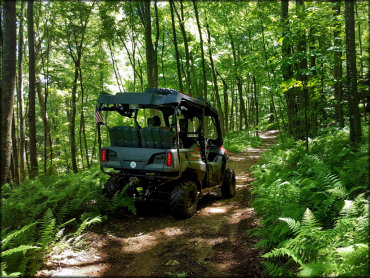
Haneyville Trail Photo
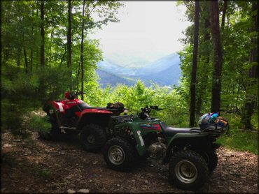
The trails wind there way through deep forests with the occasional meadow and some scenic overlooks like this one.
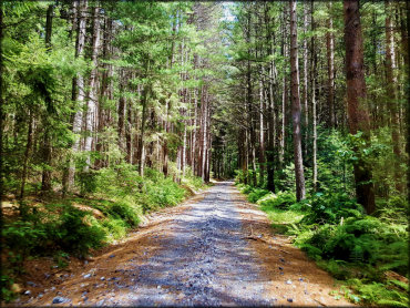
Haneyville Trail Photo
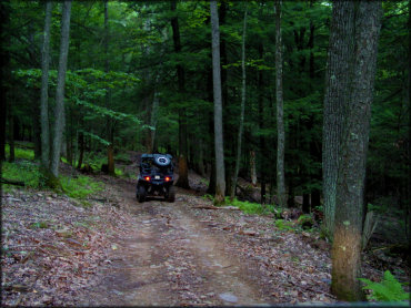
The trails are designed for just about any type of ATV or UTV up to 58 inches wide.
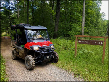
Haneyville Trail Photo
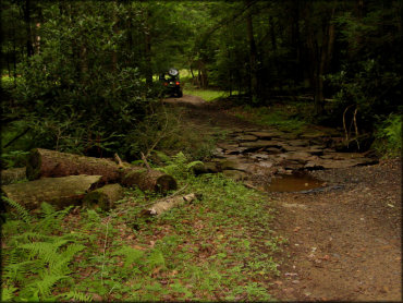
Many of the trails are considered easy to moderate difficulty and have great looking scenery and some shallow creek crossings.
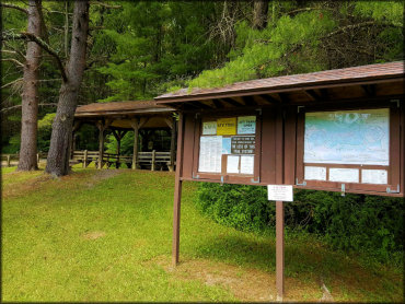
Haneyville Trail Photo
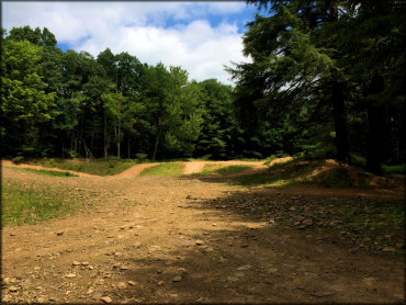
Photo Submitted 8/4/2016 (Thanks!)
Haneyville Trail Photo
Haneyville Trail Photo
Haneyville Trail Photo
Haneyville Trail Photo
Haneyville Trail Photo
Haneyville Trail Photo
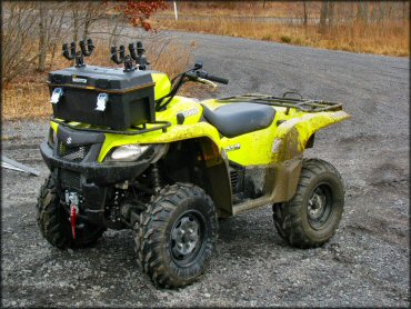
Photo Submitted 3/11/2012 (Thanks!)
RIDER COMMENTS & REVIEWS