 |
      |
| Home > Utah > Arapeen |
Arapeen OHV Trail System
Saturday, December 23, 2023
| Other Names | Reeder Canyon Loop, Potter's Pond Campground, Bacon Rind Canyon, Manti-la Sal National Forest, Sanpete County, Ferron Canyon, Indian Creek Campground, Joes Valley Campground, Millsite State Park |
| Last Known Status | Open |
Over 600+ miles of ATV and OHV roads make up the Arapeen OHV Trail System. Beautiful forest scenery, well maintained trails, multiple staging opportunities and fairly moderately challenging terrain make this a great place to take friends or family.
Occasionally ATV jamborees will host their rides along this trail system. There are numerous campgrounds that provide direct trail access. Potters Pond, Indian Creek and Joe's Valley Campground are among the many campgrounds that have direct access.
This trail system is open year-round but trails may be snow covered well into late spring or early summer. Generally the trails are snow free by July through mid October.
REGULATIONS
| Permit Required | Yes | UT OHV sticker required |
| Dates Open | July 1 - October 15 (to avoid snow) | |
| Other ATV Stickers Accepted | No | Non-residents must purchase a non-resident OHV permit. |
| Spark Arrestor | Yes | A spark arresting exhaust silencer or end cap is required for all vehicles. |
| Noise Limit | Yes | |
| Whip Flags | Not Required | |
| Maximum Vehicle Width | Yes (66 inches) | has entrance gate and narrow terrain |
 Motorcycles & Dirt Bikes Motorcycles & Dirt Bikes | Permitted | |
 ATVs ATVs | Permitted | |
 UTV & SXS UTV & SXS | Permitted | (maximum width 66 inches) |
 SUVs & Jeeps (registered) SUVs & Jeeps (registered) | Some Areas | |
| Dune Buggy & Sand Rail 4x4 (unregistered) | Some Areas | (maximum width 66 inches) |
| 2 Stroke Engines | No Restriction | |
| MX Helmet Required | Youth Only | required for persons under 18 by state law (RiderPlanet strongly recommends helmets for all riders.) |
 Camping Camping | Some Areas | (camp in developed sites only) |
 Campfires Campfires | Some Areas | (permitted in developed campsites only) |
| Night Riding | Yes | |
| Trail Blazing | Prohibited | stay on trail |
| Alcohol | No Restriction | |
| Rule Enforcement | Few/Periodic | |
| Comment | No specific decibel limit but excessive mechanical noise is prohibited. | |
TERRAIN
| Approx Size | 350,000 acres (547 sq mi) | |
| Miles Of Trail | 600 | |
| Climate Type | Forest | |
| Elevation | 6000 to 10897 ft. | |
| Trail Maintenance | Marked, Not Rated, Heavily Maintained | |
| Loose Dirt |  Some Some | |
| Hard Pack | Some | |
| Sand |  None None | |
| Mud |  Little Little | |
| Dust | Some | |
| Rocks | Some | |
| Trees |  Many Many | |
| Steep Hills |  Few Few | |
| Water Crossings | Few | |
| Small Jumps | Some | |
| Large Jumps | Few | |
| Berms | Few | |
| Sand/Gravel Pits | None | |
| Single Track | Few | |
| Roads | Some | |
| Intersections | Many | |
| Rider Traffic | Some | |
| Shade | Many | |
| Ranges/Gunfire | Few | |
| Hazards | Few | (hazards assumed marked but use caution) |
 Novice Novice | Some | |
 Amateur Amateur |  Mostly Mostly | |
 Expert Expert | Little |
TYPE OF AREA
| Area | Motorized Trails |
| Land | National Forest |
GPS POINTS

KEY SERVICES
 Gasoline Gasoline | Orangeville, UT | nearby towns of Fairview, Mt. Pleasant, Spring City, Ephraim, Manti and Sterling |
| Diesel | Orangeville, UT | nearby towns of Fairview, Mt. Pleasant, Spring City, Ephraim, Manti and Sterling |
 Water Water | On Site | |
 RV Hookup RV Hookup | On Site | Temple Hill RV Resort and Campground (435) 835-2267 |
 RV Disposal RV Disposal | On Site | Palisade State Park (435) 835-7275 or Millers Travel Center (435) 427-3315 |
| Campground | On Site | Joe's Valley Reservoir Campground (435) 384-2372 |
 Conv Store Conv Store | On Site |
FEES & PASSES
| Parking | (None) |
| Entry | (None) |
| Riding | (None) |
| Camping | Yes Tent: $10.00 RV: $10.00 Addtl. Vehicle: $0.00 Joes Valley Reservoir Campground Fees |
| Comment | Camping fees vary at different campgrounds. |
RATINGS
| Pros | multiple staging opportunities, over 600 miles of OHV roads, beautiful forest scenery |
| Cons | very little single track |
| Our Rating |  Very Good Very Good |
| Recommended Stay | 3-5 Days Fall |
| Comments | (Scroll Down For Rider Reviews & Comments) |
DRIVING DIRECTIONS
| Nearest City | Orangeville, UT | ||
| From: Orangeville, UT
1) Potter's Pond Campground (Northern Access): Take Hwy 29 north about 15 miles 2) Turn right on Miller Flat Road 3) Continue about 2 miles 4) Turn right at the T-intersection 5) Proceed about 7.5 miles 6) Turn left (west) on Potter's Canyon Road 7) Proceed about .75 miles to the Potter's Pond Campground. From: Ferron, UT 1) Millsite Campground (Southern Access): Take Ferron Canyon Road west about 4 miles 2) Millsite Campground will be on your right. From: Orangeville, UT 1) Joe's Valley Campground (Eastern Access): Take Hwy 29 north about 17.5 miles 2) Campground will be on the south side of Hwy 29. From: Manti, UT 1) Manti Community Campground (Western Access): Take Hwy 89 to E.500 south Street, turn east 2) Proceed about 6 miles (E.500 South Street turns into Manti Canyon Road) 3) Campground will be on your right (south). |


OFFICIAL CONTACTS
| Contact Info | Sanpete County Travel Office P.O. Box 148 Manti, UT 84642 (435) 835-4321 kevin@sanpete.com www.utahatvtrails.org |
| Contact Info | Manti-la Sal National Forest 599 W. Price River Drive Price, UT 84501 (435) 637-2817 mailroom_r4_manti_lasal@fs.fed.us www.fs.usda.gov |
| Contact Info | Big Pine Sports 340 N Milburn Road Fairview, UT 84629 (435) 427-3338 info@bigpinesports.com bigpinesports.com |
| Comment | ATV Rentals |
| Contact Info | Temple Hill RV Resort And Campground 296 East Johnson Road Manti, UT 84642 (435) 835-2267 reservations@templehillcampground.com www.templehillcampground.com |
| Comment | Camoground with direct trail access. |
| Contact Info | Joe's Valley Reservoir Campground (877) 444-6777 (435) 384-2372 www.recreation.gov |
| Comment | Reservations must be made at least four days in advance. |
| Contact Info | Skyline Recreation 88 N Main Street Sterling, UT 84665 (435) 851-2288 gregwayman@msn.com www.skylinerec.net |
| Comment | ATV Rentals |
| Contact Info | Pleasant Creek RV Resort 2903 S 1700 E Mt. Pleasant, UT 84647 (435) 462-2010 (435) 485-7930 www.pleasantcreek.camp |
| Comment | RV campground with direct trail access |
Arapeen Trail Photo
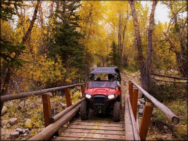
Photo Submitted 3/20/2019 (Thanks!)
Arapeen Trail Photo
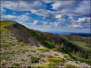
Photo Submitted 9/27/2012 (Thanks!)
Arapeen Trail Photo
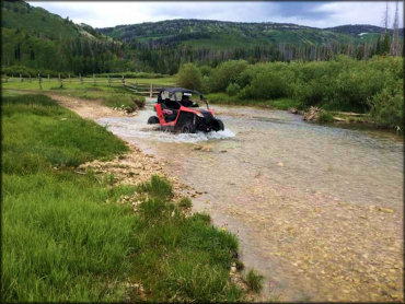
Photo Submitted 3/20/2019 (Thanks!)
Arapeen Trail Photo
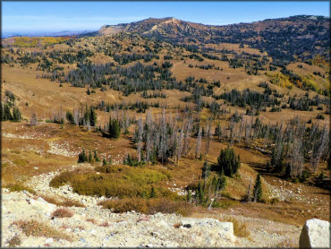
Photo Submitted 2/12/2019 (Thanks!)
Arapeen Trail Photo
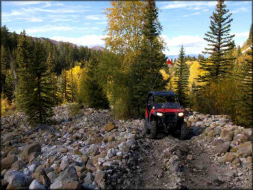
Photo Submitted 3/20/2019 (Thanks!)
Arapeen Trail Photo
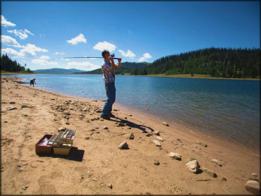
Photo Submitted 3/20/2019 (Thanks!)
Arapeen Trail Photo
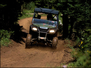
Photo Submitted 3/20/2019 (Thanks!)
Arapeen Trail Photo
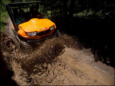
Photo Submitted 3/20/2019 (Thanks!)
Arapeen Trail Photo
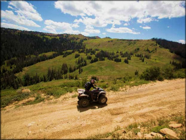
Photo Submitted 3/20/2019 (Thanks!)
Arapeen Trail Photo
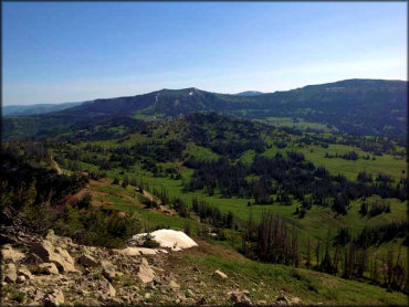
Photo Submitted 3/20/2019 (Thanks!)
Arapeen Trail Photo
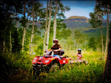
Photo Submitted 2/12/2019 (Thanks!)
Arapeen Trail Photo
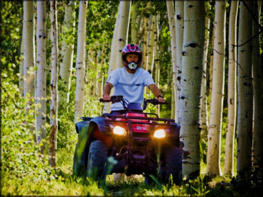
Photo Submitted 2/12/2019 (Thanks!)
Arapeen Trail Photo
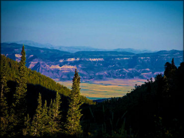
Photo Submitted 3/20/2019 (Thanks!)
RIDER COMMENTS & REVIEWS