 |
      |
| Home > Utah |
 Arapeen OHV Trail System
Status: Open
Type: Trail (National Forest)
Location: Orangeville, UT
Difficulty:

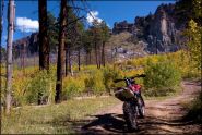
Over 600+ miles of ATV and OHV roads make up the Arapeen OHV Trail System. More...
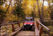
 Arch Canyon and Combs Wash
 Status: Open
Type: Trail (BLM, National Forest)
Location: Blanding, UT
Difficulty:
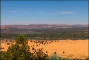
This scenic area offers miles of ATV trails that provide panoramic mountain views, interesting rock formations and colorful canyons. More...
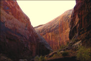 Black Dragon ATV Trail
Status: Open
Type: Trail (BLM)
Location: Green River, UT
Difficulty:
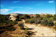
This part of the San Rafael Swell offers a unique offroad trail that forms a moderately challenging loop that takes riders though a narrow but scenic canyon. More...
 Bunker Hill MX
 Status: Open
Type: Track (Privately Owned / Commercial)
Location: Delta, UT
Difficulty:

This motocross track is open for practice during select dates. More...
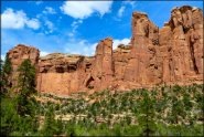
 Casto Canyon Trail
 Status: Open
Type: Trail (National Forest)
Location: Panguitch, UT
Difficulty:
The Casto Canyon Trail offers scenic views of red hoodoos, colorful sandstone cliffs and scattered ponderosa pines. More...
 Coral Pink Sand Dunes State Park
 Status: Open
Type: Dune (BLM, State Recreation)
Location: Kanab, UT
Difficulty:
Rose-colored sand dunes with scattered juniper and pinion pine trees are the main attraction at this state park. More...
Deseret Peak Complex Status: Open
Type: Track (County Land)
Location: Tooele, UT
Difficulty:
This motocross track consists of soft loamy soil with some hard pack sections. More...
 Diamond Fork
 Status: Open
Type: Trail (National Forest)
Location: Spanish Fork, UT
Difficulty:
This large area offers numerous single track trails that range from intermediate to difficult. More...
 Doc's Beach
 Status: Open
Type: Trail (BLM)
Location: Vernal, UT
Difficulty:
This popular locals spot offers a wide variety of terrain that ranges from sandy washes, short and long hillclimbs, slick rock gardens and numerous miles of double track ATV trails to explore. More...
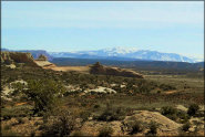 Dome Plateau
 Status: Open
Type: Trail (BLM)
Location: Moab, UT
Difficulty:
This scenic area offers a long 4x4 loop that provides panoramic views of the surrounding desert and valleys. More...
(Page 1 of 5)
(Page 1 of 5)