 |
      |
| Home > Wisconsin > Dungood ATV |
Dungood ATV Trails
Saturday, May 10, 2025
| Other Names | Marinette County Trails, Dun Good ATV Trails |
| Last Known Status | Open |
Located in the waterfall capitol of Wisconsin, this trail system offers over 200 miles of groomed ATV trails that wind through a heavily wooded forest. The Dun-Good Riders maintain the trails on a weekly basis, even during the winter months, so be sure to say thanks for all their hard work.
The McClintock County Park Campground offers direct trail access and there are several local businesses in and near Dunbar that also provide access to the trail system.
REGULATIONS
| Permit Required | No | |
| Dates Open | Open daily except during spring thaw. | |
| Other ATV Stickers Accepted | No | Wisconsin registration or a Nonresident Trail Pass required. |
| Spark Arrestor | Yes | A spark arresting exhaust silencer or end cap is required for all vehicles. |
| Noise Limit | ||
| Whip Flags | Not Required | |
| Maximum Vehicle Width | ||
 Motorcycles & Dirt Bikes Motorcycles & Dirt Bikes | Permitted | motorcycles must be street legal - limited use OHMs prohibited |
 ATVs ATVs | Permitted | |
 UTV & SXS UTV & SXS | Permitted | |
 SUVs & Jeeps (registered) SUVs & Jeeps (registered) | Prohibited | |
| Dune Buggy & Sand Rail 4x4 (unregistered) | Prohibited | |
| 2 Stroke Engines | No Restriction | |
 Camping Camping | No Restriction | (camp anywhere) |
 Campfires Campfires | ||
| Night Riding | Unknown | |
| Trail Blazing | Prohibited | stay on trail |
| Rule Enforcement | ||
| Comment | ATVs and UTVs need to have current registration stickers. | |
Advertisement
TYPE OF AREA
| Area | Motorized Trails |
| Land | County Land |
FEES & PASSES
| Parking | (None) |
| Entry | (None) |
| Riding | (None) |
| Camping | Yes Tent: $15.00 RV: $15.00 Addtl. Vehicle: $15.00 McClintock County Park Campground Fee |
RATINGS
| Our Rating |  Good Good |
| Recommended Stay | 1-2 Days |
| Comments | (Scroll Down For Rider Reviews & Comments) |
DRIVING DIRECTIONS
| Nearest City | Dunbar, WI | ||
| From: Dunbar, WI
1) Take US-8 west .25 miles 2) Turn left (south) on Airport Road, contunue about 200 yards 3) Veer right to stay on road, follow signs to staging area. |


OFFICIAL CONTACTS
| Contact Info | Marinette County Forest 1926 Hall Avenue Marinette, WI 54143 (715) 732-7530 (715) 732-7525 tourism@marinettecounty.com www.marinettecountywi.gov |
| Contact Info | Dun - Good Riders P.O. Box 247 Goodman, WI 54125 (715) 324-5009 (920) 246-2693 president@dungood.org secretary@dungood.org www.dungood.org |
| Contact Info | Wisconsin DNR P.O. Box 78701 Milwaukee, WI 53278-0701 (888) 936-7463 dnrfb@wisconsin.gov dnr.wisconsin.gov |
| Comment | ATV and UTV Permit Info |
Dungood ATV Trail Photo
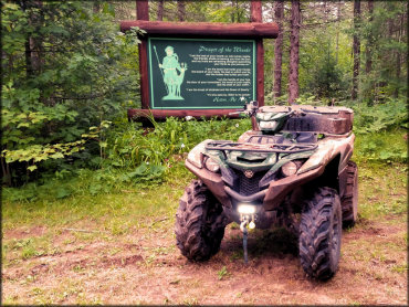
Photo Submitted 7/13/2016 (Thanks!)
Dungood ATV Trail Photo
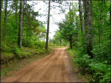
Photo Submitted 9/18/2011 (Thanks!)
ADD PHOTOS
TERRAIN
| Approx Size | 231,000 acres (361 sq mi) | |
| Miles Of Trail | 213 | |
| Climate Type | Forest | |
| Elevation | 1100 to 1200 ft. | |
| Trail Maintenance | Marked, Not Rated, Heavily Maintained | |
| Loose Dirt |  Little Little | |
| Hard Pack | Little | |
| Sand |  Mostly Mostly | |
| Mud | Little | |
| Dust |  Some Some | |
| Rocks | Little | |
| Trees |  All All | |
| Steep Hills |  None None | |
| Water Crossings | None | |
| Small Jumps | None | |
| Large Jumps | None | |
| Berms | None | |
| Sand/Gravel Pits | None | |
| Single Track | None | |
| Roads | Mostly | |
| Shade | All | |
| Hazards |  Few Few | (hazards assumed marked but use caution) |
 Novice Novice | Mostly | |
 Amateur Amateur | Little | |
 Expert Expert | None |
GPS POINTS


KEY SERVICES
 Gasoline Gasoline | 1-5 Miles (E) | Dunbar |
| Diesel | 5-20 Miles (W) | Stoney Ridge Restaurant and BP Gas Station (715) 336-2308 |
 Water Water | On Site | McClintock County Park |
 RV Hookup RV Hookup | 5-20 Miles (NW) | Lake Hilbert Campground (715) 336-3013 |
 RV Disposal RV Disposal | 5-20 Miles (NW) | Lake Hilbert Campground (715) 336-3013 |
| Campground | On Site | |
 Conv Store Conv Store | 5-20 Miles (W) | Eight Hi Club (715) 336-2372 |
RIDER COMMENTS & REVIEWS