 |
      |
| Home > Idaho |
 Baumgartner Trails
Status: Open
Type: Trail (National Forest)
Location: Featherville, ID
Difficulty:

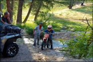
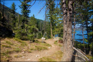
This part of the Sawtooth National Forest offers hundreds of miles of single track dirt bike trails and some challenging ATV trails that form long loops in a mixed pine tree forest. More...
 Canfield Mountain Trail System
Status: Open
Type: Trail (National Forest)
Location: Coeur d'Alene, ID
Difficulty:
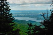
The Canfield Mountain Trail System offers about 30 miles of single-track motorcycle trails with nice views of Hayden Lake. More...
 Caribou Loop Trail
Status: Open
Type: Trail (National Forest)
Location: Soda Springs, ID
Difficulty:
This trail system crosses the borders of Idaho into Wyoming and back for a 200 mile loop. More...
 Casino Creek
 Status: Closed For Season
Type: Trail (National Forest)
Location: Stanley, ID
Difficulty:
This popular trail system offers miles of pure single track that wind through the rugged hills and mountains of the Sawtooth National Forest. More...
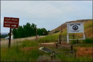 Claypeak Recreation Area
 Status: Open
Type: Combo (BLM, County Land)
Location: Payette, ID
Difficulty:
Open daily from dawn to dusk, this area offers miles of desert trails along with several makeshift motocross tracks. More...
 Cottonwood Creek
 Status: Closed For Season
Type: Trail (BLM)
Location: Twin Falls, ID
Difficulty:
This section of BLM land offers a couple designated staging areas with trails that eventually connect into the Sawtooth National Forest. More...
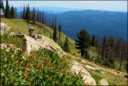
 Danskin Mountains OHV Area
 Status: Open
Type: Trail (BLM, National Forest, State of Idaho Endowment Land)
Location: Boise, ID
Difficulty:
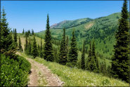
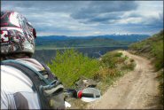
With over 160 miles of trails on over 60,000 acres, this area offers a good variety of terrain with spectacular views of the valley. More...
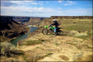 Devil's Corral
 Status: Open
Type: Trail (BLM, County Land, Jerome County)
Location: Jerome, ID
Difficulty:
Overlooking the rugged Snake River, this area offers several hundred acres of wide 4x4 dirt roads, a few makeshift motocross tracks and a couple play areas. More...
 Elk City Wagon Road
 Status: Open
Type: Trail (National Forest)
Location: Elk City, ID
Difficulty:
This historic trail is actually an old mining and wagon road that was first used around the mid 1800's to bring in supplies, workers and mail to the region. More...
 Fourth of July Pass ATV Trails
 Status: Open
Type: Trail (National Forest)
Location: Coeur d'Alene, ID
Difficulty:
This part of the Coeur d'Alene National Forest has around 35 miles of designated ATV trails that form multiple loop options. More...
(Page 1 of 5)
(Page 1 of 5)