 |
      |
| Home > Oregon > Browns Camp |
Browns Camp OHV Area
Tuesday, December 2, 2025
| Other Names | Brown's Camp, Rogers Camp, Horse Camp, University Falls, Forest Grove, Tillamook State Forest, Scoggins Creek Road, Beaver Dam Road, Lyda Camp, Firebreak Five, Stagecoach Horsecamp |
| Last Known Status | Open |
This is the eastern most OHV campground in the Tillamook State Forest and is the recommended staging area for novice and amateur OHV riders.
The area provides many types of fun trails, secluded campsites right on the banks of the creek and plenty of shade. The creek that flows through the campground is shallow and sometimes a little muddy/cloudy, and although the sharp rocks don't make it very suitable for swimming, it's deep enough do a little wading to cool off. (There is a popular swimming area down the road at the entrance to Diamond Mill OHV Area).
Most of the trails here are looped, and are marked and rated for difficulty, but bring a GPS/Radio unit anyway. There are a number of runs that are twisty and narrow, and most would also be plenty wide enough for ATVs. The trails also seemed split when necessary to offer an easy way around the deep rutted or technical spots.
Our only complaint might be that most of the turns are not well banked, so the trails didn't have a very good flow for faster riding, but that may have changed since we last visited and overall it was still very fun. Browns Camp is a great choice if you like easy woods riding.
***ANNOUNCEMENTS***
* Campground Seasonal Closure
The Browns Camp OHV Campground and staging area is closed for the season. The trails, forest roads and trailheads are open. For more information call (503) 357-2191 or (503) 359-7401.
REGULATIONS
| Permit Required | Yes | Oregon ATV Permit stickers required |
| Dates Open | Year-Round except during fire season (riding is discouraged during rainy season - call (503) 359-7463 for trail conditions). | |
| Other ATV Stickers Accepted | Yes | An operating permit issued for another state will be honored, but only if the issuing state also honors Oregon operating permits. (As of October 1, 2021, Oregon no longer honors stickers from Washington.) (AZ, CA, ID, IN, MO, NV, PA, SC, UT, VT) |
| Spark Arrestor | Yes | A spark arresting exhaust silencer or end cap is required for all vehicles. |
| Noise Limit | Yes (99 dB) | Oregon ATV noise limits apply (all vehicles limit 99 dB) |
| Whip Flags | Not Required | |
| Maximum Vehicle Width | No Restriction | |
 Motorcycles & Dirt Bikes Motorcycles & Dirt Bikes | Permitted | |
 ATVs ATVs | Permitted | |
 UTV & SXS UTV & SXS | Permitted | |
 4x4 & Jeeps (registered) 4x4 & Jeeps (registered) | Some Areas | Not Recommended not much available for 4x4 play |
| Dune Buggy & Sand Rail 4x4 (unregistered) | Some Areas | Oregon ATV Permit stickers required |
| 2 Stroke Engines | No Restriction | |
| MX Helmet Required | Youth Only | required for persons under 18 by state law (RiderPlanet strongly recommends helmets for all riders.) |
 Camping Camping | Some Areas | (camp in developed sites only) campground open seasonally April 1 - November 1 |
 Campfires Campfires | Some Areas | (permitted in developed campsites only) |
| Night Riding | Yes | Not Recommended |
| Trail Blazing | Prohibited | stay on trail |
| Alcohol | No Restriction | |
| Rule Enforcement | Few/Periodic | Jeep/SUV Patrol |
| Comment | Some trails close periodically for logging, maintenance, or for fire season. Browns Camp has 30 sites and is designated for OHV users with trail ready machines. Rogers Camp is mainly used by horseback and mountain bike riders. | |
TERRAIN
| Approx Size | 19,840 acres (31 sq mi) | |
| Miles Of Trail | 50 | |
| Climate Type | Forest | |
| Elevation | 1500 to 2500 ft. | |
| Trail Maintenance | Marked, Rated, Heavily Maintained | |
| Loose Dirt |  Some Some | |
| Hard Pack |  Mostly Mostly | |
| Sand |  None None | |
| Mud | Some | |
| Dust | Mostly | |
| Rocks | Some | |
| Trees |  All All | |
| Steep Hills |  Few Few | |
| Water Crossings | Some | all crossings have bridges, no riding in creeks |
| Small Jumps | Few | |
| Large Jumps | None | |
| Berms | Some | |
| Sand/Gravel Pits | Few | |
| Single Track | Few | mostly ATV trails 4 feet wide |
| Roads | Some | |
| Intersections | Few | |
| Rider Traffic | Few | |
| Shade |  Many Many | |
| Ranges/Gunfire | Few | |
| Hazards | Few | (hazards not marked) Beware of cliffs. deep ruts, but mostly avoidable |
 Novice Novice | Some | |
 Amateur Amateur | Mostly | |
 Expert Expert | None | |
| Comment | mostly moderate & easy trails, all trails marked & rated, some one-way trails | |
TYPE OF AREA
| Area | Motorized Trails |
| Land | State Forest |
GPS POINTS


KEY SERVICES
 Gasoline Gasoline | 5-20 Miles (E) | Gales Creek Shell (503) 357-9645 |
| Diesel | 5-20 Miles (E) | Gales Creek Shell (503) 357-9645 |
 Water Water | On Site | potable water water available at campground |
 RV Hookup RV Hookup | 20-30 Miles (SE) | Washington County Fair Complex (503) 648-1416 |
 RV Disposal RV Disposal | 5-20 Miles (SW) | Jordan Creek (503) 815-7024 |
| Campground | On Site | 29 campsites, each with picnic tables & fire grate |
 Conv Store Conv Store | 5-20 Miles (E) | Gales Creek Shell (503) 357-9645 |
FEES & PASSES
| Parking | (None) |
| Entry | (None) |
| Riding | (None) |
| Camping | Yes Tent: $20.00 RV: $20.00 Addtl. Vehicle: $5.00 Drive-in campsite $20/night. Walk-in tent site - $15/night. Camping fee includes up to two vehicles. Additional vehicles are $5/night. Cash or check only. |
| Comment | Contact Tillamook State Forest for current campground fees - (503) 357-2191. |
RATINGS
| Pros | secluded, campsite right on the bank of the creek, easy trails, most trails loop, all trails marked |
| Cons | trails not banked well, not good flow, lots of sharp loose rocks |
| Our Rating |  Very Good Very Good |
| Recommended Stay | 1-2 Days Spring/Fall |
| Comments | (Scroll Down For Rider Reviews & Comments) |
DRIVING DIRECTIONS
| Nearest City | Forest Grove, OR | ||
| Address | Beaver Dam Road, Gales Creek, OR 97117 | ||
| From: Portland, OR
1) US 20 West toward Forest Grove 2) State Hwy 6 west to mile post 33 3) Just past mile post 33 turn left (south) on Beaver Dam Road 4) Follow signs to Browns Camp or Rogers Camp. |


OFFICIAL CONTACTS
| Contact Info | Oregon Department of Forestry - Forest Grove District 801 Gales Creek Road Forest Grove, OR 97116 (503) 357-2191 (503) 359-7401 forestryinformation@oregon.gov www.oregon.gov |
| Contact Info | Oregon ATV Safety Education Card (877) 772-3359 atv.info@state.or.us www.oregon.gov |
| Contact Info | Oregon State Parks Online Store 725 Summer Street NE, Suite C Salem, OR 97301 (800) 551-6949 park.info@oregon.gov store.oregonstateparks.org |
Browns Camp Trail Photo
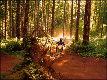
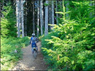
The trails got right down to business, offering a moderate and relaxed woods ride for motorcycles with lots of trees and very few rocks.
Browns Camp Trail Photo
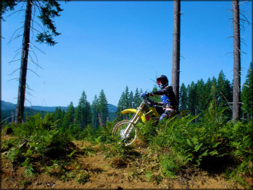
There are many spots with good scenery. Some sections of the trail are narrow, but there are other parts where there is enough room to pull off the trail and take a break.
Browns Camp Trail Photo
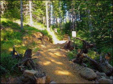
This is an example of one of the trailheads. The trails are marked and rated for difficulty.
Browns Camp Trail Photo
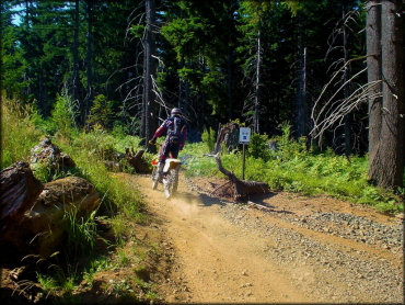
The trails here are marked and rated for difficulty and the various loops eventually lead back to the main camping area.
Browns Camp Trail Photo
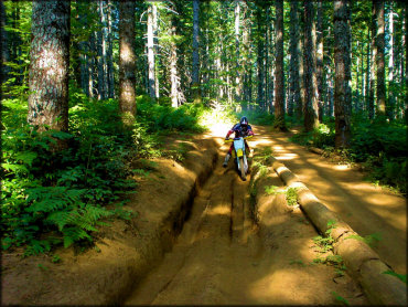
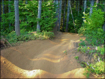
When we rode it, there were not many ruts. A couple spots like these were really the exception, and they each had a smooth bypass. I would say most of this stuff was pretty tame.
Browns Camp Trail Photo
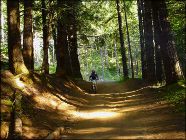
The Oregon forests are thick and dark and sometimes a little bit spooky! I definitely like to keep it moving.
Browns Camp Trail Photo
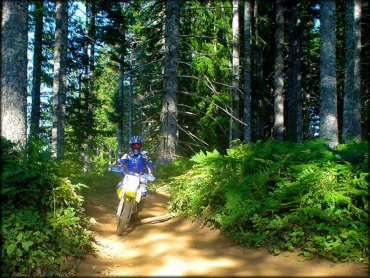
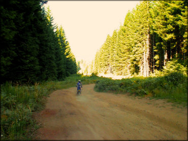
A lot of these trails were so much fun on a motorcycle! But they are probably wider now.
Browns Camp Trail Photo
Most of the routes do eventually form a long loop, but it is still a good idea to bring a GPS and maybe a radio. Don't count on your smartphone.
Browns Camp Trail Photo
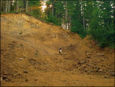
Had some fun trying to climb this gravel pit. It was loose and the rocks were big, so it was a little bit of a challenge with the two-stroke.
Browns Camp Trail Photo
Browns Camp Trail Photo
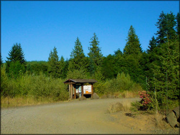
This is the entrance to the Browns Campground. There are campsites located all around the looped road but there are also more sites if you continue straight ahead.
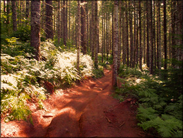
Browns Camp Trail Photo
Trails are mostly smooth and rock-free.
Browns Camp Trail Photo
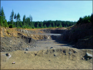
During the summer months this is an active quarry. It appears as though it's used as a shooting range in the off season.
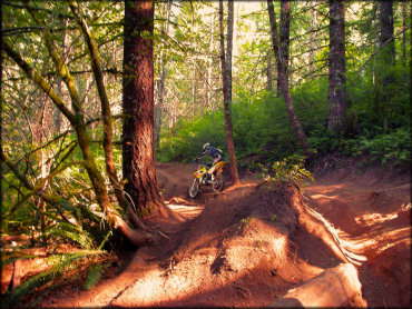
Browns Camp Trail Photo
Here is an example of some of the other ruts that the motorcycle doesn't really see but could be sticky for a UTV or ATV when wet, maybe.
Browns Camp Trail Photo
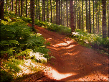
When it was smooth, it was real smooth.
Browns Camp Trail Photo
Some sections may have been a little rough looking, but there was really nothing too difficult. You don't have to be extremely experienced to ride most of these trails.
RIDER COMMENTS & REVIEWS