 |
      |
| Home > California |

 Big Pine Flats
Status: Open
Type: Trail (National Forest)
Location: Fawnskin, CA
Difficulty:

This area offers about 10 miles of designated OHV trails. More...
 Billy Hill OHV Route
Status: Open
Type: Trail (National Forest)
Location: Truckee, CA
Difficulty:
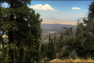
This part of the Tahoe National Forest is the northernmost section of a three-part area that is surrounded by three reservoirs; Boca Reservoir, Prosser Reservoir and Stampede Reservoir. More...
 Black Springs OHV Network
 Status: Closed For Season
Type: Trail (National Forest)
Location: Cottage Springs, CA
Difficulty:
This part of the Stanislaus National Forest offers a large network of over 100 miles of connecting forest roads and trails that form nice long loops. More...
 Boca Reservoir
 Status: Open
Type: Trail (National Forest)
Location: Hirschdale, CA
Difficulty:
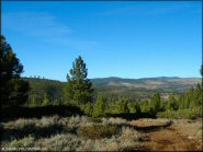
The trails along the west side of Boca Reservoir are a great place to take a beginner. More...
 Breckenridge
 Status: Open
Type: Trail (National Forest)
Location: Havilah, CA
Difficulty:
This area offers two challenging single track trails that run in a north and south direction. More...
 Burlington Motorcycle Trail System
 Status: Variable Schedule (Depends on daily conditions. Call (530) 478-6253 for recorded message.)
Type: Trail (National Forest)
Location: Nevada City, CA
Difficulty:

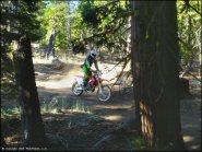
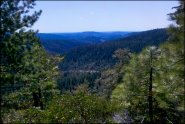
This part of the Tahoe National Forest features about 50 miles of narrow and twisty single track trails that wind through a cool mixed pine forest. More...
Buttercup Valley Status: Open
Type: Dune (BLM)
Location: Winterhaven, CA
Difficulty:
This is the southernmost section of the Glamis Dunes, but this dune area is smaller and features three designated campgrounds. More...
Buttermilk Country Status: Open
Type: Trail (National Forest)
Location: Bishop, CA
Difficulty:
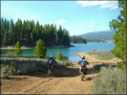
This part of the Inyo National Forest offers a popular 4x4 road and some ATV and dirt bike loops. More...
 Cahuilla Creek MX
 Status: Open
Type: Combo (Privately Owned / Commercial)
Location: Anza, CA
Difficulty:
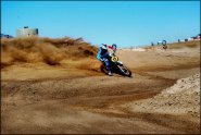
This motocross facility offers three tracks to choose from which consists of a main, vet/quad, peewee track. More...
 Cal City MX Park
Status: Open
Type: Combo (Privately Owned / Commercial)
Location: California City, CA
Difficulty:
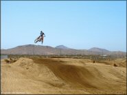
This motocross park offers two tracks that range from a 1.3 miles long main track and a separate peewee track that is surrounded by hay bales. More...