





MenuHomeFind ATV TrailsATV and Dirt Bike ArticlesCalendar of ATV and Motorcycle EventsSupport CenterFeatured MessageMenu

1000 Great Places To Ride.

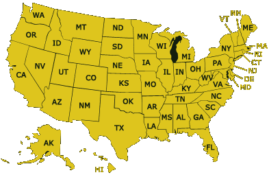
Select your region to get started!
1000 Great Places To Ride.

Select your region to get started!

Where to ride your dirt bike, ATV or UTV...

American Flag RiderPlanet USA® is a comprehensive directory of the best and most popular ATV trails, dirt bike trails, scenic OHV and UTV routes and motocross tracks in the United States. We are dedicated to helping you find great places to ride your ATV or dirt bike where people will welcome you and your vehicle.

The information presented includes ATV parks, motocross tracks, national recreation areas and dunes, national forests, BLM lands, state vehicle recreation areas, and any other legal places we've found to ride off-road. Our goal is to make all of your riding choices available in one place, and we are continuously adding new riding areas and updating existing trails so be sure to bookmark this website.

All information on this website is absolutely FREE!  With the suggestions, contributions and support from people like you, RiderPlanet USA® has become a popular and valuable tool for finding motorcycle and ATV destinations in America, and it continues to grow... so take advantage!

Cactus Crawl - AJO UTV Run

Hosted by UTV Offroad Adventures and the American Legion Post 10

Lake Powell SXS Extravaganza

Lake Powell SXS Extravaganza - What a Weekend!

Barry Goldwater Event

Hosted by UTV Offroad Adventures!

El Camino Del Diablo UTV Adventure Ride

Hosted by UTV Offroad Adventures!

Munds Park Mountain Fun Run

Hosted by UTV Offroad Adventures

Rocky Point To El Golfo

UTV Offroad Adventures: Rocky Point to El Golfo – December 5–7, 2025

White Mountain Madness 2025 Recap

Hosted by UTV Offroad Adventures

Trail Photo

Twin Sisters and Mack King Trails

Featured Trail Near Kettle Falls, WA!

This part of the Colville National Forest consists of two 4x4 trails that can be used to form a long loop. The Twin Sisters Trail is about 10 miles long and is the northern route. This trail is described as moderately difficult with some obstacles that can be bypassed. Most of the trail winds through the trees but has several open areas offering nice viewpoints. This trail is occasionally maintained by the Forest Service however chainsaws are recommended as there may be tree branches and dense vegetation blocking the route.

The Mack King Trail is the southern route and is rated as more difficult due to steep hillside crossings that require advanced driver skills. The eastern half of the trail is most difficult, compared to the western portion. To avoid the most difficult portions, it is suggested that beginners start the Mack King Trail from the western trailhead off Albian Hill Road and proceed to the view point and return.

Both trails offers scenic vistas with panoramic views. If traveling the Twin Sisters Trail from the east go 4.4 miles in (or 4.7 miles from the west) and look for a turn off that heads north. Roughly a mile in there will be a parking area below the peak. This is where the Twin Sisters Lookout used to be located (do not drive to the top due to the large number of nails still on the ground). Park and hike to the old lookout site which has excellent views.

If riding the Mack King Trail from the eastern trailhead go 4.8 miles (or from the west 3.2 miles) there is a turn off that leads in an easterly direction for approximately 400 feet to a parking area. Park here, and hike approximately 200 feet further east, uphill toward the rock outcrop. Approaching the outcrop from the northern side, climb to the top for outstanding views of the region.

  More...

Trail PhotoFrom: Kettle Falls, WA
1) Take Hwy 395 West across the Columbia River Bridge
2) Turn right to stay on Hwy 395, continue about 6 miles
3) Turn left (west) onto Deadman Creek Road, continue about 4 miles
4) Veer left to stay on Deadman Creek Road, continue 2.3 miles
5) Park and unload at Cow Camp.

For Northern Trailhead:
6) From Cow Camp continue on Deadman Creek Road 2.3 miles
7) Turn right (north-west) on FS Road, #800, continue 8.5 miles
8) Turn left (west) onto FS Road #822, continue about .25 miles toward quarry.

For Eastern Trailhead:
6) Continue west past Cow Camp 4.9 miles
7) Turn right (north) onto FS Road #520, continue 2.5 miles toward trailhead.

For Western Trailhead:
8) Continue west past FS Road #520 7.2 miles
9) Trailhead is on the right (east).
California ATV Trails List Arizona ATV Trails List Nevada ATV Trails List Florida ATV Trails List New York ATV Trails List Texas ATV Trails List North Carolina ATV Trails List Virginia Trails List Oregon ATV Trails List South Carolina ATV Trails List Pennsylvania Trails List Washington ATV Trails List Montana ATV Trails List Idaho ATV Trails List Wyoming ATV Trails List Utah ATV Trails List New Mexico ATV Trails List Colorado ATV Trails List Alaska ATV Trails List Hawaii ATV Trails List North Dakota ATV Trails List South Dakota ATV Trails List Minnesota ATV Trails List Wisconsin ATV Trails List Michigan ATV Trails List Nebraska ATV Trails List Kansas ATV Trails List Oklahoma ATV Trails List Iowa ATV Trails List Missouri ATV Trails List Illinois ATV Trails List Arkansas ATV Trails List Indiana ATV Trails List Ohio ATV Trails List Kentucky ATV Trails List Tennessee ATV Trails List Mississippi ATV Trails List Alabama ATV Trails List Georgia ATV Trails List Louisiana ATV Trails List Vermont ATV Trails List New Hampshire ATV Trails List Maine ATV Trails List Massachusetts ATV Trails List Rhode Island ATV Trails List Connecticut ATV Trails List New Jersey ATV Trails List Delaware ATV Trails List Maryland ATV Trails List West Virginia ATV Trails List