 |
      |
| Home > California |

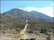
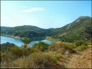
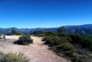 Camuesa OHV Trail
Status: Temporarily Closed
Type: Trail (National Forest)
Location: Santa Barbara, CA
Difficulty:

This part of the Los Padres National Forest has about 10 miles of easy, hard packed dirt roads. More...
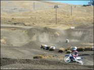
 Carnegie SVRA
Status: Open (This park reaches capacity during most weekends. To receive real-time notifications with current status text ‘OHV’ to (662) 200-4303.)
Type: Combo (State Recreation)
Location: Tracy, CA
Difficulty:

This large offroad park offers a wide variety of trails, a number of motocross tracks for all skill levels, a 4x4 area with man made obstacles, motorcycle trials area and some incredibly steep hill climbs. More...
 Chappie-Shasta OHV Area
 Status: Open
Type: Trail (BLM, National Forest)
Location: Redding, CA
Difficulty:
The trails here could be described as dry and a bit rocky, but the scenery is really top notch. More...
 Clay Pit SVRA
Status: Open
Type: Other (State Recreation)
Location: Oroville, CA
Difficulty:
This 220 acre riding area was created in the depression left from where clay was excavated to build the Lake Oroville Dam. More...
 Cleghorn OHV Trail
 Status: Open
Type: Trail (National Forest)
Location: San Bernardino, CA
Difficulty:
This old fire road is about 15 miles long and eventually ends near Silverwood Lake. More...
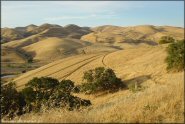
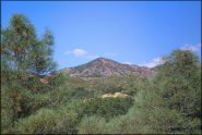 Condon Peak
 Status: Open
Type: Trail (BLM)
Location: Hollister, CA
Difficulty:
This area offers about 19 miles of trails that are open to ATVs and UTVs. More...
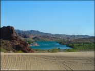 Copper Basin Dunes OHV Area
 Status: Open
Type: Combo (BLM)
Location: Parker, AZ
Difficulty:
This area boasts over 1,200 acres of open area with a variety of desert trails, shallow sand washes with patches of hard packed dirt and loose gravel, powerline roads plus isolated sand dunes, making this an excellent choice for ATV and UTV riders. More...
 Corral Canyon OHV Area
 Status: Open
Type: Trail (National Forest)
Location: Morena Village, CA
Difficulty:
This part of the Cleveland National Forest offers over 50+ miles of ATV trails, two nice campgrounds and some great views. More...
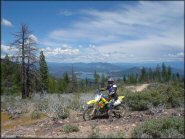
 Corral OHV Trail
 Status: Open
Type: Trail (National Forest)
Location: South Lake Tahoe, CA
Difficulty:
This small area consists of two main trails. More...