 |
      |
| Home > Alaska > Permanente Trail |
Permanente Trail
Saturday, May 10, 2025
| Other Names | Kings River Trail, Young Creek, Ruby Lake, Chickaloon Trail, Matanuska River, Chickaloon-knik-nelchina Trail System, House Rock |
| Last Known Status | Open |
This part of the Chickaloon Trail System consists of three separate trails, Permante, Young Creek and the Kings River Trail. The Kings River Trail is located on the western side of the river and is rated as difficult while the Permante Trail is located on the eastern side and is rated as easy.
The Kings River Trail eventually crosses a river to connect with Permante Trail but is not recommended due to unpredictable currents and cold temperatures. The trails are usually very muddy with numerous water crossings so come prepared.
The trails can be accessed by staging at the Kings River Bridge or the Permanente Trailhead. The Kings River Bridge has plenty of turnaround room and is a good choice for large trailers while the Permanente Trailhead offers limited parking and is close to the highway.
REGULATIONS
| Permit Required | ||
| Dates Open | Year-Round | |
| Spark Arrestor | Recommended | A spark arresting exhaust silencer or end cap is recommended. |
| Noise Limit | ||
| Whip Flags | Not Required | |
| Maximum Vehicle Width | No Restriction | |
 Motorcycles & Dirt Bikes Motorcycles & Dirt Bikes | Permitted | |
 Four Wheelers Four Wheelers | Permitted | |
 UTV & SXS UTV & SXS | Permitted | |
 4x4 & Jeeps (registered) 4x4 & Jeeps (registered) | Permitted | |
| Dune Buggy & Sand Rail 4x4 (unregistered) | Permitted | |
| 2 Stroke Engines | No Restriction | |
 Camping Camping | Some Areas | (camp in developed sites only) |
 Campfires Campfires | ||
| Night Riding | Unknown | |
| Trail Blazing | Prohibited | riders must stay on trail |
| Rule Enforcement |
TERRAIN
| Miles Of Trail | 25 | |
| Climate Type | Forest | |
| Elevation | 545 to 1200 ft. | |
| Trail Maintenance | Marked, Not Rated, Lightly Maintained | |
| Loose Dirt |  Little Little | |
| Hard Pack | Little | |
| Sand | Little | |
| Mud |  Mostly Mostly | |
| Dust |  None None | |
| Rocks |  Some Some | |
| Trees |  All All | |
| Steep Hills | Some | |
| Water Crossings | Some | |
| Small Jumps | None | |
| Large Jumps | None | |
| Berms | None | |
| Sand/Gravel Pits | None | |
| Single Track | None | |
| Hazards |  Few Few | (hazards assumed marked but use caution) |
 Novice Novice | Little | |
 Amateur Amateur | Mostly | |
 Expert Expert | Some |
TYPE OF AREA
| Area | Motorized Trails |
| Land | AK Department of Transportation |


KEY SERVICES
 Gasoline Gasoline | 5-20 Miles (E) | King Mountain Chickaloon General Store (907) 746-1801 |
| Diesel | 5-20 Miles (E) | King Mountain Chickaloon General Store (907) 746-1801 |
 Water Water | 1-5 Miles (E) | Pinnacle Mountain RV and Cafe (907) 746-6531 |
 RV Hookup RV Hookup | 1-5 Miles (E) | Pinnacle Mountain RV and Cafe (907) 746-6531 |
 RV Disposal RV Disposal | 1-5 Miles (E) | Pinnacle Mountain RV and Cafe (907) 746-6531 |
| Campground | On Site | Kings River Recreation Site |
 Conv Store Conv Store | 5-20 Miles (E) | King Mountain Chickaloon General Store (907) 746-1801 |
FEES & PASSES
| Parking | (None) |
| Entry | (None) |
| Riding | (None) |
| Camping | (None) |
RATINGS
| Our Rating |  Good Good |
| Recommended Stay | Full Day |
| Comments | (Scroll Down For Rider Reviews & Comments) |
DRIVING DIRECTIONS
| Nearest City | Sutton, AK | ||
| From: Anchorage, AK
1) AK-1/Glenn Highway North to mile post 66 2) Turn left (north) off the highway, follow signs for the trailhead. For the Permanente Trailhead: 3) Continue east past the Kings River Bridge 5.7 miles to mile post 72 4) Trailhead is on the left (north). **Note: The Permanente Trailhead is an unmarked pullout located on the north side of the highway and is easy to miss. Parking is limited and large trailers are not recommended. |


OFFICIAL CONTACTS
| Contact Info | Alaska Department of Transportation 3132 Channel Drive Juneau, AK 99811-2500 (907) 465-3900 dot.social@alaska.gov www.dot.state.ak.us |
Permanente Trail Photo
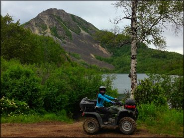
Photo Submitted 8/7/2014 (Thanks!)
Permanente Trail Photo
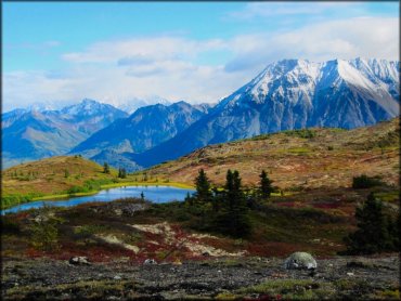
Photo Submitted 6/27/2015 (Thanks!)
Permanente Trail Photo
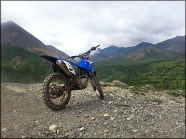
Photo Submitted 2/22/2015 (Thanks!)
Permanente Trail Photo
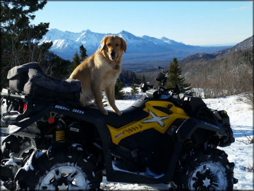
Photo Submitted 7/14/2016 (Thanks!)
RIDER COMMENTS & REVIEWS