 |
      |
| Home > Arizona > Four Peaks |
Four Peaks
Wednesday, December 31, 2025
| Other Names | Tonto National Forest, Sugarloaf Mountain, Rolls OHV Area, Sycamore Creek OHV Area, The Rolls OHV |
| Last Known Status | Open |
Deep sand washes, steep cliffs, desert single track, huge play areas, and ridge top Jeep and ATV trails with panoramic mountain views are among the many things this place has to offer. Overnight camping is permitted and there are numerous sites that are suitable for large RVs.
The four peaks for which this area is named provide a great backdrop but the most notable features of this area are the steep canyon chutes carved into the hillside of the main wash.
Nearby Saguaro Lake has a marina, beach area and boat rentals, as well as a secluded campground that is only accessible by a boat. Be sure to bring an EZ-Up and some water because there are no services and the climate is hot and dry.
REGULATIONS
| Permit Required | Yes | AZGFD sticker required |
| Dates Open | Year-Round | |
| Other ATV Stickers Accepted | No | All non-residents must purchase an Arizona OHV decal. |
| Spark Arrestor | Yes | A spark arresting exhaust silencer or end cap is required for all vehicles. |
| Noise Limit | Yes (96 dB) | |
| Whip Flags | Not Required | |
| Maximum Vehicle Width | No Restriction | |
 Motorcycles & Dirt Bikes Motorcycles & Dirt Bikes | Permitted | |
 ATVs ATVs | Permitted | |
 UTV & SXS UTV & SXS | Permitted | |
 SUVs & Jeeps (registered) SUVs & Jeeps (registered) | Permitted | |
| Dune Buggy & Sand Rail 4x4 (unregistered) | Permitted | |
| 2 Stroke Engines | No Restriction | |
| MX Helmet Required | Youth Only | required for persons under 18 by state law (RiderPlanet strongly recommends helmets for all riders.) |
 Camping Camping | No Restriction | (camp anywhere) |
 Campfires Campfires | No Restriction | |
| Night Riding | Unknown | Not Recommended |
| Trail Blazing | Some Areas | |
| Rule Enforcement | Few/Periodic |
TERRAIN
| Approx Size | 27,000 acres (42 sq mi) | |
| Miles Of Trail | 65 | |
| Climate Type | Desert | |
| Elevation | 1500 to 2800 ft. | |
| Trail Maintenance | Marked, Not Rated, Not Maintained | |
| Loose Dirt |  Some Some | |
| Hard Pack | Some | |
| Sand | Some | |
| Mud |  Little Little | |
| Dust |  Mostly Mostly | |
| Rocks | Little | |
| Trees | Some | |
| Steep Hills | Some | |
| Water Crossings | Some | |
| Small Jumps |  Many Many | |
| Large Jumps | Some | |
| Berms | Many | |
| Sand/Gravel Pits |  None None | |
| Single Track | None | |
| Roads | Some | |
| Intersections | Many | |
| Rider Traffic | Many | |
| Shade |  Few Few | |
| Ranges/Gunfire | Many | |
| Hazards | Some | (hazards not marked) Beware of cliffs. steep drop-offs, blind chutes & corners |
 Novice Novice | Some | |
 Amateur Amateur | Mostly | |
 Expert Expert | Little |
TYPE OF AREA
| Area | Motorized Trails |
| Land | National Forest |


KEY SERVICES
 Gasoline Gasoline | 1-5 Miles (SW) | Baja Gas Station (480) 837-3506 |
| Diesel | 1-5 Miles (SW) | Baja Gas Station (480) 837-3506 |
 Water Water | 1-5 Miles (SW) | Eagle View RV Resort (480) 789-5310 or (800) 843-3678 |
 RV Hookup RV Hookup | 1-5 Miles (SW) | Eagle View RV Resort (480) 789-5310 or (800) 843-3678 |
 RV Disposal RV Disposal | 1-5 Miles (SW) | Eagle View RV Resort (480) 789-5310 or (800) 843-3678 |
| Campground | On Site | |
 Conv Store Conv Store | 1-5 Miles (SW) | Bashas' (480) 837-1750 |
FEES & PASSES
| Parking | (None) |
| Entry | (None) |
| Riding | Yes ($10.00 per rider) $10 for 3-day permit, $60 for 6-month permit, $80 for annual permit |
| Camping | (None) |
RATINGS
| Pros | free, large area, variety of terrain, cool play areas |
| Cons | a lot of trash & debris, can get crowded on weekends |
| Our Rating |  Good Good |
| Recommended Stay | 1-2 Days |
| Comments | (Scroll Down For Rider Reviews & Comments) |
DRIVING DIRECTIONS
| Nearest City | Fort McDowell, AZ | ||
| Address | N Beeline Hwy, Fort McDowell, AZ 85264 | ||
| From: Phoenix, AZ
1) Take SR-87 (Beeline Hwy) North about 25 miles 2) Turn left (west) on NF-402 (or right on Four Peaks Road) 3) Various staging areas are available along the road. |


OFFICIAL CONTACTS
| Contact Info | Tonto National Forest - Supervisor's Office 2324 E. Mcdowell Road Phoenix, AZ 85006 (602) 225-5200 mailroom_r3_tonto@fs.fed.us www.fs.usda.gov |
Four Peaks Trail Photo
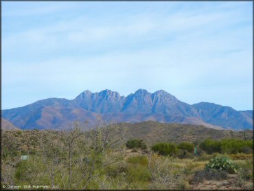
The area is named for this quadruple peaked mountain to the northeast.
Four Peaks Trail Photo
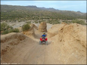
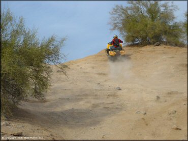
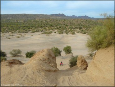
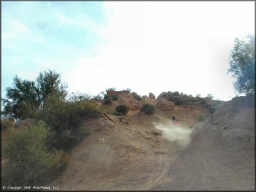
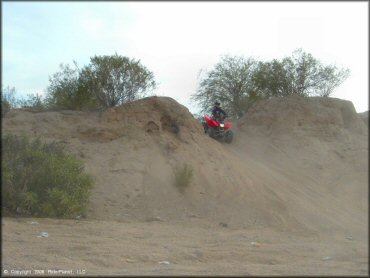
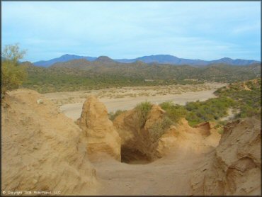
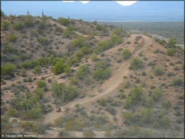
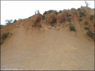
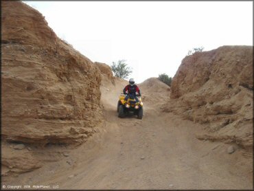
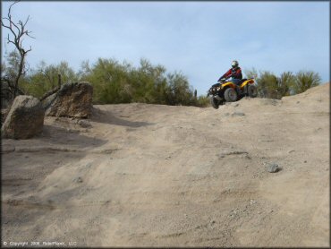
The southwestern area "Sycamore Creek Access" has a large play area with many tall chutes like this cut into the hillside.
Four Peaks Trail Photo
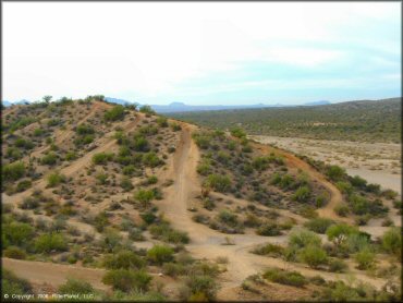
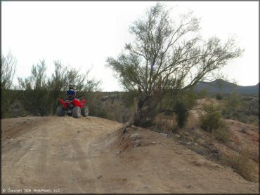
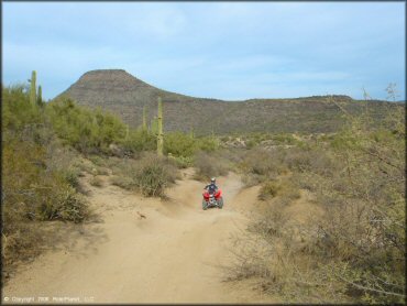
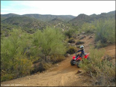
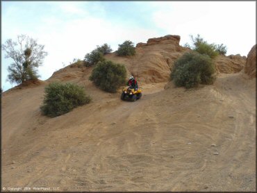
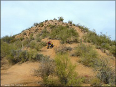
The northwest area "Sugarloaf Mountain" has trails winding along the creek banks, up the sand wash and in an out of the trees.
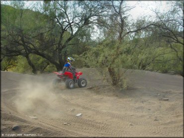
Four Peaks Trail Photo
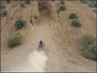
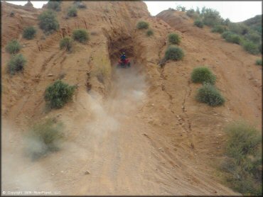
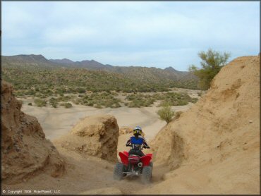
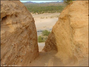
An example of the chutes in the Sycamore Creek area.
Four Peaks Trail Photo
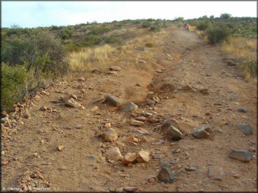
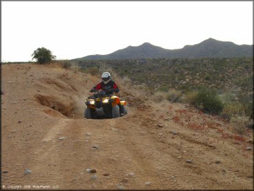
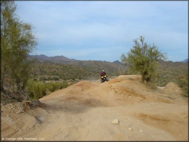
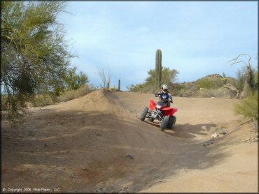
Along the west of the highway, the northern section has many wide hard pack trails. You can follow these to the sand wash.
Four Peaks Trail Photo
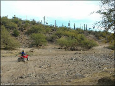
To the east of the highway "Rolls OHV Area" the trails are more rocky and technical.
Four Peaks Trail Photo
Four Peaks Trail Photo
Four Peaks Trail Photo
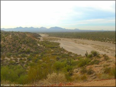
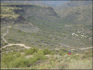
Below the chutes at Sycamore Creek is a large open sand wash. Many people bring their RVs here on weekends.
Four Peaks Trail Photo
Four Peaks Trail Photo
Four Peaks Trail Photo
Four Peaks Trail Photo
Four Peaks Trail Photo
All included, this area has just about every type of terrain that Arizona has to offer.
Four Peaks Trail Photo
Four Peaks Trail Photo
Four Peaks Trail Photo
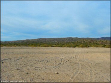
Below the chutes at Sycamore Creek is a large open sand wash. Many people bring their RVs here on weekends.
Four Peaks Trail Photo
Four Peaks Trail Photo
Four Peaks Trail Photo
Four Peaks Trail Photo
Four Peaks Trail Photo
Four Peaks Trail Photo
Four Peaks Trail Photo
Four Peaks Trail Photo
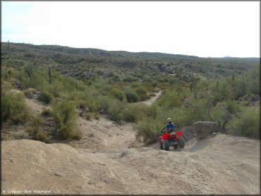
Another view of the chutes at Sycamore Creek.
Four Peaks Trail Photo
Four Peaks Trail Photo
Four Peaks Trail Photo

Four Peaks Trail Photo
Four Peaks Trail Photo
Four Peaks Trail Photo

Four Peaks Trail Photo
Four Peaks Trail Photo
RIDER COMMENTS & REVIEWS