 |
      |
| Home > California > Mammoth Bar |
Mammoth Bar OHV
Tuesday, June 30, 2026
| Other Names | Mammoth Bar OHV Area, American River, Auburn, Auburn State Recreation Area, Mammoth Bar OHV Area Trails, Mamouth, Mamoth |
| Last Known Status | Open |
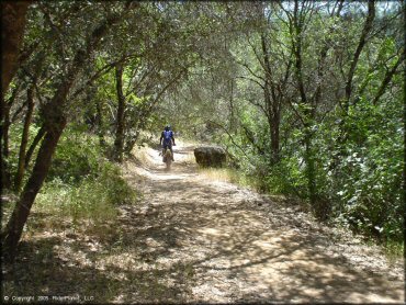
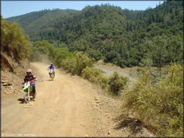
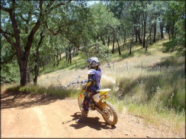
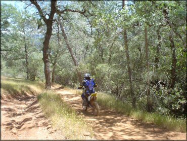
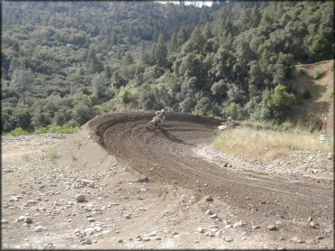
This designated OHV area offers scenic backdrops, a pristine MX track, and at least 30 miles of offroad and multiple use trails spread over 1,200 acres. All trails are marked and rated, and most are steep and narrow from the get go, with no time to get warmed up.
The nearby state recreation area offers camping, fishing, swimming, boating, and white water rafting.
(California OHMVR sticker and noise regulations are strictly enforced at the gate. ATV's are limited to 40 inches wide and all OHVs must have an FS approved spark arrestor.)
Park closes during wet weather until 24 hours after last rain.
REGULATIONS
| Permit Required | Yes | CA OHMVR stickers required |
| Dates Open | 90cc Track, and Trials Area are open Tuesday, Wednesday, Friday and Saturday | CA OHMVR red sticker vehicles permitted year round |
| Other ATV Stickers Accepted | Yes | Residents of any state not listed must purchase a Nonresident OHV Use Permit. (AR, AZ, CA, CO, CT, DE, IA, ID, IN, LA, MA, MD, ME, MI, MN, MO, MT, ND, NH, NJ, NM, NV, NY, OH, OK, OR, PA, RI, TX, UT, VT, WA, WI, WY) |
| Spark Arrestor | Yes | A spark arresting exhaust silencer or end cap is required for all vehicles. |
| Noise Limit | Yes (96 dB) | CA OHMVR noise limits apply (1985/older limit 101 dB, 1986/newer limit 96 dB) |
| Whip Flags | Not Required | |
| Maximum Vehicle Width | Yes (40 inches) | has entrance gate and narrow terrain |
 Motorcycles & Dirt Bikes Motorcycles & Dirt Bikes | Permitted | CA OHMVR stickers required |
 ATVs ATVs | Permitted | CA OHMVR stickers required (maximum width 40 inches) |
 UTV & SXS UTV & SXS | Prohibited | CA OHMVR stickers required |
 SUVs & Jeeps (registered) SUVs & Jeeps (registered) | Prohibited | |
| Dune Buggy & Sand Rail 4x4 (unregistered) | Prohibited | CA OHMVR stickers required |
| 2 Stroke Engines | No Restriction | CA OHMVR restrictions apply |
| MX Helmet Required | Yes | helmets required by state law |
 Camping Camping | Prohibited | |
 Campfires Campfires | Prohibited | |
| Night Riding | No | |
| Trail Blazing | Prohibited | stay on trails |
| Alcohol | Prohibited | |
| Rule Enforcement | Strict | Dedicated Rangers/Officers Gate Inspection |
| Comment | All regulations are strictly enforced at the gate and throughout the park by State Park Ranger. Must stay on designated trails - no free riding. | |
TERRAIN
| Approx Size | 1,280 acres (2 sq mi) | |
| Miles Of Trail | 30 | |
| Climate Type | Forest | |
| Elevation | 600 to 1700 ft. | |
| Trail Maintenance | Marked, Rated, Heavily Maintained | |
| Loose Dirt |  Mostly Mostly | |
| Hard Pack |  Some Some | |
| Sand |  None None | |
| Mud | None | closed during raining periods |
| Dust |  Little Little | |
| Rocks | Some | some expert/moderate trails are very rocky |
| Trees |  All All | |
| Steep Hills |  Many Many | mountainous area, rapid elevation changes up to 1200 ft or more |
| Water Crossings | Many | trials course only |
| Small Jumps | Some | |
| Large Jumps | None | |
| Berms | Many | |
| Sand/Gravel Pits | None | |
| Single Track | Some | some trails are one way only, clearly marked |
| Roads |  Few Few | |
| Intersections | Few | |
| Rider Traffic | Some | Sundays are busiest |
| Shade | Some | few shaded parking spots but most trails have shady parts |
| Ranges/Gunfire | None | Prohibited |
| Hazards | Some | (hazards not marked) Beware of cliffs. some trails are narrow and are adjacent to very steep cliffs |
 Novice Novice | Little | |
 Amateur Amateur | Mostly | |
 Expert Expert | Some |
TYPE OF AREA
| Area | Motorized Trails, MX Track |
| Land | State Recreation |

| Features | Public, Watered, Groomed |
| Max Engine Size | 500 cc Max |
| Min Engine Size | 90 cc Min |
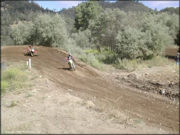
| Comment | nicely groomed, gorgeous track by the river, top notch grooming, 90cc and up |
| Features | Public |
| Max Engine Size | 90 cc Max |
| Min Engine Size | 50 cc Min |
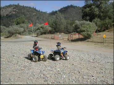
| Comment | 90cc limited or less, very nicely groomed |
| Features | Public |
| Max Engine Size | No Maximum |
| Min Engine Size | No Minimum |
| Comment | Main Track |
| Features | Public |
| Max Engine Size | 85 cc Max |
| Min Engine Size | 50 cc Min |
| Comment | PeeWee Track |


KEY SERVICES
 Gasoline Gasoline | 5-20 Miles (W) | Gas & Shop (530) 885-0200 |
| Diesel | 5-20 Miles (W) | Chevron (530) 885-7138 |
 Water Water | On Site | non-potable water |
 RV Hookup RV Hookup | 5-20 Miles (NW) | Auburn Gold Country RV Park (530) 885-0990 |
 RV Disposal RV Disposal | 5-20 Miles (NW) | Auburn Gold Country RV Park (530) 885-0990 |
| Campground | 5-20 Miles (NE) | Ruck-A-Chucky Campground (530) 885-4527 |
 Conv Store Conv Store | 5-20 Miles (W) | Gas & Shop (530) 885-0200 |
FEES & PASSES
| Parking | (None) |
| Entry | Yes ($10.00 per vehicle) |
| Riding | (None) |
| Camping | (None) |
RATINGS
| Pros | Gorgeous scenery, some trails one-way, all trails clearly marked w/difficulty |
| Cons | closes during and after heavy rains |
| Our Rating |  Very Good Very Good |
| Recommended Stay | Full Day |
| Comments | (Scroll Down For Rider Reviews & Comments) |
DRIVING DIRECTIONS
| Nearest City | Auburn, CA | ||
| Address | Old Auburn Foresthill Road, Auburn, CA 95614 | ||
| From: Sacramento, CA
1) Take I-80 East to Exit 121/Foresthill Road 2) Turn right (east) off the exit ramp onto Foresthill Road, continue 3.2 miles 3) Turn right on Old Auburn Foresthill Road, continue 1.5 miles 4) Main entrance is on the left. |


OFFICIAL CONTACTS
| Contact Info | Mammoth Bar OHV Area 501 El Dorado Street Auburn, CA 95603 (530) 885-4527 ohvinfo@parks.ca.gov info@parks.ca.gov www.parks.ca.gov |
| Comment | Extension 1 |
Mammoth Bar OHV Area Photo
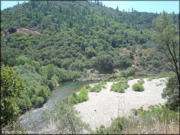
American River.
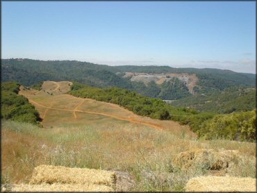
Mammoth Bar OHV Area Photo
Mammoth Bar OHV Area Photo
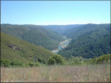
Mammoth Bar OHV Area Photo
Mammoth Bar OHV Area Photo
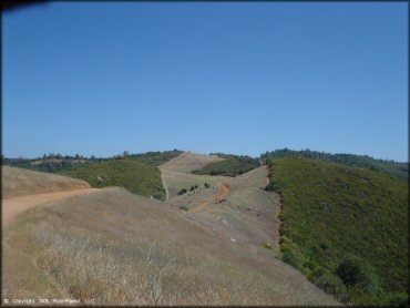
Mammoth Bar OHV Area Photo
Mammoth Bar OHV Area Photo
Mammoth Bar OHV Area Photo
Mammoth Bar OHV Area Photo
Mammoth Bar OHV Area Photo
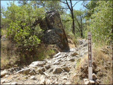
With a name like this, you know what to expect.
Mammoth Bar OHV Area Photo
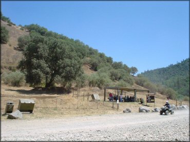
Pee-wee track.
Mammoth Bar OHV Area Photo
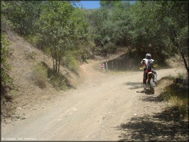
Pay attention to the signs!
Mammoth Bar OHV Area Photo
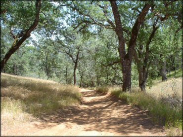
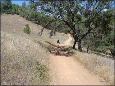
Most of the trails are smooth and easy.
Mammoth Bar OHV Area Photo
The MX track is smooth, fast and fun!
Mammoth Bar OHV Area Photo
Mammoth Bar OHV Area Photo
RIDER COMMENTS & REVIEWS