 |
      |
| Home > California > High Dome Trail |
High Dome Trail
Monday, July 28, 2025
| Other Names | Trail 3E02, Six Rivers National Forest, Patrick Creek |
| Last Known Status | Open |
This scenic four mile single-track trail is for motorcycles only, but the main forest road can be used to form nice loop. You can travel in either direction, but starting the trail at the lower trailhead (the creek crossing) is considerably easier due to the long series of super sharp switchbacks which are much easier going up than coming down.
Keep an eye out for an old fire lookout at the top with views of the Pacific Ocean and a large open meadow with a scenic mountain backdrop. The trail is short but checkout nearby Elk Camp Ridge which has an additional eight miles of challenging single track.
There are several primitive campsites overlooking the river located alongside the main road. There are no real good turnaround spots on Patricks Creek Road, but there are some campgrounds alongside Hwy 199 that can accomodate large trailers (there is no direct trail access from the highway campgrounds, so unless street legal, you will have to haul your bikes to and from the staging areas).
REGULATIONS
| Permit Required | Yes | CA OHMVR stickers required |
| Dates Open | Daily Year-Round | CA OHMVR red sticker vehicles permitted year round |
| Other ATV Stickers Accepted | Yes | Residents of any state not listed must purchase a Nonresident OHV Use Permit. (AR, AZ, CA, CO, CT, DE, IA, ID, IN, LA, MA, MD, ME, MI, MN, MO, MT, ND, NH, NJ, NM, NV, NY, OH, OK, OR, PA, RI, TX, UT, VT, WA, WI, WY) |
| Spark Arrestor | Yes | A spark arresting exhaust silencer or end cap is required for all vehicles. |
| Noise Limit | Yes (96 dB) | CA OHMVR noise limits apply (1985/older limit 101 dB, 1986/newer limit 96 dB) |
| Whip Flags | Not Required | |
| Maximum Vehicle Width | Yes (40 inches) | narrow terrain |
 Motorcycles & Dirt Bikes Motorcycles & Dirt Bikes | Permitted | CA OHMVR stickers required |
 ATVs ATVs | Prohibited | CA OHMVR stickers required most trails too narrow |
 UTV & SXS UTV & SXS | Prohibited | CA OHMVR stickers required most trails too narrow |
 SUVs & Jeeps (registered) SUVs & Jeeps (registered) | Prohibited | |
| Dune Buggy & Sand Rail 4x4 (unregistered) | Prohibited | CA OHMVR stickers required |
| 2 Stroke Engines | No Restriction | CA OHMVR restrictions apply |
| MX Helmet Required | Yes | helmets required by state law |
 Camping Camping | Some Areas | |
 Campfires Campfires | Some Areas | |
| Night Riding | Unknown | Not Recommended |
| Trail Blazing | Prohibited | stay on trails |
| Alcohol | No Restriction | |
| Rule Enforcement | Few/Periodic |
TERRAIN
| Approx Size | 5,120 acres (8 sq mi) | |
| Miles Of Trail | 4 | |
| Climate Type | Forest | |
| Elevation | 1300 to 3800 ft. | |
| Trail Maintenance | Marked, Not Rated, Lightly Maintained | |
| Loose Dirt |  Some Some | |
| Hard Pack |  Mostly Mostly | |
| Sand |  None None | |
| Mud |  Little Little | |
| Dust | Little | |
| Rocks | Little | |
| Trees |  All All | |
| Steep Hills | Some | |
| Water Crossings |  Few Few | |
| Small Jumps | None | |
| Large Jumps | None | |
| Berms | Few | |
| Sand/Gravel Pits | None | |
| Single Track | All | |
| Roads | Some | |
| Intersections | Few | |
| Rider Traffic | Few | |
| Shade | All | |
| Ranges/Gunfire | None | |
| Hazards | Few | (hazards not marked) |
 Novice Novice | Some | |
 Amateur Amateur | Mostly | |
 Expert Expert | Little |
TYPE OF AREA
| Area | Motorized Trails |
| Land | National Forest |
GPS POINTS


KEY SERVICES
 Gasoline Gasoline | 20-30 Miles (SW) | Hiouchi /Chevron |
| Diesel | 20-30 Miles (SW) | Hiouchi /Chevron |
 Water Water | 5-20 Miles (SW) | Panther Creek Campground (877) 444-6777 |
 RV Hookup RV Hookup | 5-20 Miles (SW) | Hiouchi Hamlet RV Resort (707) 458-3321 |
 RV Disposal RV Disposal | 5-20 Miles (SW) | Hiouchi Hamlet RV Resort (707) 458-3321 |
| Campground | 1-5 Miles (S) | Patrick Creek Campground (707) 442-1721 |
 Conv Store Conv Store | 5-20 Miles (SW) | Hiouchi Hamlet Market (707) 458-3114 |
FEES & PASSES
| Parking | (None) |
| Entry | (None) |
| Riding | (None) |
| Camping | (None) |
RATINGS
| Pros | single track, scenic forest and ocean views |
| Cons | some sections blocked by fallen trees, trails are short |
| Our Rating |  Very Good Very Good |
| Recommended Stay | 1-2 Days |
| Comments | (Scroll Down For Rider Reviews & Comments) |
DRIVING DIRECTIONS
| Nearest City | Gasquet, CA | ||
| Address | Patricks Creek Road, Gasquet, CA 95543 | ||
| From: Crescent City, CA
1) Take US-101 North about 3 miles 2) Take exit for US-199 east, continue about 21 miles 3) Turn left (north) on Patricks Creek Road, continue about .5 miles (after passing Patricks Creek Lodge you will turn left again on Patricks Creek Road) 4) Continue about .5 miles, turn left (west) onto turnoff. Stage here and ride in or... 5) Continue on Patricks Creek Road, about 3 miles 6) Veer left at intersection on Old Gasquet Toll Road, continue .5 miles 7) After crossing bridge turn right onto 315. The lower trailhead is immediately on the right. 8) The upper trailhead is another 5.8 miles up the road. |


OFFICIAL CONTACTS
| Contact Info | Six Rivers National Forest - Smith River NRA Highway 199 P.O. Box 228 Gasquet, CA 95543 (707) 457-3131 mailroom_r5_six_rivers@usda.gov www.fs.usda.gov |
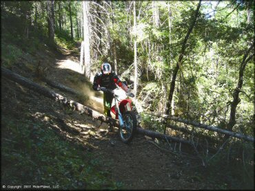
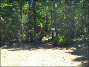
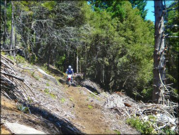
High Dome Trail Photo
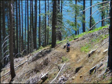
The trails are narrow and views... magnificent!
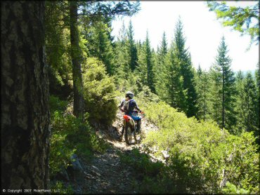
High Dome Trail Photo
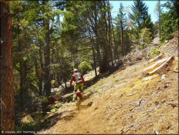
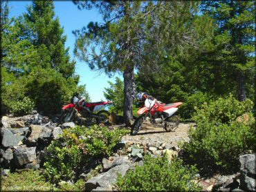
The trail portion of the loop is pure single track; ATVs over 40 inches wide are not permitted.
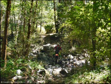
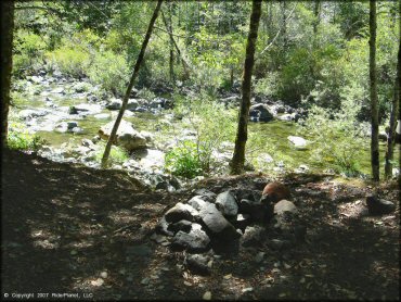
High Dome Trail Photo
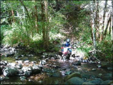
This creek crossing guards the lower trail entrance, or exit.
High Dome Trail Photo
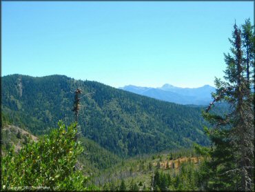
There is no shortage of scenic views on this ride.
High Dome Trail Photo
Trails are mostly maintained, but there were a couple of freshly fallen trees that day.
High Dome Trail Photo
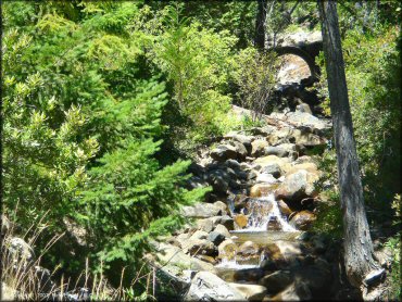
A nice view of the creek you'll pass by on the main road.
High Dome Trail Photo
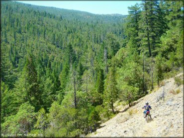
Starting the descent on the main loop.
High Dome Trail Photo
Another view of the creek at the loop trailhead.
High Dome Trail Photo
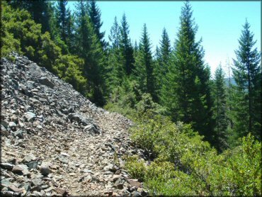
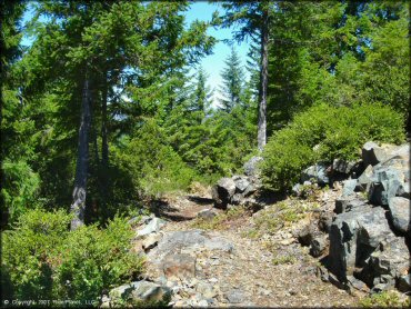
Apart from this one section, there were virtually no rocks on this trail.
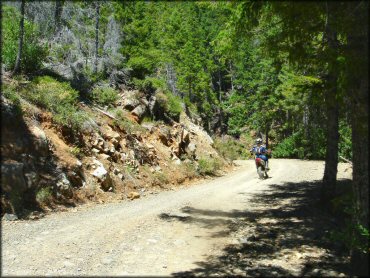
High Dome Trail Photo
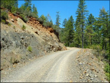
This forest road can be used the access the lower and upper trailheads, or to make the ride a loop.
High Dome Trail Photo
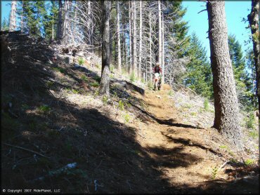
Part of the loop descent.
High Dome Trail Photo
The fire lookout at the top would be a good place to break for a lunch, but you'll get there too quickly.
High Dome Trail Photo
A view of the trail near the lookout point.
High Dome Trail Photo
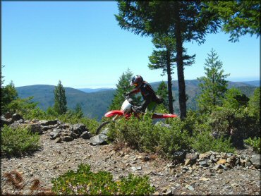
You can actually see the Pacific Ocean from the fire lookout. It's a great view.
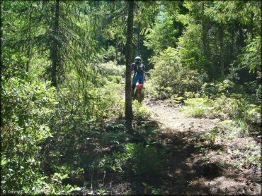
High Dome Trail Photo
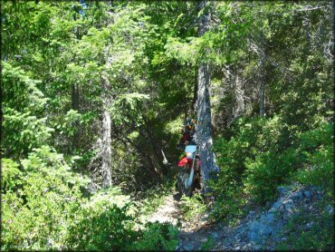
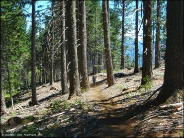
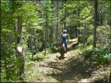
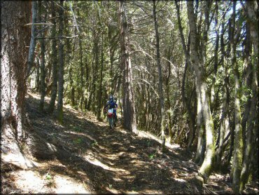
A thicker portion of the trail loop.
High Dome Trail Photo
High Dome Trail Photo
The upper trailhead looks like this. Watch for it on the right side of the forest road.
High Dome Trail Photo
There are a number of inviting primitive campsites right on the river banks along the main road when you first enter the area.
High Dome Trail Photo
This forest road can be used the access the lower and upper trailheads, or to make the ride a loop.
High Dome Trail Photo
High Dome Trail Photo
High Dome Trail Photo
This is somewhere near the beginning of the short section of rocky trail. After this the trail is mostly smooth.
High Dome Trail Photo
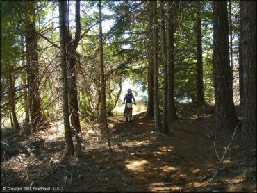
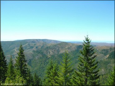
More than just panoramic views, there was also great forest scenery all along this loop also.
High Dome Trail Photo
High Dome Trail Photo
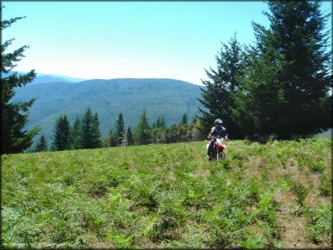
The meadow at the top of the hill was fun to check out. Nothing much there but a nice view.
High Dome Trail Photo
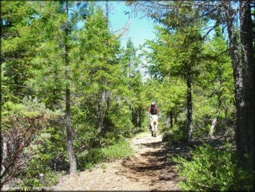
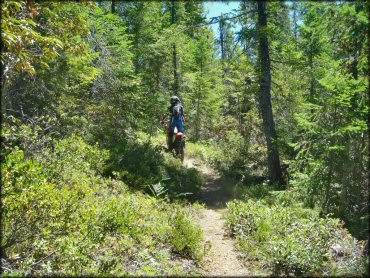
This is my idea of a perfect woods trail. Too bad there was not more of it.
High Dome Trail Photo
High Dome Trail Photo
Although a bit short, the views made this ride a lot of fun.
High Dome Trail Photo
RIDER COMMENTS & REVIEWS