 |
      |
| Home > California > Rowher Flat |
Rowher Flat OHV Area
Tuesday, March 10, 2026
| Other Names | Angeles National Forest, Rowher Flats, Los Angeles Gateway Ranger District, Drinkwater, Texas Canyon |
| Last Known Status | Open |
This part of the Angeles National Forest offers about 60 miles of offroad trails, technical hill climbs and some play areas. Trails are marked, rated and groomed, but are mostly hard pack dirt.
Recent upgrades have been made to the staging areas which now offer loading ramps, vault toilets, shade ramadas, picnic tables, trash cans and fire rings (bring your own water). The main staging area has a large parking lot plus an adjacent 80cc mini track and 4x4 training course.
Additional access can be found off Bouquet Canyon Road which can also be used to reach the northern portion of Rowher Flats and Drinkwater Flats.
An Adventure Pass is required and must be obtained prior to arrival since there is no self pay kiosk.
***ANNOUNCEMENTS***
Adventure Pass Required
An Adventure Pass is required and must be obtained prior to arrival since there is no self pay kiosk. Pass can be purchased online, at local ranger stations or via mail.
REGULATIONS
| Permit Required | Yes | CA OHMVR stickers required valid registration required for all vehicles |
| Dates Open | Year-Round | CA OHMVR red sticker vehicles permitted from 10/1 to 4/30 |
| Other ATV Stickers Accepted | Yes | Residents of any state not listed must purchase a Nonresident OHV Use Permit. (AR, AZ, CA, CO, CT, DE, IA, ID, IN, LA, MA, MD, ME, MI, MN, MO, MT, ND, NH, NJ, NM, NV, NY, OH, OK, OR, PA, RI, TX, UT, VT, WA, WI, WY) |
| Spark Arrestor | Yes | A spark arresting exhaust silencer or end cap is required for all vehicles. |
| Noise Limit | Yes (96 dB) | CA OHMVR noise limits apply (1985/older limit 101 dB, 1986/newer limit 96 dB) |
| Whip Flags | Not Required | |
| Maximum Vehicle Width | No Restriction | |
 Motorcycles & Dirt Bikes Motorcycles & Dirt Bikes | Permitted | CA OHMVR stickers required |
 ATVs ATVs | Permitted | CA OHMVR stickers required |
 UTV & SXS UTV & SXS | Permitted | CA OHMVR stickers required |
 SUVs & Jeeps (registered) SUVs & Jeeps (registered) | Some Areas | permitted on designated 4x4 trails and open area |
| Dune Buggy & Sand Rail 4x4 (unregistered) | Some Areas | CA OHMVR stickers required permitted on designated 4x4 trails and open area |
| 2 Stroke Engines | Certain Times | CA OHMVR restrictions apply |
| MX Helmet Required | Yes | helmets required by state law |
 Camping Camping | Some Areas | (camp in developed sites only) camping permitted in staging areas - first come, first serve |
 Campfires Campfires | Some Areas | (permitted in developed campsites only) |
| Night Riding | Unknown | |
| Trail Blazing | Prohibited | stay on trail OHVs restricted to operate on marked roads and trails only. |
| Alcohol | No Restriction | |
| Rule Enforcement | Some |
TERRAIN
| Approx Size | 10,240 acres (16 sq mi) | |
| Miles Of Trail | 60 | |
| Climate Type | Desert | |
| Elevation | 2100 to 4844 ft. | |
| Trail Maintenance | Marked, Rated, Lightly Maintained | Trails have been groomed and are less rocky than they use to be. |
| Loose Dirt |  None None | |
| Hard Pack |  All All | |
| Sand | None | |
| Mud |  Little Little | |
| Dust |  Some Some | |
| Rocks | Some | |
| Trees |  Few Few | |
| Steep Hills |  Many Many | |
| Water Crossings | Few | |
| Small Jumps | Few | |
| Large Jumps | None | |
| Berms | Few | |
| Sand/Gravel Pits | None | |
| Single Track | Some | |
| Roads | Few | |
| Intersections | Some | |
| Rider Traffic | Few | |
| Shade | None | |
| Ranges/Gunfire | None | |
| Hazards | Few | (hazards not marked) |
 Novice Novice | Some | |
 Amateur Amateur |  Mostly Mostly | |
 Expert Expert | Little |
TYPE OF AREA
| Area | Motorized Trails, trails are hard packed, some open play areas |
| Land | National Forest |

| Features | Public |
| Max Engine Size | 80 cc Max |
| Min Engine Size | 50 cc Min |
| Comment | mini track/kids course |
GPS POINTS


KEY SERVICES
 Gasoline Gasoline | 5-20 Miles (SW) | Mobil Gas Station (661) 252-5777 |
| Diesel | 5-20 Miles (SW) | Shell (661) 252-1012 |
 Water Water | 5-20 Miles (SE) | Action/Los Angeles North KOA (661) 268-1214 or (800) 562-2172 |
 RV Hookup RV Hookup | 5-20 Miles (SE) | Action/Los Angeles North KOA (661) 268-1214 or (800) 562-2172 |
 RV Disposal RV Disposal | 5-20 Miles (SE) | Action/Los Angeles North KOA (661) 268-1214 or (800) 562-2172 |
| Campground | On Site | |
 Conv Store Conv Store | 5-20 Miles (SW) | Mobil Gas Station (661) 252-5777 |
FEES & PASSES
| Parking | Yes ($5.00) Adventure Pass Fee - $5/day or $30/year |
| Entry | (None) |
| Riding | (None) |
| Camping | (None) |
| Comment | Adventure Pass not required for green or red sticker OHVs, but is required for all street-legal vehicles parked within the OHV Area. |
RATINGS
| Pros | secluded, basic services, many trails, some free play areas, trails marked & rated |
| Cons | hard, dry, rocky, run down |
| Our Rating |  Fair Fair |
| Recommended Stay | Half Day |
| Comments | (Scroll Down For Rider Reviews & Comments) |
DRIVING DIRECTIONS
| Nearest City | Santa Clarita, CA | ||
| Address | Rush Canyon Road, Santa Clarita, CA 91390 | ||
| From: Santa Clarita, CA
1) Take Hwy 14 E (Antleope Valley Freeway) about 5 miles to Exit 9 (Sand Canyon) 2) Turn left (north) off the exit ramp onto Sand Canyon Road, continue 2 miles 3) Turn right (east) onto Sierra Highway, continue 4.5 miles 4) Turn left (west) onto Rush Canyon Road, continue about 4 miles toward main staging area. **Note: No stopping, unloading, or OHV riding permitted on Rush Canyon Road.** For Sierra Pelona Ridge Trailhead: From Santa Clarita, CA 1) Take Bouquet Canyon Road north about 13 miles 2) Trailhead is on the right (east). Note: Pelona Ridge Trailhead is about located about 1 mile north past the Big Oaks Lodge. |


OFFICIAL CONTACTS
| Contact Info | Angeles National Forest - Los Angeles Gateway Ranger District 12371 N. Little Tujunga Canyon Road San Fernando, CA 91342 (818) 899-1900 sm.fs.angeles_info@usda.gov www.fs.usda.gov |
| Comment | Ext. 221 |
| Contact Info | Angeles National Forest - Acton Work Center 33708 Crown Valley Road Acton, CA 93510 (661) 269-2808 |
| Contact Info | USDA Adventure Pass 602 S. Tippecanoe Avenue San Bernardino, CA 92408-2607 (909) 382-2622 (909) 382-2623 www.fs.usda.gov |
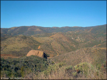
Rowher Flat Trail Photo
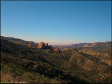
On the way in you can see the Texas Canyon Rocks, a popular hiking and rock climbing area.
Rowher Flat Trail Photo
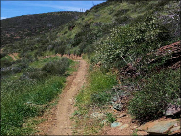
A good photo of some of the single track in the area.
Rowher Flat Trail Photo
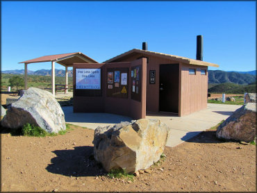
The Forest Service recently upgraded the staging areas with new restrooms, shade gazebos, information kiosks and picnic tables. Be sure to say thanks!
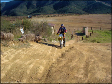
Rowher Flat Trail Photo
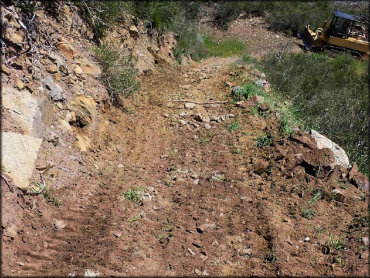
Recently some of the trails have been graded. Here is an example of some of the work done.
Rowher Flat Trail Photo
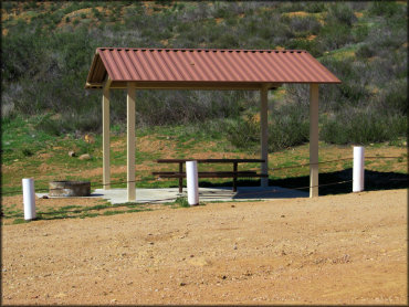
One of the recently added shade gazebos with a picnic table and fire ring.
Rowher Flat Trail Photo
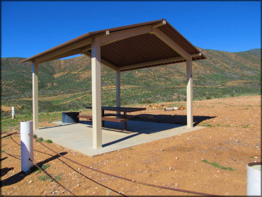
Another view of a shade gazebo with a picnic table and fire ring.
Rowher Flat Trail Photo
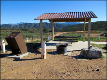
One of the recently added shade gazebos with a picnic table, fire ring, trash receptacle and decorative concrete pavers.
Rowher Flat Trail Photo
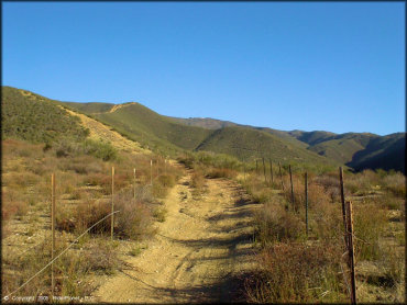
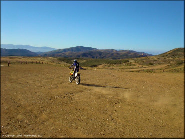
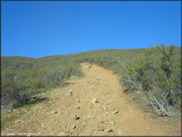
A view of one of the ATV trails. As you can see, most of the terrain is hard pack.
Rowher Flat Trail Photo
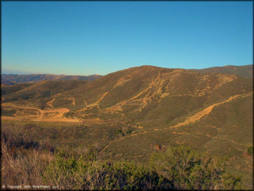
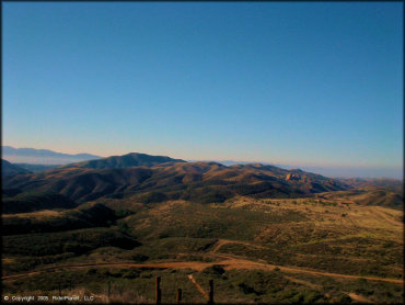
This was taken from the main entrace road. You can see that the trails go on for miles and miles.
Rowher Flat Trail Photo
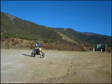
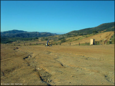
The staging area has plenty of room to practice basic riding skills.
Rowher Flat Trail Photo
This photo was taken sometime around late 2004. Many upgrades have been made since then.
Rowher Flat Trail Photo
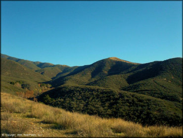
This photo sums up the scenery.
Rowher Flat Trail Photo
This photo was taken at one of the staging areas around late 2004. You can see that improvements have been made since then.
Rowher Flat Trail Photo
The main staging area is flat and wide with plenty of parking.
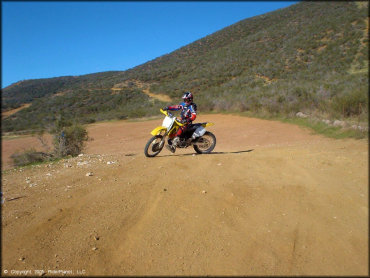
Rowher Flat Trail Photo
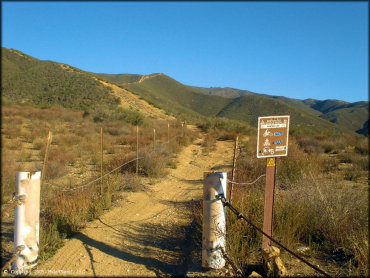
Trails are clearly marked and rated. This trail is open to ATVs and dirt bikes.
Rowher Flat Trail Photo
Aerial view of the staging area taken from the main entrance road.
Rowher Flat Trail Photo
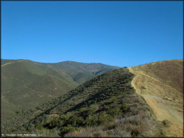
Some of the trails follow the ridgelines, offering some great scenic views.
Rowher Flat Trail Photo
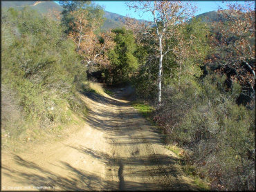
There are a few sections that go through some trees but they are few and far between.
Rowher Flat Trail Photo
Another view of the trails taken from the main entrance road.
Rowher Flat Trail Photo
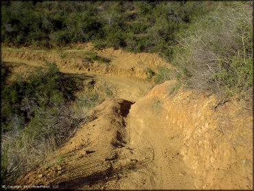
Some sections are a little rugged.
Rowher Flat Trail Photo
This is what you will mostly encounter here - hard pack with some loose chunk rock.
Rowher Flat Trail Photo
Another view of what the staging area looked like in 2004. Since then recent amenities like shade gazebos have been added.
RIDER COMMENTS & REVIEWS