 |
      |
| Home > California > Shad Pad |
Shad Pad
Saturday, May 10, 2025
| Other Names | Marysville, Yuba River, Yuba City, Riverfront, E-Street MX, MMX Racing |
| Last Known Status | Destroyed |
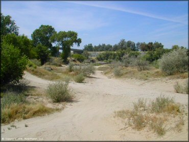
This area at one time offered a network of sandy trails through the trees that dipped down to the banks of the river. It was a local sand lot, and dormant 80's MX track controlled and owned by Yuba County. In 2004 it was re-purchased by a private party and re-developed into a full fledged motocross park.
This Shad Pad review page remains for historical and informational purposes only. The new tracks that now operate at this location are E-Street MX and MMX Racing.
REGULATIONS
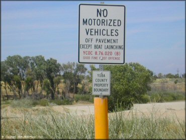
| Permit Required | No | illegal |
| Dates Open | Trails no longer exists, land has been redeveloped. | |
| Other ATV Stickers Accepted | Yes | Residents of any state not listed must purchase a Nonresident OHV Use Permit. (AR, AZ, CA, CO, CT, DE, IA, ID, IN, LA, MA, MD, ME, MI, MN, MO, MT, ND, NH, NJ, NM, NV, NY, OH, OK, OR, PA, RI, TX, UT, VT, WA, WI, WY) |
| Spark Arrestor | Yes | A spark arresting exhaust silencer or end cap is required for all vehicles. |
| Noise Limit | ||
| Whip Flags | Not Required | |
| Maximum Vehicle Width | ||
 Motorcycles & Dirt Bikes Motorcycles & Dirt Bikes | Prohibited | |
 ATVs ATVs | Prohibited | |
 UTV & SXS UTV & SXS | Prohibited | |
 SUVs & Jeeps (registered) SUVs & Jeeps (registered) | Prohibited | |
| Dune Buggy & Sand Rail 4x4 (unregistered) | Prohibited | |
| 2 Stroke Engines | Prohibited | |
| MX Helmet Required | Yes | helmets required by state law |
 Camping Camping | Prohibited | |
 Campfires Campfires | Prohibited | |
| Night Riding | Unknown | |
| Trail Blazing | Permitted | |
| Alcohol | Some Areas | CA open container law |
| Rule Enforcement | Few/Periodic | Armed OfficersNOT LEGAL, but not normally enforced, sometimes sheriff asks riders to leave |
TERRAIN
| Approx Size | 100 acres | |
| Miles Of Trail | 5 | |
| Climate Type | Dry River Bed | |
| Elevation | 50 to 80 ft. | |
| Trail Maintenance | Unknown | |
| Loose Dirt |  Little Little | |
| Hard Pack |  Some Some | |
| Sand |  Mostly Mostly | |
| Mud |  None None | |
| Dust | Mostly | |
| Rocks | Some | |
| Trees |  Many Many | |
| Steep Hills | None | |
| Water Crossings | None | |
| Small Jumps | Some | |
| Large Jumps |  Few Few | |
| Berms | Many | |
| Sand/Gravel Pits | Few | |
| Single Track | Few | |
| Roads | None | |
| Intersections | Many | |
| Rider Traffic | Few | |
| Shade | Many | |
| Ranges/Gunfire | Few | |
| Hazards | Few | (hazards not marked) |
 Novice Novice | Little | |
 Amateur Amateur | Mostly | |
 Expert Expert | None |
TYPE OF AREA
| Area | Motorized Trails, MX Track, dry river bed - sand & smooth stones |
| Land | County Land, controlled/owned by Yuba County |

| Features | Public |
| Max Engine Size | No Maximum |
| Min Engine Size | No Minimum |
| Comment | narrower than track 1, unmaintained |
| Features | Public |
| Max Engine Size | No Maximum |
| Min Engine Size | No Minimum |
| Comment | sandy, jumps rounded off, unmaintained |
GPS POINTS


KEY SERVICES
 Gasoline Gasoline | 1-5 Miles (SE) | AM/PM (530) 741-3721 |
| Diesel | 1-5 Miles (NW) | AM/PM (530) 741-3721 |
 Water Water | Marysville, CA | |
 RV Hookup RV Hookup | 1-5 Miles (N) | Travelhome RV Park (530) 674-8910 |
 RV Disposal RV Disposal | 1-5 Miles (N) | Travelhome RV Park (530) 674-8910 |
| Campground | 1-5 Miles (N) | Travelhome RV Park (530) 674-8910 |
 Conv Store Conv Store | 1-5 Miles (E) | Wal-Mart Supercenter Store (530) 634-9751 |
FEES & PASSES
| Parking | (None) |
| Entry | (None) |
| Riding | (None) |
| Camping | (None)prohibited |
| Comment | controlled/owned by Yuba County, county board of supervisors may convert to private mx park
occasionally sheriff chases off riders - no tickets given, was open for riding for 15 years, closed in Fall 03, now is being used, but perhaps not legally |
RATINGS
| Pros | sandy, lots of cool berms, jumps, trails by the water |
| Cons | OHV use prohibited, you may get kicked out, low chance of ticket |
| Our Rating |  Good Good |
| Recommended Stay | Half Day |
| Comments | (Scroll Down For Rider Reviews & Comments) |
DRIVING DIRECTIONS
| Nearest City | Marysville, CA | ||
| From: Sacramento, CA
1) Take Hwy 70 N to Marysville 2) Exit 20B, left off the ramp onto N. Beale Rd./Rancho Rd. 3) 1/4 mile - turn right just before I-70 on ramp. |


OFFICIAL CONTACTS
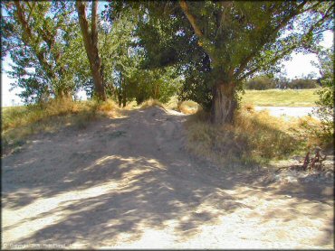
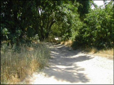
Shad Pad OHV Area Photo
The trails go under the highway and through the trees.
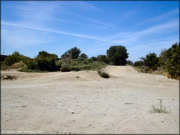
Shad Pad OHV Area Photo
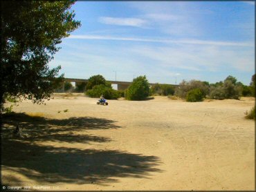
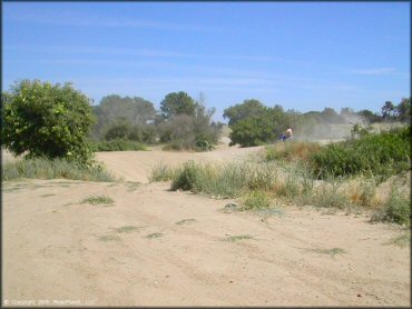
Shad Pad OHV Area Photo
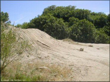
Large play area.
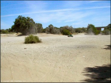
Shad Pad OHV Area Photo
Shad Pad OHV Area Photo
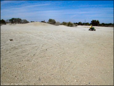
Shad Pad OHV Area Photo
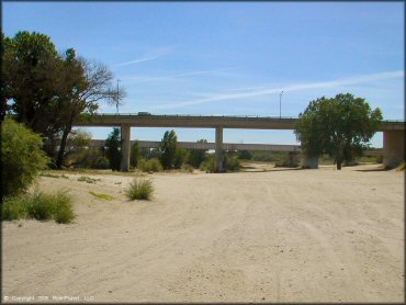
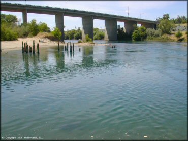
Many people park under the highway for the shade.
Shad Pad OHV Area Photo
The MX track is run down.
Shad Pad OHV Area Photo
Ride at your own risk!
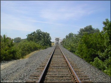
Shad Pad OHV Area Photo
Shad Pad OHV Area Photo
Shad Pad OHV Area Photo
Shad Pad OHV Area Photo
Shad Pad OHV Area Photo
Shad Pad OHV Area Photo
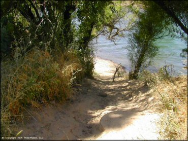
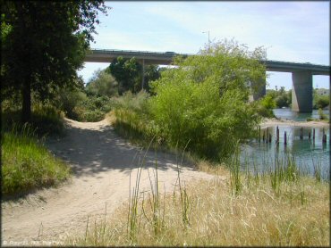
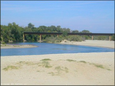
Some trails lead to the banks of the Yuba River.
Shad Pad OHV Area Photo
Shad Pad OHV Area Photo
RIDER COMMENTS & REVIEWS