 |
      |
| Home > California > Atwater Cycle Park |
Atwater Cycle Park
Saturday, May 10, 2025
| Other Names | Broken Arrow Archery Club |
| Last Known Status | Destroyed |
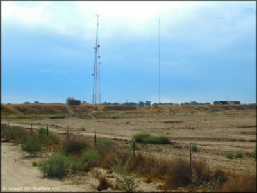
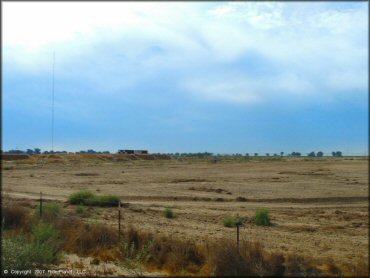
Located in central California, this track is permanently closed and the land has been redeveloped. All that you will find here is an archery range, but we will leave this listing up for a least a couple of years to end any confusion and save you a wasted trip. If you are looking for places to ride in this general area then La Grange OHV Park, Miami Creek, Hollister Hills SVRA, Carnegie SVRA, Club Moto, and Diablo MX are some good alternatives.
REGULATIONS
| Permit Required | No | |
| Dates Open | Track no longer exists, land has been redeveloped. | |
| Spark Arrestor | Recommended | A spark arresting exhaust silencer or end cap is recommended. |
| Noise Limit | ||
| Whip Flags | ||
| Maximum Vehicle Width | ||
 Motorcycles & Dirt Bikes Motorcycles & Dirt Bikes | Prohibited | |
 ATVs ATVs | Prohibited | |
 UTV & SXS UTV & SXS | Prohibited | |
 SUVs & Jeeps (registered) SUVs & Jeeps (registered) | Prohibited | |
| Dune Buggy & Sand Rail 4x4 (unregistered) | Prohibited | |
| 2 Stroke Engines | Prohibited | |
 Camping Camping | Prohibited | |
 Campfires Campfires | Prohibited | |
| Night Riding | No | |
| Trail Blazing | Prohibited | |
| Rule Enforcement |
Advertisement
TYPE OF AREA
| Area | MX Track |
| Land | Privately Owned / Commercial |
FEES & PASSES
| Parking | (None) |
| Entry | (None) |
| Riding | (None) |
| Camping | (None) |
RATINGS
| Our Rating |  Good Good |
| Recommended Stay | Full Day |
| Comments | (Scroll Down For Rider Reviews & Comments) |
DRIVING DIRECTIONS
| Nearest City | Atwater, CA | ||
| From: Atwater, CA
(CLOSED PERMANENTLY - DO NOT VISIT) 1) Take SR-99 South to Exit 195 2) Continue straight off the exit ramp onto Bell Drive, proceed about 200 yards 3) Turn left at the T-intersection to stay on Bell Drive, continue about 1 block 4) Turn right (south) on N. Applegate Road, continue about 2.8 miles 5) Turn right (west) on SR-140, continue .9 miles 6) Turn left (south) on S. Bert Crane Road, continue about 1.5 miles. Track is on the left. |


OFFICIAL CONTACTS
Atwater Cycle Park Track Photo
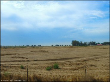
This is where the track was.
Atwater Cycle Park Track Photo
Atwater Cycle Park Track Photo
ADD PHOTOS
TERRAIN
| Approx Size | 40 acres | |
| Climate Type | Urban/man-made | |
| Elevation | 120 to 130 ft. | |
| Hazards |  Few Few | (hazards not marked) |
 Novice Novice |  Some Some | |
 Amateur Amateur |  Mostly Mostly | |
 Expert Expert |  Little Little |
GPS POINTS


KEY SERVICES
 Gasoline Gasoline | 1-5 Miles (N) | Atwater |
| Diesel | 1-5 Miles (N) | Atwater |
 Water Water | 1-5 Miles (NE) | Applegate Market (209) 676-0552 |
 RV Hookup RV Hookup | 20-30 Miles (SW) | San Luis RV Resort (209) 826-5542 |
 RV Disposal RV Disposal | 20-30 Miles (SW) | San Luis RV Resort (209) 826-5542 |
| Campground | 30+ Miles (SW) | San Luis Reservoir |
 Conv Store Conv Store | 1-5 Miles (NE) | Applegate Market (209) 676-0552 |
RIDER COMMENTS & REVIEWS