 |
      |
| Home > California > Greenhorn |
Greenhorn
Monday, July 28, 2025
| Other Names | Tahoe National Forest, Yuba River Ranger District, You Bet Road, Grass Valley, Idaho Maryland Road, Red Dog Road, Hansen Brothers Gravel Pit, Greenhorn Creek, Greenhorn Summit Snowmobile Area, Frog Meadow Area |
| Last Known Status | Closed |
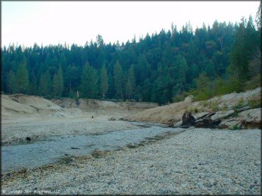
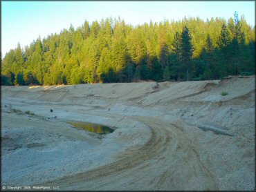
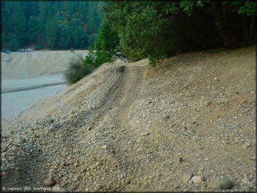
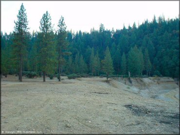
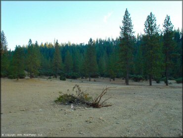
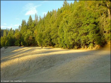
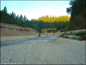
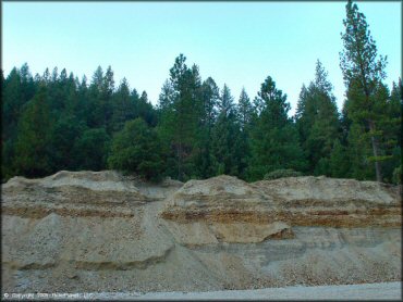
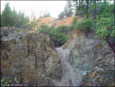
This area sits on the outskirts of a large gravel pit that has a small creek trickling through the center. The scenery here is decent and visitors can park off the Buckeye Road Crossing and hike the drainage but note that motorized use is no longer permitted.
Nearby places that are still open to offroad use include Foresthill, Burlington Motorcycle Trails and Indian Springs.
REGULATIONS
| Permit Required | No | |
| Dates Open | Closed | |
| Other ATV Stickers Accepted | Yes | Residents of any state not listed must purchase a Nonresident OHV Use Permit. (AR, AZ, CA, CO, CT, DE, IA, ID, IN, LA, MA, MD, ME, MI, MN, MO, MT, ND, NH, NJ, NM, NV, NY, OH, OK, OR, PA, RI, TX, UT, VT, WA, WI, WY) |
| Spark Arrestor | No | A spark arresting exhaust silencer or end cap is not required but is always recommended. |
| Noise Limit | No | |
| Whip Flags | Not Required | |
| Maximum Vehicle Width | ||
 Motorcycles & Dirt Bikes Motorcycles & Dirt Bikes | Prohibited | |
 ATVs ATVs | Prohibited | |
 UTV & SXS UTV & SXS | Prohibited | |
 SUVs & Jeeps (registered) SUVs & Jeeps (registered) | Prohibited | |
| Dune Buggy & Sand Rail 4x4 (unregistered) | Prohibited | |
| 2 Stroke Engines | Prohibited | |
| MX Helmet Required | Yes | helmets required by state law |
 Camping Camping | Not Recommended | |
 Campfires Campfires | Not Recommended | |
| Night Riding | No | |
| Trail Blazing | Prohibited | stay on trail |
| Alcohol | Prohibited | |
| Rule Enforcement | None |
Advertisement
TERRAIN
| Approx Size | 5,120 acres (8 sq mi) | |
| Miles Of Trail | 5 | |
| Climate Type | Forest | |
| Elevation | 2500 to 3750 ft. | |
| Trail Maintenance | Not Marked, Not Rated, Not Maintained | |
| Loose Dirt |  Little Little | |
| Hard Pack |  Some Some | |
| Sand |  None None | |
| Mud | Little | |
| Dust | Little | |
| Rocks | Some | |
| Trees |  All All | |
| Steep Hills |  Few Few | |
| Water Crossings | Few | |
| Small Jumps | Few | |
| Large Jumps | Few | |
| Berms | Few | |
| Sand/Gravel Pits |  Many Many | |
| Single Track | Some | |
| Roads | Few | |
| Intersections | Some | |
| Rider Traffic | Few | |
| Shade | Many | |
| Ranges/Gunfire | Few | |
| Hazards | Few | (hazards not marked) private property signs are posted |
 Novice Novice | Some | |
 Amateur Amateur |  Mostly Mostly | |
 Expert Expert | Little |
TYPE OF AREA
| Area | Motorized Trails, Gravel Pit |
| Land | BLM, National Forest |
GPS POINTS


KEY SERVICES
 Gasoline Gasoline | 5-20 Miles (NW) | Nevada City |
| Diesel | 5-20 Miles (NW) | Nevada City |
 Water Water | 5-20 Miles (W) | Grass Valley |
 RV Hookup RV Hookup | 1-5 Miles (N) | Scotts Flat Lake Recreation Area (530) 265-5302 |
 RV Disposal RV Disposal | 1-5 Miles (N) | Scotts Flat Lake Recreation Area (530) 265-5302 |
| Campground | 1-5 Miles (N) | Scotts Flat Lake Recreation Area (530) 265-5302 |
 Conv Store Conv Store | 5-20 Miles (W) | Grass Valley |
FEES & PASSES
| Parking | (None) |
| Entry | (None) |
| Riding | (None) |
| Camping | (None) |
RATINGS
| Pros | nice scenery, small creek flows through the gravel pit, secluded |
| Our Rating |  Good Good |
| Recommended Stay | Full Day Summer & Fall |
| Comments | (Scroll Down For Rider Reviews & Comments) |
DRIVING DIRECTIONS
| Nearest City | Grass Valley, CA | ||
| From: Grass Valley, CA
1) Follow Idaho Maryland Road for about 6 1/2 miles (road eventually turns into Banner Lava Cap Road) 2) Take a right at the fork to Red Dog Road, continue 1.7 miles 3) Turn left (east) onto Buckeye Road, continue about 2 miles. |


OFFICIAL CONTACTS
| Contact Info | Tahoe National Forest - Yuba River Ranger District 15924 Highway 49 Camptonville, CA 95922 (530) 288-3231 (530) 478-6253 mailroom_r5_tahoe@fs.fed.us www.fs.usda.gov |
| Contact Info | BLM - Mother Lode Field Office 5152 Hillsdale Circle El Dorado Hills, CA 95762 (916) 941-3101 (916) 941-3130 blm_ca_web_ml@blm.gov www.blm.gov |
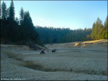
Greenhorn Trail Photo
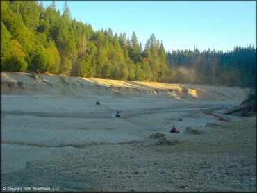
Main riding area.
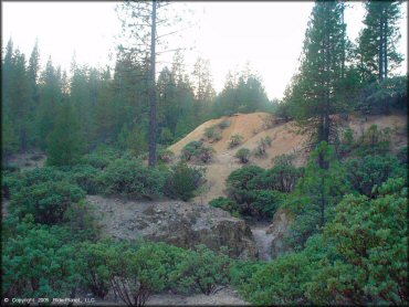
Greenhorn Trail Photo
Greenhorn Trail Photo
Greenhorn Trail Photo
Greenhorn Trail Photo
Greenhorn Trail Photo
Greenhorn Trail Photo
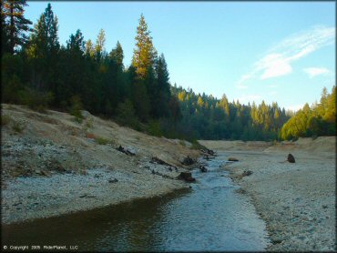
Greenhorn Creek.
Greenhorn Trail Photo
Greenhorn Trail Photo
Greenhorn Trail Photo
Greenhorn Trail Photo
Greenhorn Trail Photo
Advertisement
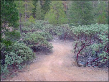
Greenhorn Trail Photo
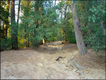
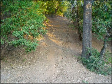
Some of the trails across from the gravel pit are a bit rough
Greenhorn Trail Photo
Greenhorn Trail Photo
Greenhorn Trail Photo
RIDER COMMENTS & REVIEWS