 |
      |
| Home > California > Lubbs Trail |
Lubbs Trail
Wednesday, July 30, 2025
| Other Names | Six Rivers National Forest, Orleans Ranger District |
| Last Known Status | Open |
Located in "Bigfoot Country", a small network of old jeep trails and forest service roads can be found in this area. Many of the trails we encountered were overgrown with thick forest vegetation so it was impossible to go very far.
The main access road had steep drop-offs to the sides, some fairly rocky sections and a number of low overhanging tree branches. There are no turnaround opportunities for passenger vehicles early on, so once you go in you have to go all the way in, and watch out! The famous Patterson-Gimlin Bigfoot footage was shot about 20 miles from here.
REGULATIONS
| Permit Required | Yes | CA OHMVR stickers required |
| Dates Open | Year-Round | CA OHMVR red sticker vehicles permitted year round |
| Other ATV Stickers Accepted | Yes | Residents of any state not listed must purchase a Nonresident OHV Use Permit. (AR, AZ, CA, CO, CT, DE, IA, ID, IN, LA, MA, MD, ME, MI, MN, MO, MT, ND, NH, NJ, NM, NV, NY, OH, OK, OR, PA, RI, TX, UT, VT, WA, WI, WY) |
| Spark Arrestor | Yes | A spark arresting exhaust silencer or end cap is required for all vehicles. |
| Noise Limit | Yes (96 dB) | CA OHMVR noise limits apply (1985/older limit 101 dB, 1986/newer limit 96 dB) |
| Whip Flags | Not Required | |
| Maximum Vehicle Width | No Restriction | |
 Motorcycles & Dirt Bikes Motorcycles & Dirt Bikes | Permitted | CA OHMVR stickers required |
 ATVs ATVs | Permitted | CA OHMVR stickers required |
 UTV & SXS UTV & SXS | Permitted | CA OHMVR stickers required |
 SUVs & Jeeps (registered) SUVs & Jeeps (registered) | Permitted | |
| Dune Buggy & Sand Rail 4x4 (unregistered) | Permitted | CA OHMVR stickers required |
| 2 Stroke Engines | Certain Times | CA OHMVR restrictions apply |
| MX Helmet Required | Yes | helmets required by state law |
 Camping Camping | Some Areas | Not Recommended |
 Campfires Campfires | Some Areas | Not Recommended |
| Night Riding | Unknown | Not Recommended |
| Trail Blazing | Prohibited | no trailblazing |
| Alcohol | No Restriction | |
| Rule Enforcement | None |
TERRAIN
| Approx Size | 6,400 acres (10 sq mi) | |
| Miles Of Trail | 3 | |
| Climate Type | Forest | |
| Elevation | 2800 to 4800 ft. | |
| Trail Maintenance | Marked, Not Rated, Not Maintained | |
| Loose Dirt |  Some Some | |
| Hard Pack |  Mostly Mostly | |
| Sand |  None None | |
| Mud |  Little Little | |
| Dust | Some | |
| Rocks | Some | |
| Trees |  All All | |
| Steep Hills |  Few Few | |
| Water Crossings | Few | |
| Small Jumps | None | |
| Large Jumps | None | |
| Berms | None | |
| Sand/Gravel Pits | None | |
| Single Track | None | |
| Roads | All | |
| Intersections | Few | |
| Rider Traffic | None | |
| Shade | All | |
| Ranges/Gunfire | None | |
| Hazards | Some | (hazards not marked) Beware of cliffs. |
 Novice Novice | Mostly | |
 Amateur Amateur | Little | |
 Expert Expert | None |
TYPE OF AREA
| Area | Motorized Trails |
| Land | National Forest |


KEY SERVICES
 Gasoline Gasoline | 5-20 Miles (N) | Orleans |
| Diesel | 5-20 Miles (N) | Orleans |
 Water Water | 5-20 Miles (N) | Orleans |
 RV Hookup RV Hookup | 5-20 Miles (NW) | Klamath Riverside RV Park & Campground (530) 627-3239 |
 RV Disposal RV Disposal | 5-20 Miles (NW) | Klamath Riverside RV Park & Campground (530) 627-3239 |
| Campground | 5-20 Miles (NW) | Klamath Riverside RV Park & Campground (530) 627-3239 |
 Conv Store Conv Store | 5-20 Miles (N) | Orleans |
FEES & PASSES
| Parking | (None) |
| Entry | (None) |
| Riding | (None) |
| Camping | (None) |
RATINGS
| Pros | free, main trail leads to nice swimming hole |
| Cons | no single track, main entrance road is steep & narrow, area consists of old jeep trails |
| Our Rating |  Poor Poor |
| Recommended Stay | Half Day |
| Comments | (Scroll Down For Rider Reviews & Comments) |
DRIVING DIRECTIONS
| Nearest City | Orleans, CA | ||
| From: Eureka, CA
1) Take US-101 North about 11 miles 2) Take exit for SR-299 east, continue about 40 miles 3) Turn left (north) on SR-96 (Bigfoot Scenic Highway), continue 37 miles 4) After crossing bridge turn right on Red Cap Road, continue 10.4 miles (Red Cap Road turns into NF-10N01) 5) Veer right at fork on NF-10N03. Trailhead is on the right side of road. |


OFFICIAL CONTACTS
| Contact Info | Six Rivers National Forest - Orleans Ranger District Highway 96 P.O. Box 410 Orleans, CA 95556 (530) 627-3291 mailroom_r5_six_rivers@usda.gov www.fs.usda.gov |
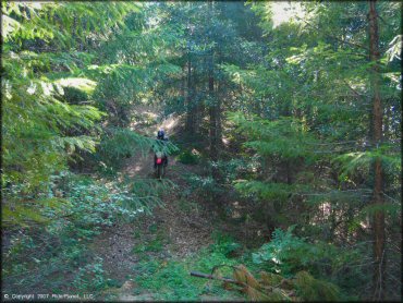
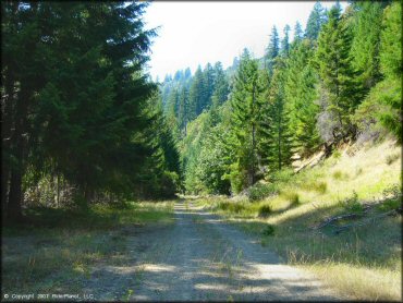
Lubbs Trail Photo
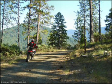
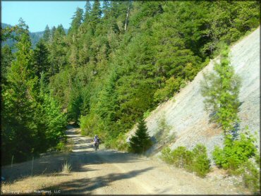
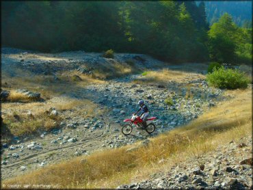
We did not find any narrow trails here, just jeep and forest roads, but the remoteness and scenic views were nice.
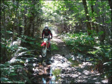
Lubbs Trail Photo
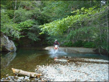
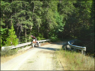
There were a couple of shallow water crossings.
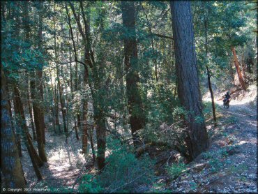
Lubbs Trail Photo
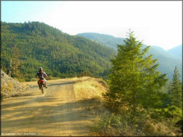
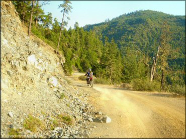
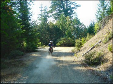
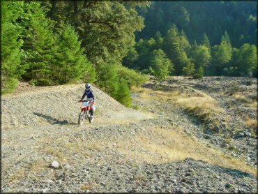
The main road is smooth and designed for passenger vehicles; not really a challenge for motorcycles.
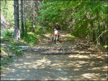
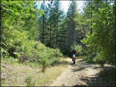
Lubbs Trail Photo
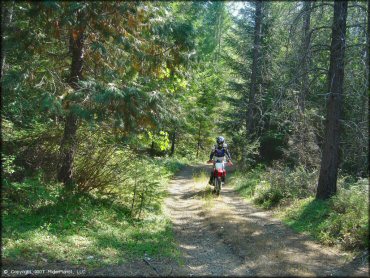
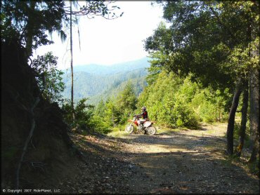
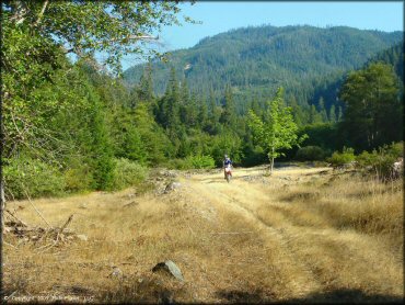
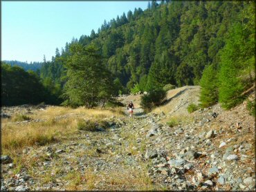
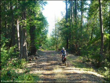
This is a good example of the terrain you can expect on these forest roads. This is mostly the type of trails we found throughout the area.
Lubbs Trail Photo
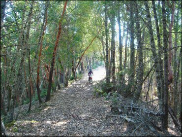
The trails did not appear to be heavily maintained, probably due to a lack of visitors. We encountered numerous dead ends, fallen branches, and a portion of the trails were completely overgrown and inaccessible.
Lubbs Trail Photo
And although it didn't appear to us that these trails get much use, keep in mind that things may have changed significantly since we visited.
Lubbs Trail Photo
Toward the end the main trail eventually just sort of disintegrated.
Lubbs Trail Photo
So it was back the way we came in!
Lubbs Trail Photo
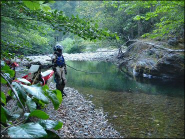
There was still time to take this side trail and follow it to the end to find this swimming hole. Do you feel like we are being watched? Me too.
Lubbs Trail Photo
Let's keep moving. This is bigfoot country.
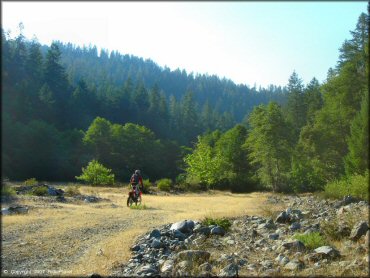
Lubbs Trail Photo
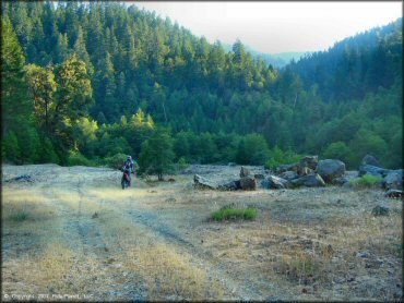
A quick stop to take in the view.
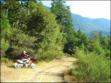
Lubbs Trail Photo
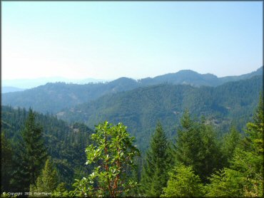
This is the view.
Lubbs Trail Photo
Now let's bail because this whole place is kinda creepy and the sun is dropping!
Lubbs Trail Photo
Tempting fate. Heeeere squatchy squatchy!
Lubbs Trail Photo
She's not waiting around.
Lubbs Trail Photo
A fun day, but a long drive and not a lot of motorcycle or ATV trails. Good tourism in the area though.
Lubbs Trail Photo
Lubbs Trail Photo
Lubbs Trail Photo
Lubbs Trail Photo
Lubbs Trail Photo
Lubbs Trail Photo
Lubbs Trail Photo
Lubbs Trail Photo
Lubbs Trail Photo
Lubbs Trail Photo
RIDER COMMENTS & REVIEWS