 |
      |
| Home > California > Millwood |
Millwood OHV Area
Friday, August 29, 2025
| Other Names | Sequoia National Forest, Hume Lake Ranger District, Mill Flat Campground, Millwood OHV Staging Area, Sequoia Lake, Happy Gap, Cherry Gap Staging Area, Chicago Stump, Verplank Ridge, Hoist Ridge, Millwood Staging Area, Huckleberry Meadow, Bearskin Creek, Quail Flat, Goodmill 4-Wheel Drive Route, Old Shay Rail Road Motorcycle Route, Sequoia National Forest And Giant Sequoia National Monument, Flat Creek |
| Last Known Status | Open |
This part of the Sequoia National Forest has about 25 miles of motorized trails that wind through some of the tallest trees around. The trails offer a nice mix of terrain that ranges from fast and smooth hard pack to rugged and rocky with a few creek crossings.
The trail system has several trailheads and campgrounds to choose from - those looking for mostly easy to moderate trails with basic campground amenities should set up camp at Millwood Staging Area. For access to the more difficult trails stage at Cherry Gap or Abbott Creek Campground. Parking is limited at all of the trailheads and large trailers are not recommended.
Other area highlights include the Sequoia and Kings Canyon National Park, home to the world's tallest trees.
REGULATIONS
| Permit Required | Yes | CA OHMVR stickers required |
| Dates Open | Spring - Late Fall | CA OHMVR red sticker vehicles permitted from Oct 1 to May 31 |
| Other ATV Stickers Accepted | Yes | Residents of any state not listed must purchase a Nonresident OHV Use Permit. (AR, AZ, CA, CO, CT, DE, IA, ID, IN, LA, MA, MD, ME, MI, MN, MO, MT, ND, NH, NJ, NM, NV, NY, OH, OK, OR, PA, RI, TX, UT, VT, WA, WI, WY) |
| Spark Arrestor | Yes | A spark arresting exhaust silencer or end cap is required for all vehicles. |
| Noise Limit | Yes (96 dB) | CA OHMVR noise limits apply (1985/older limit 101 dB, 1986/newer limit 96 dB) |
| Whip Flags | Not Required | |
| Maximum Vehicle Width | No Restriction | |
 Motorcycles & Dirt Bikes Motorcycles & Dirt Bikes | Permitted | CA OHMVR stickers required |
 ATVs ATVs | Permitted | CA OHMVR stickers required |
 UTV & SXS UTV & SXS | Permitted | CA OHMVR stickers required |
 SUVs & Jeeps (registered) SUVs & Jeeps (registered) | Permitted | |
| Dune Buggy & Sand Rail 4x4 (unregistered) | Permitted | CA OHMVR stickers required |
| 2 Stroke Engines | Certain Times | CA OHMVR restrictions apply |
| MX Helmet Required | Yes | helmets required by state law |
 Camping Camping | Some Areas | (camp in developed sites only) |
 Campfires Campfires | Some Areas | (permitted in developed campsites only) |
| Night Riding | Unknown | |
| Trail Blazing | Prohibited | stay on designated trails |
| Rule Enforcement |
TERRAIN
| Approx Size | 38,400 acres (60 sq mi) | |
| Miles Of Trail | 25 | |
| Climate Type | Forest | |
| Elevation | 4500 to 6000 ft. | |
| Trail Maintenance | Marked, Rated, Lightly Maintained | |
| Loose Dirt |  Mostly Mostly | |
| Hard Pack |  Some Some | |
| Sand |  Little Little | |
| Mud | Little | |
| Dust | Little | |
| Rocks | Some | |
| Trees |  All All | |
| Steep Hills |  Many Many | |
| Water Crossings | Some | |
| Small Jumps |  None None | |
| Large Jumps | None | |
| Berms |  Few Few | |
| Sand/Gravel Pits | None | |
| Single Track | Some | |
| Shade | Many | |
| Hazards | Few | (hazards assumed marked but use caution) |
 Novice Novice | Some | |
 Amateur Amateur | Mostly | |
 Expert Expert | Little |
TYPE OF AREA
| Area | Motorized Trails |
| Land | National Forest |
GPS POINTS


KEY SERVICES
 Gasoline Gasoline | 5-20 Miles (NE) | Hume Lake General Store (559) 305-7770 |
| Diesel | 5-20 Miles (NE) | Hume Lake General Store (559) 305-7770 |
 Water Water | 5-20 Miles (S) | Eshom Campground (559) 338-2251 |
 RV Hookup RV Hookup | 30+ Miles (W) | Lakeridge Camping & Boating Resort (559) 787-2260 or (877) 787-2260 |
 RV Disposal RV Disposal | 30+ Miles (W) | Lakeridge Camping & Boating Resort (559) 787-2260 or (877) 787-2260 |
| Campground | On Site | |
 Conv Store Conv Store | 5-20 Miles (NE) | Hume Lake General Store (559) 305-7770 |
FEES & PASSES
| Parking | (None) |
| Entry | (None) |
| Riding | (None) |
| Camping | (None) |
RATINGS
| Our Rating |  Very Good Very Good |
| Recommended Stay | 1-2 Days |
| Comments | (Scroll Down For Rider Reviews & Comments) |
DRIVING DIRECTIONS
| Nearest City | Miramonte, CA | ||
| Address | Millwood Road, Miramonte, CA 93641 | ||
| From: Fresno, CA
1) Take SR-180 East about 50 miles 2) Turn left (north) on NF-13S97/Millwood Road, continue about 2 miles 3) Staging area is on the right. |


OFFICIAL CONTACTS
| Contact Info | Sequoia National Forest - Hume Lake Ranger District 35860 East Kings Canyon Road Dunlap, CA 93621 (559) 338-2251 sm.fs.sequoianf@usda.gov www.fs.usda.gov |
| Contact Info | Sequoia And Kings Canyon National Park 47050 Generals Highway Three Rivers, CA 93271-9700 (559) 565-3341 www.nps.gov |
Millwood Trail Photo
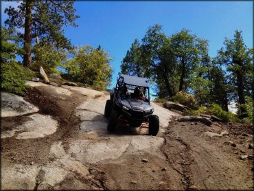
Photo Submitted 7/27/2014 (Thanks!)
Millwood Trail Photo
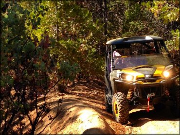
Photo Submitted 7/27/2014 (Thanks!)
Millwood Trail Photo
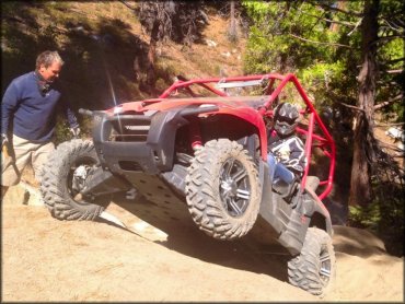
Photo Submitted 7/27/2014 (Thanks!)
Millwood Trail Photo
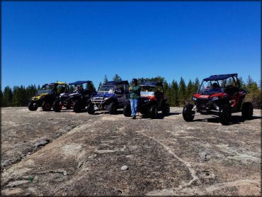
Photo Submitted 7/27/2014 (Thanks!)
Millwood Trail Photo
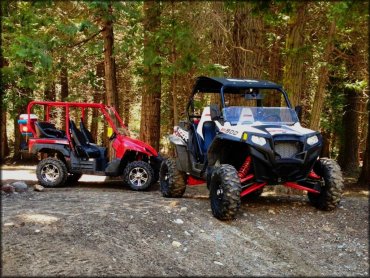
Photo Submitted 7/27/2014 (Thanks!)
RIDER COMMENTS & REVIEWS