 |
      |
| Home > California > French Meadow |
French Meadow
Thursday, October 9, 2025
| Other Names | Sequoia National Forest, Kern River Ranger District, Squirrel Valley, Dry Meadow, Piute Mountains, Piute Peak, Kelso Creek, Landers Camp, Piaute Springs OHV, Willow Gulch Trail, Landers Station |
| Last Known Status | Open |
This part of the Sequoia National Forest offers about 500+ miles of designated black diamond single track. The trails are well marked and wind through a wide range of elevation changes. Most of the terrain is hard pack with occasional loose chunk rock and moderate elevation changes.
Free primitive camping with direct trail access can be found at Landers Camp or Piaute Springs OHV. Landers Camp is the preferred place for those with campers or trailers since there is plenty of shade and level parking. There is no drinking water or other amenities so bring your own supplies. The Pacific Crest Trail (hiking only) can also be accessed from Landers Camp.
REGULATIONS
| Permit Required | Yes | CA OHMVR stickers required |
| Dates Open | Year-Round | CA OHMVR red sticker vehicles permitted year round |
| Other ATV Stickers Accepted | Yes | Residents of any state not listed must purchase a Nonresident OHV Use Permit. (AR, AZ, CA, CO, CT, DE, IA, ID, IN, LA, MA, MD, ME, MI, MN, MO, MT, ND, NH, NJ, NM, NV, NY, OH, OK, OR, PA, RI, TX, UT, VT, WA, WI, WY) |
| Spark Arrestor | Yes | A spark arresting exhaust silencer or end cap is required for all vehicles. |
| Noise Limit | Yes (96 dB) | CA OHMVR noise limits apply (1985/older limit 101 dB, 1986/newer limit 96 dB) |
| Whip Flags | Not Required | |
| Maximum Vehicle Width | ||
 Motorcycles & Dirt Bikes Motorcycles & Dirt Bikes | Permitted | CA OHMVR stickers required |
 ATVs ATVs | Prohibited | CA OHMVR stickers required |
 UTV & SXS UTV & SXS | Prohibited | CA OHMVR stickers required |
 SUVs & Jeeps (registered) SUVs & Jeeps (registered) | Prohibited | |
| Dune Buggy & Sand Rail 4x4 (unregistered) | Prohibited | CA OHMVR stickers required |
| 2 Stroke Engines | No Restriction | CA OHMVR restrictions apply |
| MX Helmet Required | Yes | helmets required by state law |
 Camping Camping | Some Areas | (camp in developed sites only) |
 Campfires Campfires | Some Areas | (permitted in developed campsites only) |
| Night Riding | Unknown | Not Recommended |
| Trail Blazing | Prohibited | keep on designated trails |
| Rule Enforcement |
TERRAIN
| Approx Size | 35,000 acres (55 sq mi) | |
| Miles Of Trail | 500 | |
| Climate Type | Forest | |
| Elevation | 6100 to 8000 ft. | |
| Trail Maintenance | Marked, Rated, Lightly Maintained | |
| Loose Dirt |  Little Little | |
| Hard Pack |  Mostly Mostly | |
| Sand | Little | |
| Mud | Little | |
| Dust |  Some Some | |
| Rocks | Some | |
| Trees |  All All | |
| Steep Hills |  Many Many | |
| Water Crossings | Some | |
| Small Jumps |  None None | |
| Large Jumps | None | |
| Berms | Many | |
| Sand/Gravel Pits | None | |
| Single Track | All | |
| Roads |  Few Few | |
| Shade | Some | |
| Hazards | Few | (hazards assumed marked but use caution) |
 Novice Novice | Little | |
 Amateur Amateur | Some | |
 Expert Expert | Mostly |
TYPE OF AREA
| Area | Motorized Trails |
| Land | National Forest |
GPS POINTS


KEY SERVICES
 Gasoline Gasoline | 5-20 Miles (NW) | Shell (760) 379-3747 |
| Diesel | 5-20 Miles (NW) | Shell (760) 379-3747 |
 Water Water | 20-30 Miles (NW) | Lake Isabella KOA (760) 378-2001 |
 RV Hookup RV Hookup | 20-30 Miles (NW) | Lake Isabella KOA (760) 378-2001 |
 RV Disposal RV Disposal | 20-30 Miles (NW) | Lake Isabella KOA (760) 378-2001 |
| Campground | On Site | |
 Conv Store Conv Store | 5-20 Miles (NW) | Shell (760) 379-3747 |
FEES & PASSES
| Parking | (None) |
| Entry | (None) |
| Riding | (None) |
| Camping | (None) |
RATINGS
| Our Rating |  Very Good Very Good |
| Recommended Stay | 3-5 Days |
| Comments | (Scroll Down For Rider Reviews & Comments) |
DRIVING DIRECTIONS
| Nearest City | Weldon, CA | ||
| Address | Piute Mountain Road, Weldon, CA 93283 | ||
| From: Lake Isabella, CA
For Landers OHV Staging Area: 1) Take Hwy 178 East about 13 miles 2) Turn right (south) onto Kelso Valley Road, continue about 17 miles 3) Veer right (west) onto Piute Mountain Road, continue 8.2 miles 4) Turn right (north) onto FS Road 29S05, continue about 1 mile 5) Landers Staging Area is on the left (west). For Piaute Springs OHV Staging Area: 6) Continue west on Piute Mountain Road 3.2 miles 7) Turn right (north) onto FS Road 27S02, continue about .6 miles 8) Staging area is on the left (west). |


OFFICIAL CONTACTS
| Contact Info | Sequoia National Forest - Kern River Ranger District 105 Whitney Road Kernville, CA 93238 (760) 376-3781 sm.fs.sequoianf@usda.gov www.fs.usda.gov |
French Meadow Trail Photo
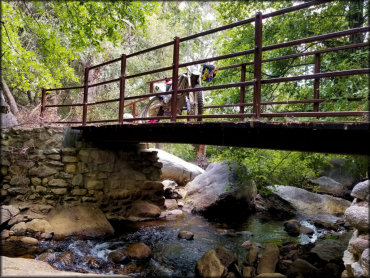
Photo Submitted 8/28/17 (Thanks!)
French Meadow Trail Photo
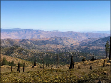
Photo Submitted 10/15/2018 (Thanks!)
French Meadow Trail Photo
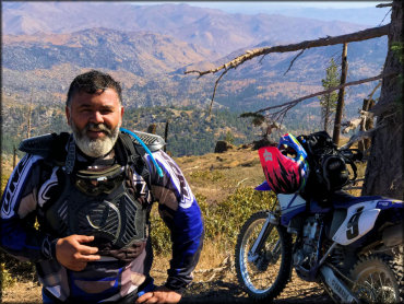
Photo Submitted 10/15/2018 (Thanks!)
French Meadow Trail Photo
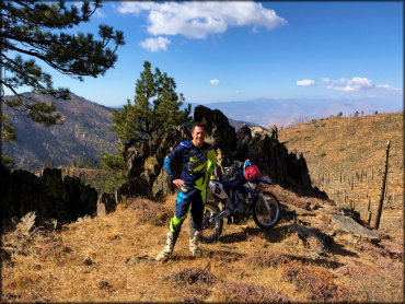
Photo Submitted 10/15/2018 (Thanks!)
French Meadow Trail Photo
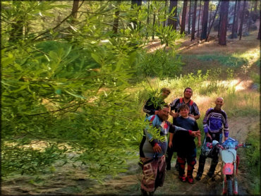
Photo Submitted 8/28/17 (Thanks!)
French Meadow Trail Photo
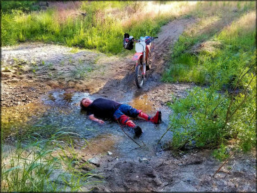
Photo Submitted 8/28/17 (Thanks!)
French Meadow Trail Photo
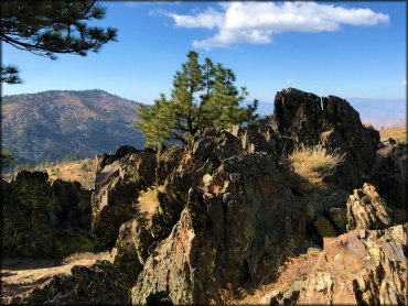
Photo Submitted 10/15/2018 (Thanks!)
RIDER COMMENTS & REVIEWS