 |
      |
| Home > Colorado > Alpine Loop |
Alpine Loop
Sunday, May 31, 2026
| Other Names | Alpine Triangle, San Juan National Forest, Cinnamon Pass, San Juan Mountains, Red Mountain, Mineral Point, Kendall Mountain, California Gulch, Black Bear Pass, Continental Divide, Ophir Pass, Telluride, Silverton, Ouray, Engineer Pass |
| Last Known Status | Open |
This popular summer destination has around 65 miles of designated motorized trails with plenty of side roads that wind through the San Juan Mountains. The trail system mainly consists of old mining roads that wind near abandoned mines, railroads, mills, and ghost towns, providing visitors a glimpse into the areas history.
The trail system has five designated staging areas and several RV campgrounds that provide direct trail access. There are plenty of primitive campgrounds with direct trail access that charge a small fee but free camping can be found at Lost Trail Campground.
The area is very popular with Jeeps and ATVs but is also a good place to bring a dual sport motorcycle. Most of the trails are rated as moderately challenging but there are a couple of expert level only trails which include Black Bear Pass and Poughkeepsie Gulch.
The trails are only passable during the summer months and are usually snow free by mid June. Other area highlights include natural hot springs in Ouray that are sulphur free.
REGULATIONS
| Permit Required | Yes | Colorado OHV Sticker |
| Dates Open | June - October | |
| Other ATV Stickers Accepted | No | Colorado Non-Resident OHV permit required. |
| Spark Arrestor | Yes | A spark arresting exhaust silencer or end cap is required for all vehicles. |
| Noise Limit | Yes (96 dB) | (1998/older limit 99 dB, 1998/newer limit 96 dB) |
| Whip Flags | Not Required | |
| Maximum Vehicle Width | No Restriction | |
 Motorcycles & Dirt Bikes Motorcycles & Dirt Bikes | Permitted | |
 ATVs ATVs | Permitted | |
 UTV & SXS UTV & SXS | Permitted | |
 4x4 & Jeeps (registered) 4x4 & Jeeps (registered) | Permitted | |
| Dune Buggy & Sand Rail 4x4 (unregistered) | Permitted | |
| 2 Stroke Engines | No Restriction | |
 Camping Camping | Some Areas | (camp in developed sites only) |
 Campfires Campfires | Some Areas | (permitted in developed campsites only) |
| Night Riding | Unknown | Not Recommended |
| Trail Blazing | Prohibited | keep on the trail |
| Rule Enforcement |
TERRAIN
| Miles Of Trail | 65 | |
| Climate Type | Forest | |
| Elevation | 7800 to 12640 ft. | |
| Trail Maintenance | Marked, Not Rated, Lightly Maintained | |
| Loose Dirt |  Little Little | |
| Hard Pack |  Mostly Mostly | |
| Sand |  None None | |
| Mud |  Some Some | |
| Dust | Some | |
| Rocks | Some | |
| Trees |  Many Many | |
| Steep Hills | Many | |
| Water Crossings | Some | |
| Small Jumps | None | |
| Large Jumps | None | |
| Berms |  Few Few | |
| Sand/Gravel Pits | None | |
| Single Track | Some | |
| Roads | Some | |
| Shade | Many | |
| Hazards | Some | (hazards assumed marked but use caution) Beware of cliffs. some trails have very steep and narrow dropoffs |
 Novice Novice | Little | |
 Amateur Amateur | Mostly | |
 Expert Expert | Some |
TYPE OF AREA
| Area | Motorized Trails |
| Land | BLM, National Forest |
GPS POINTS


KEY SERVICES
 Gasoline Gasoline | Silverton, CO | |
| Diesel | Silverton, CO | |
 Water Water | On Site | check trail map for campgrounds |
 RV Hookup RV Hookup | On Site | |
 RV Disposal RV Disposal | On Site | |
| Campground | On Site | check trail map for campgrounds |
 Conv Store Conv Store | Silverton, CO |
FEES & PASSES
| Parking | (None) |
| Entry | (None) |
| Riding | (None) |
| Camping | Yes Tent: $0.00 RV: $0.00 Addtl. Vehicle: $0.00 |
| Comment | Camping fees vary at individual campgrounds - call for rates and availability. |
RATINGS
| Our Rating |  Very Good Very Good |
| Recommended Stay | 1-2 Days |
| Comments | (Scroll Down For Rider Reviews & Comments) |
DRIVING DIRECTIONS
| Nearest City | Silverton, CO | ||
| From: Montrose, CO
1) Take US-550 South about 35 miles 2) Turn right onto Camp Bird Road, continue 2 miles 3) Staging area is on the right (north) For the Alpine Loop Trailhead: 4) Take US-550 south about 40 miles 5) Alpine Loop Trailhead is on the left (east). For the Red Mountain Trailhead: 6) Continue south past the Alpine Loop Trailhead on US-550 9.5 miles 7) Turn left (east) onto dirt road, continue about .25 miles toward staging area. |

OFFICIAL CONTACTS
| Contact Info | San Juan National Forest - Silverton Field Station 1468 Greene Street Silverton, CO 81433 (970) 387-5530 mailroom_r2_san_juan@fs.fed.us www.fs.usda.gov |
| Contact Info | BLM - Gunnison Field Office 210 W. Spencer Street Gunnison, CO 81230 (970) 642-4940 ewaters@blm.gov www.blm.gov |
| Contact Info | Colorado Parks And Wildlife - Registration Unit 13787 South Highway 85 Littleton, CO 80125 (303) 791-1920 dnr.ivrsparks@state.co.us cpw.state.co.us |
| Contact Info | Silver Summit RV Park And Jeep Rentals 640 Mineral Street Silverton, CO 81433 (970) 387-0240 (970) 210-3683 silversummitrv@gmail.com silversummitrvpark.com |
| Contact Info | Silverton Lakes Campground 2100 Kendall Street Silverton, CO 81433 (970) 387-9888 silvertonlakes@live.com silvertonlakes.com |
| Comment | Full service campground with direct trail access. |
| Contact Info | Eureka Campground Silverton, CO (970) 618-3913 terri@eurekacampground.com eurekacampground.com |
| Comment | Full service campground with direct trail access. |
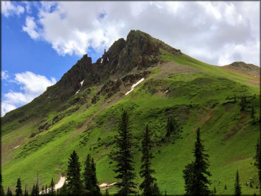
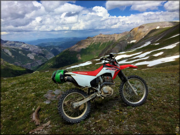
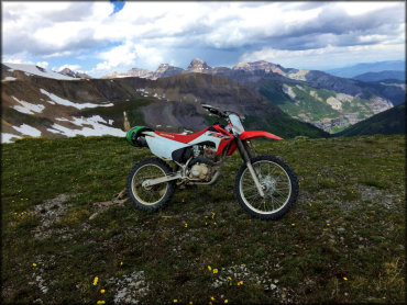
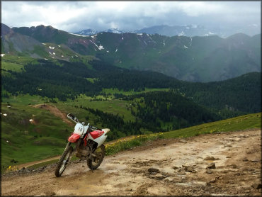
Alpine Loop Trail Photo
No matter where you are on this loop, the scenery is simply stunning.
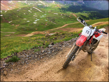
Alpine Loop Trail Photo
One of many scenic views from the trail.
Alpine Loop Trail Photo
What a great looking ride and the perfect set of photos. Thanks for sharing!
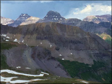
Alpine Loop Trail Photo
Another fantastic view of a rugged mountain peak alongside the trail.
Alpine Loop Trail Photo
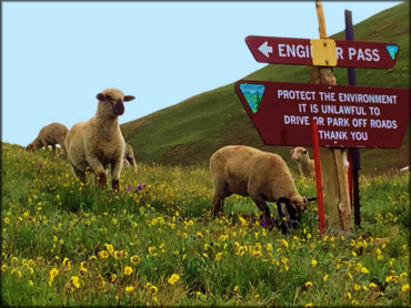
Some wild mountain sheep grazing on Engineer Pass.
Alpine Loop Trail Photo
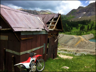
Is this ghost town haunted?
Alpine Loop Trail Photo
Another fantastic photo taken from the trail.
Alpine Loop Trail Photo
With the rugged mountains and grassy meadows, it's almost impossible to take a bad photo.
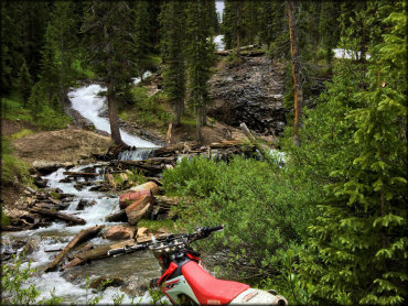
Alpine Loop Trail Photo
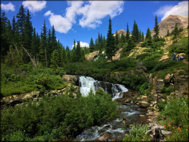
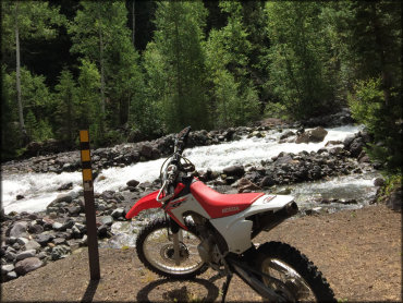
This is just one of the many creeks and small waterfalls that you will see alongside the trail.
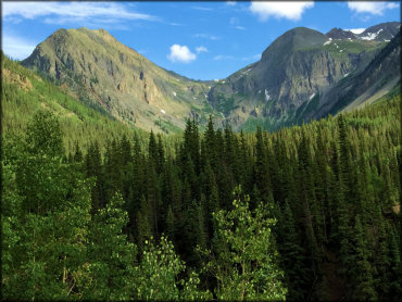
Alpine Loop Trail Photo
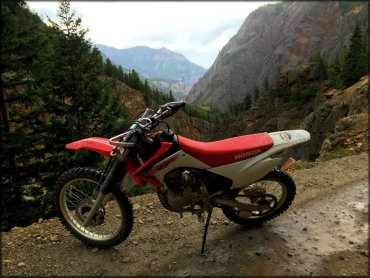
The mountains and forest views are hard to beat.
Alpine Loop Trail Photo
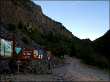
This is the starting point of the Alpine Loop.
Alpine Loop Trail Photo
The scenery here is top notch.
Alpine Loop Trail Photo
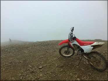
The view can get a little cloudy as you climb in elevation.
Alpine Loop Trail Photo
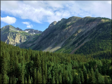
The mountains and pine trees make this a pleasant ride.
Alpine Loop Trail Photo
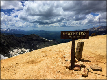
A view from Imogene Pass, another scenic point on the Alpine Loop.
Alpine Loop Trail Photo
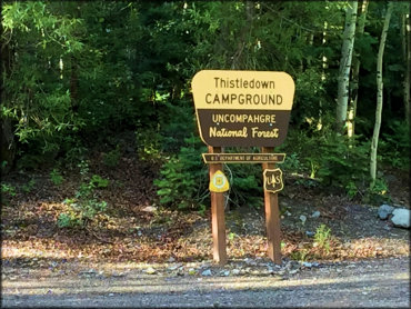
Thistledown Campground is located near the Angel Creek Staging Area.
Alpine Loop Trail Photo
The Alpine Loop has numerous places to pull off and take a break. This spot would be a nice place to have some lunch.
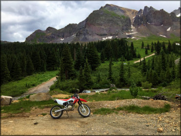
Alpine Loop Trail Photo
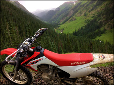
Another fantastic shot of mountains, pine trees and green meadows.
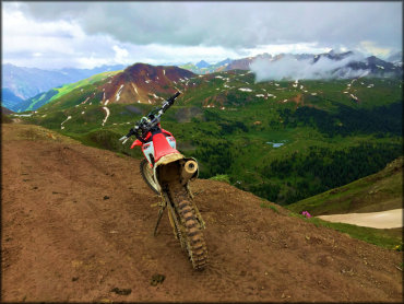
Alpine Loop Trail Photo
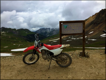
Engineer Pass is just one of the many scenic view points on the Alpine Trail.
Alpine Loop Trail Photo
The panoramic views are hard to beat.
Alpine Loop Trail Photo
Some of the mountain peaks are snow covered even during the summer months.
Alpine Loop Trail Photo
You will sometimes find sheep grazing in the grassy meadows.
RIDER COMMENTS & REVIEWS