 |
      |
| Home > Colorado > Peach Valley |
Peach Valley OHV Area
Saturday, May 10, 2025
| Other Names | Peach Valley OHV, Falcon Rd, Selig Canal, Peach Valley Rd, Gunnison Gorge National Conservation Area |
| Last Known Status | Open |
This is a popular off-road area that offers over 15 square miles of desert terrain that consists of hardpacked and crusty ATV trails to narrow single track and rugged hill climbs.
The main staging area offers plenty of room for parking and amenities include loading ramps, some shade gazebos, vault toilets, picnic tables and informational kiosks. The BLM recently installed a training course with three loops (beginner, intermediate and advanced). Obstacles range from light gravel sections to rock gardens and strategically placed logs to navigate through.
There are no fees but machines must display a current Colorado OHV Sticker. There is no water so bring your own.
REGULATIONS
| Permit Required | Yes | Colorado OHV Sticker |
| Dates Open | Year-Round | |
| Other ATV Stickers Accepted | No | Colorado Non-Resident OHV permit required. |
| Spark Arrestor | Yes | A spark arresting exhaust silencer or end cap is required for all vehicles. |
| Noise Limit | Yes (96 dB) | (1998/older limit 99 dB, 1998/newer limit 96 dB) |
| Whip Flags | Not Required | |
| Maximum Vehicle Width | Yes (50 inches) | has entrance gate or posts |
 Motorcycles & Dirt Bikes Motorcycles & Dirt Bikes | Permitted | |
 ATVs ATVs | Permitted | (maximum width 50 inches) |
 UTV & SXS UTV & SXS | Permitted | (maximum width 50 inches) |
 4x4 & Jeeps (registered) 4x4 & Jeeps (registered) | Prohibited | |
| Dune Buggy & Sand Rail 4x4 (unregistered) | Prohibited | |
| 2 Stroke Engines | No Restriction | |
 Camping Camping | No Restriction | (camp anywhere) |
 Campfires Campfires | No Restriction | |
| Night Riding | Unknown | |
| Trail Blazing | Prohibited | stay on trail |
| Alcohol | No Restriction | |
| Rule Enforcement | Few/Periodic |
TERRAIN
| Approx Size | 9,700 acres (15 sq mi) | |
| Miles Of Trail | 75 | |
| Climate Type | Desert | |
| Elevation | 5800 to 6500 ft. | |
| Trail Maintenance | Marked, Not Rated, Lightly Maintained | |
| Loose Dirt |  Some Some | |
| Hard Pack | Some | |
| Sand |  Little Little | |
| Mud | Little | |
| Dust | Some | |
| Rocks | Some | |
| Trees |  Few Few | |
| Steep Hills | Some | |
| Water Crossings |  None None | |
| Small Jumps | Some | |
| Large Jumps | Some | |
| Berms | Some | |
| Sand/Gravel Pits | None | |
| Single Track | Some | |
| Roads | Few | |
| Intersections | Some | |
| Rider Traffic | Some | |
| Shade | Few | |
| Hazards | Some | (hazards assumed marked but use caution) |
 Novice Novice | Some | |
 Amateur Amateur |  Mostly Mostly | |
 Expert Expert | Little |
TYPE OF AREA
| Area | Motorized Trails |
| Land | BLM |

| Features | Public |
| Max Engine Size | 85 cc Max |
| Min Engine Size | 50 cc Min |
| Comment | PeeWee Track |
GPS POINTS


KEY SERVICES
 Gasoline Gasoline | 1-5 Miles (NW) | Olathe |
| Diesel | 1-5 Miles (NW) | Olathe |
 Water Water | 1-5 Miles (NW) | Olathe |
 RV Hookup RV Hookup | 5-20 Miles (SE) | Cedar Creek RV Park (877) 425-3884 |
 RV Disposal RV Disposal | 5-20 Miles (SE) | Cedar Creek RV Park (877) 425-3884 |
| Campground | On Site | primitive camping |
 Conv Store Conv Store | 1-5 Miles (NW) | Busy Corner Market (970) 323-5055 |
FEES & PASSES
| Parking | (None) |
| Entry | (None) |
| Riding | (None) |
| Camping | (None) |
RATINGS
| Our Rating |  Good Good |
| Recommended Stay | Full Day |
| Comments | (Scroll Down For Rider Reviews & Comments) |
DRIVING DIRECTIONS
| Nearest City | Olathe, CO | ||
| Address | Peach Valley Road, Montrose, CO 81401 | ||
| From: Montrose, CO
1) Take Hwy 50 North about 9 miles 2) Turn right (east) on Falcon Road (Falcon Road turns into Peach Valley Road) 3) Continue about 4 miles toward the OHV area. |


OFFICIAL CONTACTS
| Contact Info | BLM - Uncompahgre Field Office 2465 S. Townsend Ave Montrose, CO 81401 (970) 240-5300 sconnolly@blm.gov www.blm.gov |
| Contact Info | Colorado Parks And Wildlife - Registration Unit 13787 South Highway 85 Littleton, CO 80125 (303) 791-1920 dnr.ivrsparks@state.co.us cpw.state.co.us |
| Comment | Colorado OHV Registration Info |
Peach Valley Trail Photo
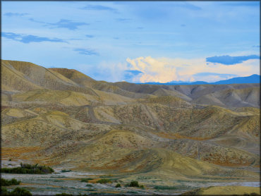
Photo Submitted 10/15/2019 (Thanks!)
Peach Valley Trail Photo
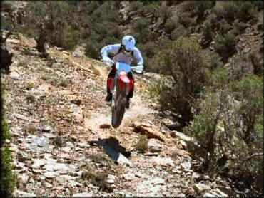
Photo Submitted 6/18/2012 (Thanks!)
Peach Valley Trail Photo
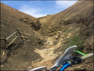
Photo Submitted 8/6/2017 (Thanks!)
Peach Valley Trail Photo
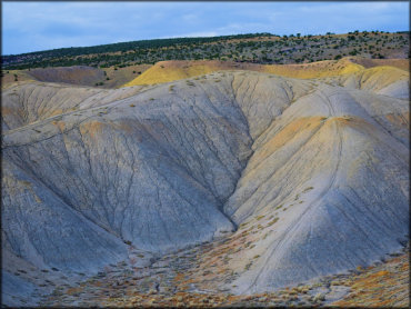
Photo Submitted 10/15/2019 (Thanks!)
Peach Valley Trail Photo
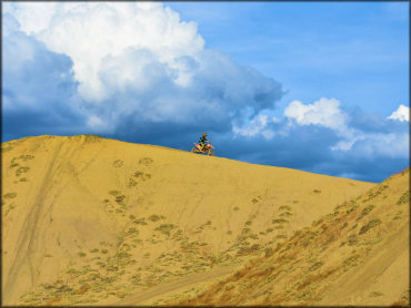
Photo Submitted 10/15/2019 (Thanks!)
Peach Valley Trail Photo
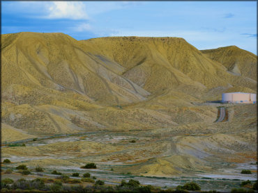
Photo Submitted 10/15/2019 (Thanks!)
Peach Valley Trail Photo
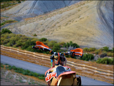
Photo Submitted 10/15/2019 (Thanks!)
RIDER COMMENTS & REVIEWS