 |
      |
| Home > Colorado > Rainbow Falls |
Rainbow Falls
Tuesday, August 19, 2025
| Other Names | Pike National Forest, Pikes Peak Ranger District, Long Hollow Trailhead, Moab Hill, Quartz Mountain, Missouri Gulch, Fern Creek, Illinois Gulch, 717 ATV Trails |
| Last Known Status | Open |
This part of the Pike National Forest offers about 20 miles of smooth and fast motorized trails. Most of the terrain is hard packed but there are some challenging sections with rugged climbs.
Most of the trails can be explored in a 4x4 but there are a few wide enough for ATVs. One of the draws of the area is a popular rock crawling section known as Moab Hill. This trail system is very popular and weekends are usually busy.
Primitive camping is permitted throughout the forest but the closest developed campground is Painted Rocks (reservations are required and must be made at least four days in advance).
REGULATIONS
| Permit Required | Yes | Colorado OHV Sticker |
| Dates Open | Year-Round | |
| Other ATV Stickers Accepted | No | Colorado Non-Resident OHV permit required. |
| Spark Arrestor | Yes | A spark arresting exhaust silencer or end cap is required for all vehicles. |
| Noise Limit | Yes (96 dB) | (1998/older limit 99 dB, 1998/newer limit 96 dB) |
| Whip Flags | Not Required | |
| Maximum Vehicle Width | No Restriction | |
 Motorcycles & Dirt Bikes Motorcycles & Dirt Bikes | Permitted | |
 ATVs ATVs | Permitted | |
 UTV & SXS UTV & SXS | Permitted | |
 4x4 & Jeeps (registered) 4x4 & Jeeps (registered) | Permitted | |
| Dune Buggy & Sand Rail 4x4 (unregistered) | Permitted | |
| 2 Stroke Engines | No Restriction | |
| MX Helmet Required | Yes | |
 Camping Camping | Some Areas | |
 Campfires Campfires | Some Areas | (permitted in developed campsites only) |
| Night Riding | Unknown | |
| Trail Blazing | Prohibited | vehicles must stay on trail |
| Rule Enforcement |
TERRAIN
| Approx Size | 5,000 acres (8 sq mi) | |
| Miles Of Trail | 20 | |
| Climate Type | Forest | |
| Elevation | 7600 to 9000 ft. | |
| Trail Maintenance | Marked, Not Rated, Lightly Maintained | |
| Loose Dirt |  Some Some | |
| Hard Pack | Some | |
| Sand |  None None | |
| Mud |  Little Little | |
| Dust | Little | |
| Rocks | Little | |
| Trees |  All All | |
| Steep Hills | Some | |
| Berms | Some | |
| Sand/Gravel Pits | None | |
| Hazards |  Few Few | (hazards assumed marked but use caution) |
 Novice Novice | Some | |
 Amateur Amateur |  Mostly Mostly | |
 Expert Expert | Little |
TYPE OF AREA
| Area | Motorized Trails |
| Land | National Forest |
GPS POINTS


KEY SERVICES
 Gasoline Gasoline | 5-20 Miles (S) | Diamond Shamrock Corner Store (719) 687-1491 |
| Diesel | 5-20 Miles (S) | Diamond Shamrock Corner Store (719) 687-1491 |
 Water Water | 1-5 Miles (S) | Painted Rocks Campground (877) 444-6777 |
 RV Hookup RV Hookup | 5-20 Miles (S) | Bristlecone Lodge (719) 687-9518 |
 RV Disposal RV Disposal | 5-20 Miles (S) | Bristlecone Lodge (719) 687-9518 |
| Campground | 1-5 Miles (S) | Painted Rocks Campground (877) 444-6777 |
 Conv Store Conv Store | 5-20 Miles (S) | Diamond Shamrock Corner Store (719) 687-1491 |
FEES & PASSES
| Parking | (None) |
| Entry | (None) |
| Riding | (None) |
| Camping | (None) |
RATINGS
| Our Rating |  Good Good |
| Recommended Stay | Full Day |
| Comments | (Scroll Down For Rider Reviews & Comments) |
DRIVING DIRECTIONS
| Nearest City | Woodland Park, CO | ||
| Address | Rainbow Falls Road, Sedalia, CO 80135 | ||
| From: Woodland Park, CO
1) Take SR-67 north about 10 miles 2) Turn right (east) on Rainbow Falls Park Road, continue .25 miles 3) Staging area is on the right. |

OFFICIAL CONTACTS
| Contact Info | Pike National Forest - Pikes Peak Ranger District 601 South Weber Street Colorado Springs, CO 80903 (719) 636-1602 mailroom_r2_pike_san_isabel@fs.fed.us www.fs.usda.gov |
| Contact Info | Colorado Parks And Wildlife - Registration Unit 13787 South Highway 85 Littleton, CO 80125 (303) 791-1920 dnr.ivrsparks@state.co.us cpw.state.co.us |
| Comment | Colorado OHV Registration Info |
Rainbow Falls Trail Photo
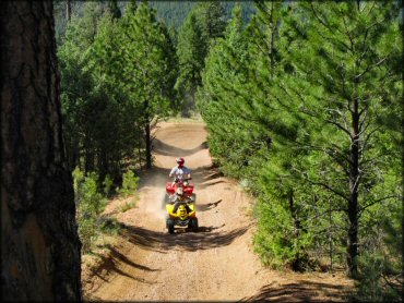
Photo Submitted 5/14/2013 (Thanks! Great shot.)
Rainbow Falls Trail Photo
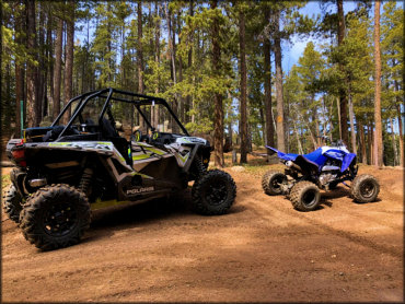
Photo Submitted 3/27/2018 (Thanks!)
Rainbow Falls Trail Photo
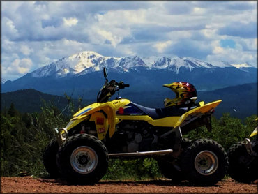
Photo Submitted 4/25/2017 (Thanks!)
Rainbow Falls Trail Photo
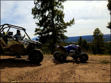
Photo Submitted 3/27/2018 (Thanks!)
Rainbow Falls Trail Photo
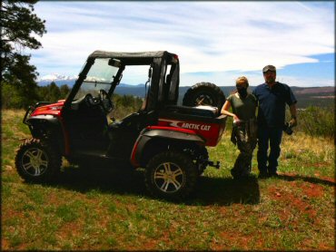
Photo Submitted 5/28/2013 (Thanks!)
Rainbow Falls Trail Photo
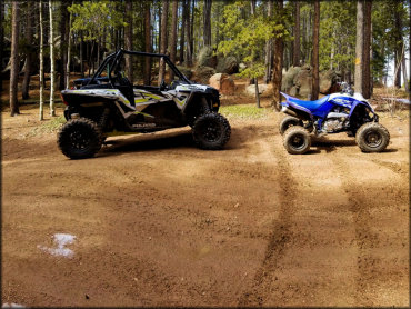
Photo Submitted 3/27/2018 (Thanks!)
Rainbow Falls Trail Photo
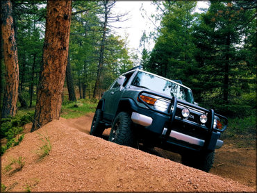
Photo Submitted 6/12/2019 (Thanks!)
Rainbow Falls Trail Photo
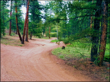
Photo Submitted 6/12/2019 (Thanks!)
Rainbow Falls Trail Photo
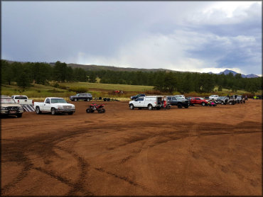
Photo Submitted 6/12/2019 (Thanks!)
Rainbow Falls Trail Photo
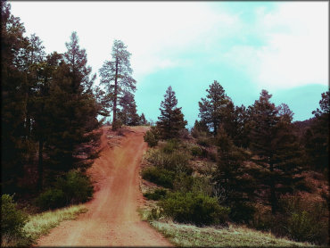
Photo Submitted 6/12/2019 (Thanks!)
RIDER COMMENTS & REVIEWS