 |
      |
| Home > Colorado > Horsetooth Reservoir |
Horsetooth Reservoir MX Track
Saturday, May 10, 2025
| Other Names | Horsetooth Dam, Lory State Park |
| Last Known Status | Closed |
This makeshift motocross play track once featured numerous jumps and berms, some natural elevation changes, drop chutes, short climbs and a couple of very short side trails. The parking area had a kiosk with a pay station and the track and parking area were at one time maintained by the county as part of Horsetooth Reservoir.
Unfortunately the track rarely saw much use and has since been shut down. The track and parking area are overgrown and the entrance is blocked and gated. The entire area under the dam now appears to be off limits to the public.
REGULATIONS
| Permit Required | Yes | |
| Dates Open | Closed | |
| Other ATV Stickers Accepted | No | Colorado Non-Resident OHV permit required. |
| Spark Arrestor | Yes | A spark arresting exhaust silencer or end cap is required for all vehicles. |
| Noise Limit | ||
| Whip Flags | Not Required | |
| Maximum Vehicle Width | ||
 Motorcycles & Dirt Bikes Motorcycles & Dirt Bikes | Permitted | |
 ATVs ATVs | Prohibited | |
 UTV & SXS UTV & SXS | Prohibited | |
 4x4 & Jeeps (registered) 4x4 & Jeeps (registered) | Prohibited | |
| Dune Buggy & Sand Rail 4x4 (unregistered) | Prohibited | |
| 2 Stroke Engines | Prohibited | |
 Camping Camping | Prohibited | |
 Campfires Campfires | Prohibited | |
| Night Riding | No | |
| Alcohol | Prohibited | |
| Rule Enforcement |
TERRAIN
| Approx Size | 80 acres | |
| Climate Type | Urban/Man-Made | |
| Elevation | 5200 to 5400 ft. | |
| Loose Dirt |  None None | |
| Hard Pack |  Mostly Mostly | |
| Sand | None | |
| Mud | None | |
| Dust | Mostly | |
| Rocks |  Little Little | |
| Trees |  Few Few | |
| Steep Hills | None | |
| Water Crossings | None | |
| Small Jumps | Few | |
| Large Jumps | None | |
| Berms | Few | |
| Sand/Gravel Pits | None | |
| Single Track | None | |
| Roads | None | |
| Intersections |  Some Some | |
| Rider Traffic | None | |
| Shade | None | |
| Ranges/Gunfire | None | |
| Hazards | Few | (hazards not marked) Beware of cliffs. |
 Novice Novice | Mostly | |
 Amateur Amateur | Little | |
 Expert Expert | None |
TYPE OF AREA
| Area | MX Track |
| Land | County Land |

| Features | Public |
| Max Engine Size | No Maximum |
| Min Engine Size | No Minimum |
| Comment | Main Track (makeshift) |
GPS POINTS


KEY SERVICES
 Gasoline Gasoline | 1-5 Miles (NE) | Schrader's Country Store (970) 484-7700 |
| Diesel | 1-5 Miles (NE) | Schrader's Country Store (970) 484-7700 |
 Water Water | 5-20 Miles (S) | South Bay Campground (970) 679-4570 |
 RV Hookup RV Hookup | 5-20 Miles (S) | South Bay Campground (970) 679-4570 |
 RV Disposal RV Disposal | 5-20 Miles (S) | South Bay Campground (970) 679-4570 |
| Campground | 5-20 Miles (S) | South Bay Campground (970) 679-4570 |
 Conv Store Conv Store | 1-5 Miles (NE) | Schrader's Country Store (970) 484-7700 |
FEES & PASSES
| Parking | (None) |
| Entry | (None) |
| Riding | (None) |
| Camping | (None) |
RATINGS
| Our Rating |  Poor Poor |
| Recommended Stay | Half Day |
| Comments | (Scroll Down For Rider Reviews & Comments) |
DRIVING DIRECTIONS
| Nearest City | Fort Collins, CO | ||
| From: Fort Collins, CO
1) West on Laporte Ave to the edge of town 2) Turn right (north) onto N Overland Trail, continue 2.3 miles 3) Turn left (west) onto CR 50 / Bingham Hill Road, continue 1.9 miles 4) Turn left (south) onto CR 23 / Front Street, continue 1.2 miles 5) Turn right (west) onto CR 25G, continue 0.1 miles 6) Track entrance is on the left. |


OFFICIAL CONTACTS
| Contact Info | Larimer County 800 S. County Road 31 Loveland, CO 80537 (970) 679-4570 info@larimer.org www.larimer.org |
Horsetooth Reservoir Track Photo
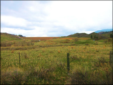
This used to be the parking area and what remains of the track is in the background. Photo Submitted 5/1/2018 (Thanks!)
Horsetooth Reservoir Track Photo
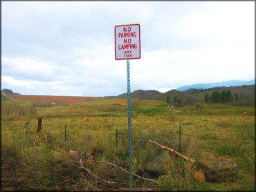
Photo Submitted 5/1/2018 (Thanks!)
Horsetooth Reservoir Track Photo
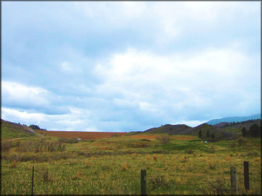
Photo Submitted 5/1/2018 (Thanks!)
Horsetooth Reservoir Track Photo
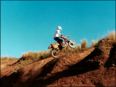
Photo Submitted 7/19/2019 (Thanks!)
Horsetooth Reservoir Track Photo
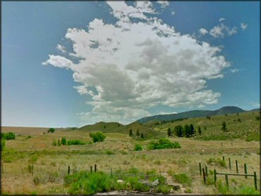
Photo Submitted 7/29/2013 (Thanks!)
RIDER COMMENTS & REVIEWS