 |
      |
| Home > Florida > Mallory Swamp |
Mallory Swamp ATV Trail
Saturday, May 10, 2025
| Other Names | Lafayette County, Mallory Swamp Wildlife Management Area |
| Last Known Status | Open |
This area of the Mallory Swamp Wildlife Management Area has about 35 miles of designated ATV trails. The trails are better described as roads that are mostly wide and flat with some occasional loose sand. The main staging area is a grassy parking lot with some shade under a large oak tree but there are no other services and cell phone coverage is spotty.
Visitors should be careful when using a GPS tool for driving directions here because this method can take you through some backwoods roads that are narrow and overgrown or muddy, leading you a long way just to find a locked gate, especially if you are coming from the eastern or central part of Florida. The best way to reach the staging area we've found is to navigate to the town of Mayo first, then take SR-51 south to County Road 360.
The trails are open daily for riding except during hunting season which generally runs from September through April. Exact dates vary so call before you haul.
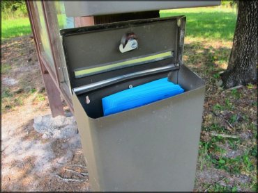
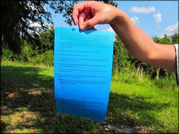
There is no fee but a daily use permit is required which simply means you will have to fill out one of the blue forms found at the kiosk at the main staging area (bring a pen).
REGULATIONS
| Permit Required | Yes | Special Use Authorization Permit |
| Dates Open | April through late September | |
| Other ATV Stickers Accepted | Unknown | |
| Spark Arrestor | Yes | A spark arresting exhaust silencer or end cap is required for all vehicles. |
| Noise Limit | Yes (86 dB) | |
| Whip Flags | Not Required | |
| Maximum Vehicle Width | No Restriction | |
 Motorcycles & Dirt Bikes Motorcycles & Dirt Bikes | Permitted | motorcycles must be street legal |
 ATVs ATVs | Permitted | |
 UTV & SXS UTV & SXS | Permitted | |
 SUVs & Jeeps (registered) SUVs & Jeeps (registered) | Prohibited | |
| Dune Buggy & Swamp Buggy 4x4 (unregistered) | Prohibited | |
| 2 Stroke Engines | No Restriction | |
| MX Helmet Required | Youth Only | required for persons under 16 by state law (RiderPlanet strongly recommends helmets for all riders.) |
 Camping Camping | Prohibited | |
 Campfires Campfires | Prohibited | |
| Night Riding | No | |
| Trail Blazing | Prohibited | stay on trail |
| Alcohol | Prohibited | |
| Rule Enforcement | ||
| Comment | Florida law requires OHVs to be titled when operating on public land. Proof of ownership is required when operating machines. | |
TERRAIN
| Approx Size | 30,501 acres (48 sq mi) | |
| Miles Of Trail | 35 | |
| Climate Type | Swamp | |
| Elevation | 60 to 90 ft. | |
| Trail Maintenance | Marked, Not Rated, Lightly Maintained | |
| Loose Dirt |  None None | |
| Hard Pack |  Mostly Mostly | |
| Sand |  Little Little | |
| Mud | None | |
| Dust | Little | |
| Rocks | None | |
| Trees |  Some Some | |
| Steep Hills | None | |
| Water Crossings | None | |
| Small Jumps | None | |
| Large Jumps | None | |
| Berms | None | |
| Sand/Gravel Pits | None | |
| Single Track | None | |
| Roads | Mostly | |
| Shade |  Few Few | |
| Hazards | Few | (hazards not marked) |
 Novice Novice | Mostly | |
 Amateur Amateur | Some | |
 Expert Expert | Little |
TYPE OF AREA
| Area | Motorized Trails |
| Land | State Forest |
GPS POINTS


KEY SERVICES
 Gasoline Gasoline | 5-20 Miles (NE) | BP Gas Station (386) 935-2359 |
| Diesel | 5-20 Miles (NE) | BP Gas Station (386) 935-2359 |
 Water Water | 1-5 Miles (E) | Ellie Rays RV Resort and Lounge (386) 935-9518 |
 RV Hookup RV Hookup | 1-5 Miles (E) | Ellie Rays RV Resort and Lounge (386) 935-9518 |
 RV Disposal RV Disposal | 1-5 Miles (E) | Ellie Rays RV Resort and Lounge (386) 935-9518 |
| Campground | Mayo, FL | |
 Conv Store Conv Store | 5-20 Miles (NE) | BP Gas Station (386) 935-2359 |
FEES & PASSES
| Parking | (None) |
| Entry | (None) |
| Riding | (None) |
| Camping | (None) |
RATINGS
| Our Rating |  Good Good |
| Recommended Stay | Full Day |
| Comments | (Scroll Down For Rider Reviews & Comments) |
DRIVING DIRECTIONS
| Nearest City | Mayo, FL | ||
| From: Gainesville, FL
1) Take SR-27 west about 40 miles 2) Turn left (south) onto SR-51/Fletcher Street, continue about 3 miles 3) Turn left (east) onto CR-360, continue about 18 miles (pavement will end and turn to dirt, also you will see a sign for Mallory Swamp Wildlife Management Area) 4) Continue straight onto dirt road, proceed 2.7 miles 5) Veer left at the fork, continue 2 miles 6) Veer right at the fork, continue 1.6 miles (follow the signs for ATV Parking) 7) Turn left (east) onto dirt road, continue 2.3 miles toward staging area. |


OFFICIAL CONTACTS
| Contact Info | Suwannee River Water Management District 9225 CR 49 Live Oak, FL 32060 (386) 362-1001 (800) 226-1066 recreation@srwmd.org map.mysuwanneeriver.com |
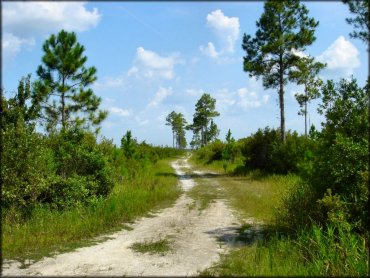
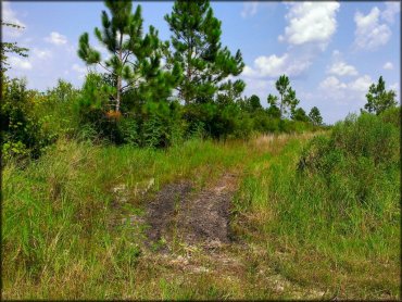
Mallory Swamp Trail Photo
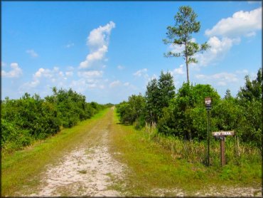
This area is mostly made up of flat and wide trails. This is the place to go if you are looking for an easy day ride.
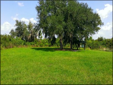
Mallory Swamp Trail Photo
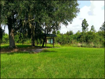
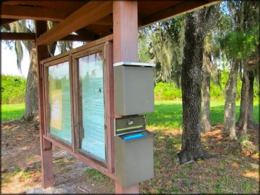
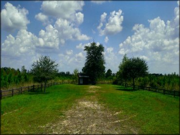
The main staging area has a large shade tree, grassy parking and a kiosk. The daily use permits can be found here.
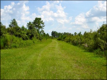
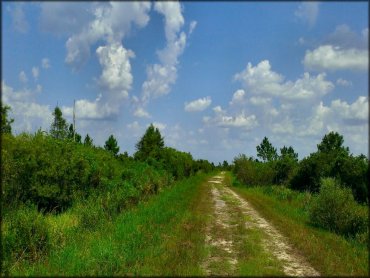
Mallory Swamp Trail Photo
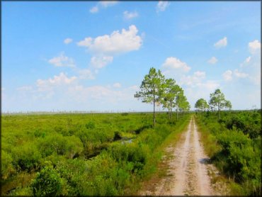
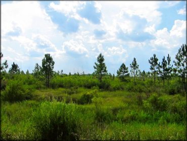
This photo sums up the area. Shade is sparse and the temperature gets hot and humid during the summer months.
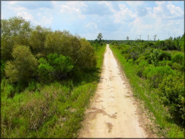
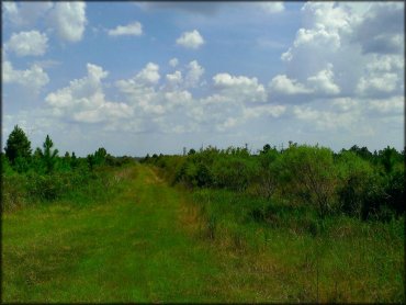
Mallory Swamp Trail Photo
Mallory Swamp Trail Photo
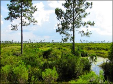
The swamp consists of various pine and cypress trees.
Mallory Swamp Trail Photo
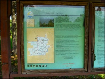
The kiosk at the main staging area has a trail map of the area.
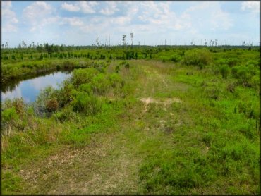
Mallory Swamp Trail Photo
Mallory Swamp Trail Photo
Mallory Swamp Trail Photo
Mallory Swamp Trail Photo
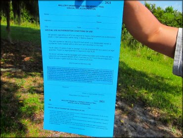
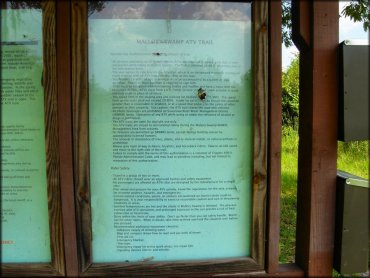
A view of the daily use permit.
Mallory Swamp Trail Photo
Mallory Swamp Trail Photo
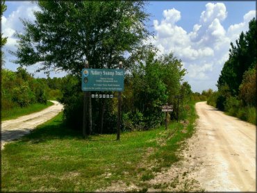
This sign marks the entrance into the Mallory Swamp. Veer right at the fork.
Mallory Swamp Trail Photo
This is another view of the ranger station.
Mallory Swamp Trail Photo

This is the ranger station located just a short distance past the Mallory Swamp entrance sign. It appears to be vacant during the summer months.
Mallory Swamp Trail Photo
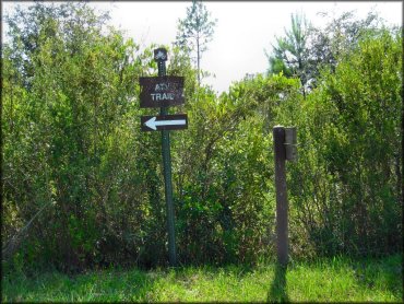
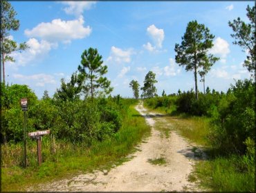
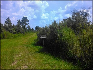
The ATV trail is marked and is located just past the main staging area.
Mallory Swamp Trail Photo
Mallory Swamp Trail Photo
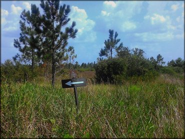
Follow the signs to the main staging area.
Mallory Swamp Trail Photo
Mallory Swamp Trail Photo
Mallory Swamp Trail Photo
Mallory Swamp Trail Photo
Mallory Swamp Trail Photo
Mallory Swamp Trail Photo
Mallory Swamp Trail Photo
Mallory Swamp Trail Photo
Mallory Swamp Trail Photo
The main entrance road is marked with signs.
RIDER COMMENTS & REVIEWS