 |
      |
| Home > Idaho > Steamboat Creek |
Steamboat Creek
Tuesday, March 31, 2026
| Other Names | Coeur d'Alene National Forest, Coeur d'Alene River Ranger District, Cougar Peak, Black Canyon Saddle, Steamboat Saddle, Riley Saddle, Grassy Mountain, Spyglass Peak, Leiberg Saddle, Stull Saddle, Skull Saddle, Trail 803, 803 Motorized Trail, Laverne Saddle, Bumblebee |
| Last Known Status | Open |
This part of the Coeur d'Alene National Forest offers over 25+ miles of designated ATV trails plus forest service roads to explore. The main trail follows the side of a mountain and has some gradual elevation changes there are some steep dropoffs, so use caution.
There is a designated staging area with informational kiosk located off Forest Service Road 400 but to access the actual trailhead you will have to do some additional traveling. The western trailhead can be accessed about six miles off Forest Service Road 409. The eastern trailhead can be reached by heading a couple miles south from the staging area and turning right (west) onto Forest Service Road 257.
Please note that the ATV trails are open to machines 50 inches or less in width but there are some old forest service roads that can be used by wider machines. Dispersed camping is permitted but for those looking for a designated campsites try Bumble Bee Campground. Steamboat Creek can be used to tie into the Laverne and Bumble Bee trails. Cabin rentals are just a short distance away which include the historic Magee Ranger Station and Avery Creek Cabin.
REGULATIONS
| Permit Required | Yes | Idaho OHV Registration Sticker |
| Dates Open | April 1 - September 7 | |
| Other ATV Stickers Accepted | No | A non-resident registration sticker must be purchased. (As of January 2020, Idaho no longer honors stickers from other states.) |
| Spark Arrestor | Yes | A spark arresting exhaust silencer or end cap is required for all vehicles. |
| Noise Limit | Yes (96 dB) | |
| Whip Flags | Not Required | |
| Maximum Vehicle Width | Yes (50 inches) | has entrance gate and narrow terrain |
 Motorcycles & Dirt Bikes Motorcycles & Dirt Bikes | Permitted | |
 ATVs ATVs | Permitted | (maximum width 50 inches) |
 UTV & SXS UTV & SXS | Permitted | (maximum width 50 inches) |
 4x4 & Jeeps (registered) 4x4 & Jeeps (registered) | Prohibited | |
| Dune Buggy & Sand Rail 4x4 (unregistered) | Prohibited | |
| 2 Stroke Engines | No Restriction | |
| MX Helmet Required | Youth Only | required for persons under 18 by state law (RiderPlanet strongly recommends helmets for all riders.) |
 Camping Camping | No Restriction | (camp anywhere) |
 Campfires Campfires | ||
| Night Riding | Unknown | |
| Trail Blazing | Prohibited | stay on trail |
| Rule Enforcement |
TERRAIN
| Miles Of Trail | 25 | |
| Climate Type | Forest | |
| Elevation | 2300 to 4000 ft. | |
| Trail Maintenance | Marked, Not Rated, Lightly Maintained | |
| Loose Dirt |  Little Little | |
| Hard Pack |  Mostly Mostly | |
| Sand |  None None | |
| Mud | Little | |
| Dust | Little | |
| Rocks |  Some Some | |
| Trees |  All All | |
| Steep Hills | Some | |
| Water Crossings |  Few Few | |
| Small Jumps | None | |
| Large Jumps | None | |
| Berms | None | |
| Sand/Gravel Pits | None | |
| Single Track | None | |
| Roads | Some | |
| Intersections | Some | |
| Rider Traffic | Few | |
| Shade | All | |
| Hazards | Few | (hazards assumed marked but use caution) |
 Novice Novice | Little | |
 Amateur Amateur | Mostly | |
 Expert Expert | Some |
TYPE OF AREA
| Area | Motorized Trails |
| Land | National Forest |


KEY SERVICES
 Gasoline Gasoline | 5-20 Miles (SE) | H & H Riverstop (208) 682-4317 |
| Diesel | 5-20 Miles (SE) | H & H Riverstop (208) 682-4317 |
 Water Water | 5-20 Miles (SW) | Bumblebee Campground (208) 664-2318 |
 RV Hookup RV Hookup | 5-20 Miles (S) | Albert's Landing River Resort (208) 682-4179 |
 RV Disposal RV Disposal | 5-20 Miles (S) | Albert's Landing River Resort (208) 682-4179 |
| Campground | 5-20 Miles (SW) | Bumblebee Campground (208) 664-2318 |
 Conv Store Conv Store | 5-20 Miles (SE) | H & H Riverstop (208) 682-4317 |
FEES & PASSES
| Parking | (None) |
| Entry | (None) |
| Riding | (None) |
| Camping | (None) |
RATINGS
| Our Rating |  Good Good |
| Recommended Stay | Full Day |
| Comments | (Scroll Down For Rider Reviews & Comments) |
DRIVING DIRECTIONS
| Nearest City | Kingston, ID | ||
| Address | Steamboat Creek Road, Kingston, ID 83839 | ||
| From: Coeur d'Alene, ID
1) Take I-90 East to Exit 43 2) Turn left (north) off the exit ramp onto Hwy 9, continue 5.4 miles 3) Turn left (west) onto Little North Fork Road, continue .3 miles 4) After crossing bridge, turn right (north) onto FS Road 503/Old River Road, continue 6 miles 5) Turn left (north) onto FS Road 400/Steamboat Creek Road, continue 5.2 miles 6) Staging area is on the right (east). |

OFFICIAL CONTACTS
| Contact Info | Coeur d'Alene National Forest - Coeur d'Alene River District 2502 East Sherman Avenue Coeur d'Alene, ID 83814-5899 (208) 664-2318 mailroom_r1_idaho_panhandle@fs.fed.us www.fs.usda.gov |
| Contact Info | Idaho Parks And Recreation 5657 E. Warm Springs Ave Boise, ID 83716 (208) 334-4197 reghelpline@idpr.idaho.gov parksandrecreation.idaho.gov |
| Comment | Idaho OHV Sticker Info |
Steamboat Creek Trail Photo
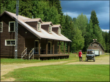
Photo Submitted 10/5/2016 (Thanks!)
Steamboat Creek Trail Photo
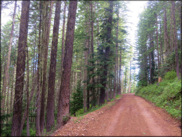
Photo Submitted 10/5/2016 (Thanks!)
Steamboat Creek Trail Photo
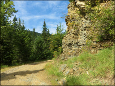
Photo Submitted 10/5/2016 (Thanks!)
Steamboat Creek Trail Photo
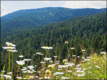
Photo Submitted 10/5/2016 (Thanks!)
Steamboat Creek Trail Photo
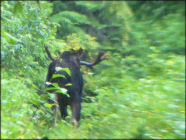
Photo Submitted 10/5/2016 (Thanks!)
RIDER COMMENTS & REVIEWS