 |
      |
| Home > Idaho > Cottonwood Creek |
Cottonwood Creek
Saturday, May 10, 2025
| Other Names | South Hills, Dry Creek, Cherry Spring, North Cottonwood Creek, Indian Springs |
| Last Known Status | Open |
This section of BLM land offers a couple designated staging areas with trails that eventually connect into the Sawtooth National Forest. The terrain here mainly consists of sagebrush and rolling hills but if you keep heading south the vegetation will change into some nice forest scenery and eventually tie into the South Hills.
There is no fee charged to park at Cottonwood Creek or Indian Springs but there are no services, so bring shade and water. This area also closes to motorized use around mid January through mid March but exact dates vary so call first before heading out.
REGULATIONS
| Permit Required | Yes | Idaho OHV Registration Sticker |
| Dates Open | March 16 - January 16 | |
| Other ATV Stickers Accepted | No | A non-resident registration sticker must be purchased. (As of January 2020, Idaho no longer honors stickers from other states.) |
| Spark Arrestor | Yes | A spark arresting exhaust silencer or end cap is required for all vehicles. |
| Noise Limit | Yes (96 dB) | |
| Whip Flags | Not Required | |
| Maximum Vehicle Width | No Restriction | |
 Motorcycles & Dirt Bikes Motorcycles & Dirt Bikes | Permitted | |
 ATVs ATVs | Permitted | |
 UTV & SXS UTV & SXS | Permitted | |
 4x4 & Jeeps (registered) 4x4 & Jeeps (registered) | Permitted | |
| Dune Buggy & Sand Rail 4x4 (unregistered) | Permitted | |
| 2 Stroke Engines | No Restriction | |
| MX Helmet Required | Youth Only | required for persons under 18 by state law (RiderPlanet strongly recommends helmets for all riders.) |
 Camping Camping | No Restriction | (camp anywhere) |
 Campfires Campfires | ||
| Night Riding | Unknown | |
| Trail Blazing | Prohibited | stay on trail |
| Rule Enforcement |
TERRAIN
| Approx Size | 25,600 acres (40 sq mi) | |
| Miles Of Trail | 20 | |
| Climate Type | Desert | |
| Elevation | 4150 to 5600 ft. | |
| Trail Maintenance | Marked, Not Rated, Lightly Maintained | |
| Loose Dirt |  Little Little | |
| Hard Pack |  Mostly Mostly | |
| Sand | Little | |
| Mud |  Some Some | |
| Dust | Little | |
| Rocks | Little | |
| Trees |  None None | |
| Steep Hills | Some | |
| Water Crossings |  Few Few | |
| Small Jumps | Few | |
| Large Jumps | None | |
| Berms | None | |
| Sand/Gravel Pits | None | |
| Single Track | None | |
| Roads | Some | |
| Intersections | Some | |
| Rider Traffic | Some | |
| Shade | None | |
| Hazards | Few | (hazards not marked) |
 Novice Novice | Some | |
 Amateur Amateur | Mostly | |
 Expert Expert | Little |
TYPE OF AREA
| Area | Motorized Trails |
| Land | BLM |
GPS POINTS


KEY SERVICES
 Gasoline Gasoline | 5-20 Miles (NE) | Rock Creek General Store (208) 423-5659 |
| Diesel | 5-20 Miles (NE) | Rock Creek General Store (208) 423-5659 |
 Water Water | 5-20 Miles (SW) | Nat-Soo-Pah Hot Springs (208) 655-4337 |
 RV Hookup RV Hookup | 5-20 Miles (SW) | Nat-Soo-Pah Hot Springs (208) 655-4337 |
 RV Disposal RV Disposal | 5-20 Miles (SW) | Nat-Soo-Pah Hot Springs (208) 655-4337 |
| Campground | Twin Falls, ID | |
 Conv Store Conv Store | 5-20 Miles (NE) | Rock Creek General Store (208) 423-5659 |
FEES & PASSES
| Parking | (None) |
| Entry | (None) |
| Riding | (None) |
| Camping | (None) |
RATINGS
| Pros | free, lots of parking space |
| Cons | no shade in staging areas |
| Our Rating |  Good Good |
| Recommended Stay | Full Day |
| Comments | (Scroll Down For Rider Reviews & Comments) |
DRIVING DIRECTIONS
| Nearest City | Twin Falls, ID | ||
| From: Twin Falls, ID
1) Take Blue Lakes Blvd/N 3000 south about 10 miles 2) Turn left (east) onto E2800N, continue 1.6 miles 3) Cottonwood Creek Staging Area is on the right (south). For Indian Springs Staging Area: 4) Continue east past Cottonwood Creek Staging area 3.7 miles 5) Indian Springs Staging area is on the right (south). |

OFFICIAL CONTACTS
| Contact Info | BLM - Burley Field Office 15 East 200 South Burley, ID 83318 (208) 735-2060 blm_id_burleyoffice@blm.gov www.blm.gov |
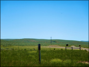
Cottonwood Creek Trail Photo
The Cottonwood Creek trails head south and eventually connect to the South Hills Area. Photo Submitted 8/4/2019 (Thanks!)
Cottonwood Creek Trail Photo
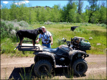
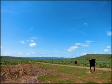
Both Cottonwood Creek and Indian Springs staging areas have plenty of room for trailers and RVs to park. There are no services so bring water and shade.
Cottonwood Creek Trail Photo
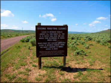
The Cottonwood Creek area is closed to motorized use from mid January through mid March. Exact opening dates may vary so call first before heading out.
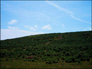
Cottonwood Creek Trail Photo
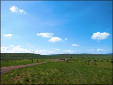
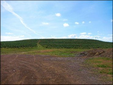
The area is mostly rolling hills covered with sage and scrub brush. There are no trees up here until you reach the South Hills Area.
Cottonwood Creek Trail Photo
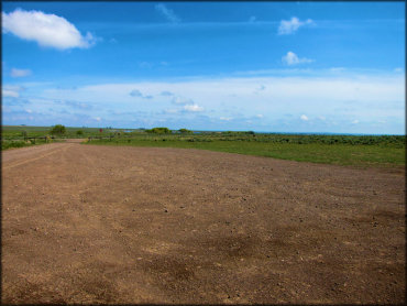
Both staging areas have plenty of room for trailers and RVs to park. There are no services so bring water, shade and pack out what you bring.
Cottonwood Creek Trail Photo
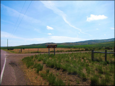
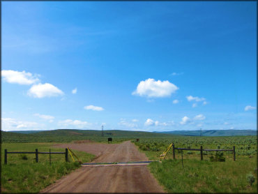
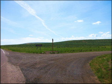
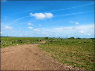
This is the entrance for Indian Springs Road Staging Area.
Cottonwood Creek Trail Photo
The vegetation starts out with the typical sage and scrub brush but if you keep heading south the landscape will change to an aspen forest with green meadows.
Cottonwood Creek Trail Photo
This staging area is located off North Cottonwood Creek Road.
Cottonwood Creek Trail Photo
This staging area is located off Indian Springs Road.
Cottonwood Creek Trail Photo
The is another view of the staging area off Indian Springs Road.
Cottonwood Creek Trail Photo
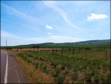
The staging areas are located off the highway, making it easy to get in and out.
Cottonwood Creek Trail Photo
The trails here are mostly hard packed and rocky 4x4 trails.
Cottonwood Creek Trail Photo
Another view of the staging areas.
RIDER COMMENTS & REVIEWS