 |
      |
| Home > Kentucky > Redbird Crest Trail System |
Redbird Crest Trail System
Wednesday, August 20, 2025
| Other Names | Daniel Boone National Forest, Redbird Ranger District, Peabody Trailhead, Sugar Creek Trailhead, Bear Creek Trailhead, Red Bird River |
| Last Known Status | Open |
This part of the Daniel Boone National Forest offers over 100 miles of motorized trails with a large portion that is designated as pure single track. Most of the terrain is rough, narrow and rugged with many sections following mountain ridgetops.
The trail system has three developed staging areas, and each comes with a vault toilet. The single track is located about .3 miles east past the Peabody Staging Area but motorcycles must be street legal since a section of paved road must be crossed to access the trailhead.
The area is open year-round but a trail pass is required to ride here, which can be purchased through nearby vendors or by visiting the Redbird Crest Ranger Station.
REGULATIONS
| Permit Required | Yes | |
| Dates Open | Year-Round | |
| Other ATV Stickers Accepted | Unknown | |
| Spark Arrestor | Yes | A spark arresting exhaust silencer or end cap is required for all vehicles. |
| Noise Limit | Yes (96 dB) | |
| Whip Flags | Not Required | |
| Maximum Vehicle Width | Yes (50 inches) | has entrance gate and narrow terrain |
 Motorcycles & Dirt Bikes Motorcycles & Dirt Bikes | Permitted | |
 Four Wheelers Four Wheelers | Permitted | (maximum width 50 inches) |
 UTV & SXS UTV & SXS | Permitted | (maximum width 50 inches) |
 SUVs & Jeeps (registered) SUVs & Jeeps (registered) | Prohibited | |
| Dune Buggy & Sand Rail 4x4 (unregistered) | Prohibited | |
| 2 Stroke Engines | No Restriction | |
| MX Helmet Required | Yes | |
 Camping Camping | ||
 Campfires Campfires | ||
| Night Riding | Unknown | |
| Trail Blazing | Prohibited | keep on designated trails |
| Alcohol | Prohibited | |
| Rule Enforcement | ||
| Comment | Only street legal machines are permitted on Trail 14 and 15. | |
TERRAIN
| Miles Of Trail | 100 | |
| Climate Type | Forest | |
| Elevation | 1500 to 1800 ft. | |
| Trail Maintenance | Marked, Not Rated, Lightly Maintained | trails are marked with orange blazes |
| Loose Dirt |  Some Some | |
| Hard Pack | Some | |
| Sand |  None None | |
| Mud | Some | |
| Dust |  Little Little | |
| Rocks | Little | |
| Trees |  All All | |
| Steep Hills | Some | |
| Water Crossings |  Few Few | |
| Small Jumps | Few | |
| Large Jumps | None | |
| Berms | Few | |
| Sand/Gravel Pits | None | |
| Single Track | Some | |
| Roads | Few | |
| Shade |  Many Many | |
| Hazards | Few | (hazards assumed marked but use caution) |
 Novice Novice | Some | |
 Amateur Amateur |  Mostly Mostly | |
 Expert Expert | Little |
TYPE OF AREA
| Area | Motorized Trails |
| Land | National Forest |
GPS POINTS


KEY SERVICES
 Gasoline Gasoline | 5-20 Miles (E) | Triple R Market (606) 672-3410 |
| Diesel | 5-20 Miles (E) | Triple R Market (606) 672-3410 |
 Water Water | 5-20 Miles (SE) | Stinnett Area Community Center (606) 374-3740 |
 RV Hookup RV Hookup | 5-20 Miles (SE) | Stinnett Area Community Center (606) 374-3740 |
 RV Disposal RV Disposal | 5-20 Miles (SE) | Stinnett Area Community Center (606) 374-3740 |
| Campground | 5-20 Miles (SE) | Stinnett Area Community Center (606) 374-3740 |
 Conv Store Conv Store | 5-20 Miles (E) | Triple R Market (606) 672-3410 |
FEES & PASSES
| Parking | (None) |
| Entry | (None) |
| Riding | Yes ($15.00 per rider) Annual Pass - $60 |
| Camping | (None) |
RATINGS
| Our Rating |  Very Good Very Good |
| Recommended Stay | 1-2 Days |
| Comments | (Scroll Down For Rider Reviews & Comments) |
DRIVING DIRECTIONS
| Nearest City | Big Creek, KY | ||
| Address | Frank Bowling Road, Big Creek, KY 40914 | ||
| From: Big Creek, KY
1) Take Hwy 66 South about 2 miles 2) Turn left (north) onto Frank Bowling Road, continue about .25 miles toward Peabody Trailhead. For Bear Creek Trailhead: 3) Continue south past Peabody Trailhead about 12 miles 4) Staging area is on the right (west). For Sugar Creek Trailhead: 5) Take Hwy 421 East from Big Creek about 7.5 miles 6) Turn right (south) onto Foresty Road/Game Reserve Road, continue .8 miles 7) Trailhead entrance is on the right (west). |


OFFICIAL CONTACTS
| Contact Info | Daniel Boone National Forest - Redbird Ranger District 91 Peabody Road Big Creek, KY 40914 (606) 598-2192 mailroom_r8_danielboone@fs.fed.us www.fs.usda.gov |
Redbird Crest Trail System Photo
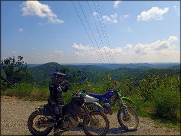
Photo Submitted 10/19/2021 (Thanks!)
Redbird Crest Trail System Photo
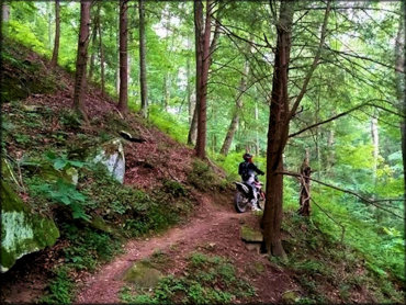
Photo Submitted 1/7/2023 (Thanks!)
Redbird Crest Trail System Photo
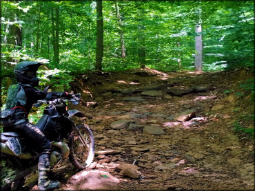
Photo Submitted 1/7/2023 (Thanks!)
Redbird Crest Trail System Photo
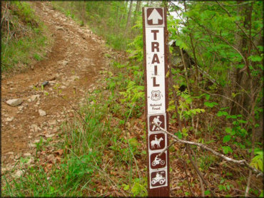
Photo Submitted 3/17/2017 (Thanks!)
Redbird Crest Trail System Photo

Photo Submitted 1/7/2023 (Thanks!)
RIDER COMMENTS & REVIEWS