 |
      |
| Home > Minnesota > Soo Pits |
Soo Pits OHV Trails
Tuesday, March 31, 2026
| Other Names | Spring Lake, Moosehorn River, Portage River, Moosehead Lake, Soo Line ATV Trail, Willard Munger State Trail |
| Last Known Status | Open |
Located just minutes from the town of Moose Lake, this area offers about five miles of motorized trails plus an old abandoned gravel pit to play in. The Soo Line ATV Trail runs near the gravel pit, making it a good place to access (ATVs only). The historic Willard Munger State Trail follows the nearby Moose River and is open to non-motorized use only.
REGULATIONS
| Permit Required | Yes | MN OHV Permit |
| Dates Open | April 1 - November 30 | |
| Other ATV Stickers Accepted | Unknown | |
| Spark Arrestor | Yes | A spark arresting exhaust silencer or end cap is required for all vehicles. |
| Noise Limit | Yes (96 dB) | OHMs not to exceed distance of 20 inches, ATVs 99dB at 20 inches |
| Whip Flags | Not Required | |
| Maximum Vehicle Width | Yes (65 inches) | |
 Motorcycles & Dirt Bikes Motorcycles & Dirt Bikes | Permitted | |
 ATVs ATVs | Permitted | |
 UTV & SXS UTV & SXS | Permitted | (maximum width 65 inches) |
 SUVs & Jeeps (registered) SUVs & Jeeps (registered) | Prohibited | |
| Dune Buggy & Sand Rail 4x4 (unregistered) | Prohibited | |
| 2 Stroke Engines | No Restriction | |
| MX Helmet Required | Youth Only | required for operators under 18 by state law (RiderPlanet strongly recommends helmets for all riders.) |
 Camping Camping | ||
 Campfires Campfires | ||
| Night Riding | Unknown | |
| Trail Blazing | Some Areas | |
| Rule Enforcement |
Advertisement
TYPE OF AREA
| Area | Motorized Trails, Gravel Pit |
| Land | County Land |
FEES & PASSES
| Parking | (None) |
| Entry | (None) |
| Riding | (None) |
| Camping | (None) |
RATINGS
| Our Rating |  Good Good |
| Recommended Stay | Full Day |
| Comments | (Scroll Down For Rider Reviews & Comments) |
DRIVING DIRECTIONS
| Nearest City | Moose Lake, MN | ||
| From: St. Paul, MN
1) Take I-35 North to Exit 214 2) Turn left (west) off the exit ramp on SR-73, continue 2.9 miles 3) Veer right (east) on SR-27, continue .5 miles 4) Turn left (north) on Old CR-8, follow to staging area. |


OFFICIAL CONTACTS
| Contact Info | Carlton County (218) 384-9179 www.co.carlton.mn.us |
| Contact Info | Minnesota DNR License Bureau 500 Lafayette Road St. Paul, MN 55155 (888) 665-4236 info.dnr@state.mn.us www.dnr.state.mn.us |
| Comment | OHV Permit Info |
| Contact Info | Evergreen PAC ATV Club www.evergreen-pac-atvclub.org |
Soo Pits Trail Photo
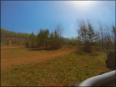
Photo Submitted 5/26/2015 (Thanks!)
ADD PHOTOS
TERRAIN
| Miles Of Trail | 5 | |
| Climate Type | Forest | |
| Elevation | 1000 to 1050 ft. | |
| Trail Maintenance | Unknown | |
| Hazards |  Few Few | (hazards assumed marked but use caution) |
 Novice Novice |  Some Some | |
 Amateur Amateur |  Mostly Mostly | |
 Expert Expert |  Little Little |
GPS POINTS


KEY SERVICES
 Gasoline Gasoline | 1-5 Miles (SW) | Gateway Amoco (218) 485-8391 |
| Diesel | 1-5 Miles (SW) | Gateway Amoco (218) 485-8391 |
 Water Water | 1-5 Miles (SW) | Moose Lake City Campground (218) 485-4761 |
 RV Hookup RV Hookup | 1-5 Miles (S) | Red Fox Campground & RV Park (218) 485-0341 |
 RV Disposal RV Disposal | 1-5 Miles (S) | Red Fox Campground & RV Park (218) 485-0341 |
| Campground | 1-5 Miles (SW) | Moose Lake City Campground (218) 485-4761 |
 Conv Store Conv Store | 1-5 Miles (SW) | Market Place Foods (218) 485-4336 |
RIDER COMMENTS & REVIEWS