 |
      |
| Home > Minnesota > UPM Trail |
UPM Trail
Saturday, May 10, 2025
| Other Names | UPM Blandin Trail, Itasca County, Smith Lake, Cook Lake, Split Hand Lake, Pokegama Creek |
| Last Known Status | Open |
This area offers 21 miles of wide and easy UTV trails that wind through a dense mixed hardwood forest. There is a large flat parking area which offers direct access to the trail system. Recently a new spur trail was added which ends near Cook Lake, which features a picnic area and fire pit. Future plans include adding restroom facilities.
The trail is rated as mostly easy heads both east and west of Highway 169. The area offers scenic views of numerous lakes, shallow creeks and rolling hills, making this a good choice to bring the family or a group ride.
A number of restaurants and gas stations are located near the trail. The trail has a seasonal closure which begins in November through mid May. Be sure to say thanks to the Rapids Riders ATV Club for maintaining this trail system.
REGULATIONS
| Permit Required | Yes | MN OHV Permit |
| Dates Open | May 15 - November 1 | |
| Other ATV Stickers Accepted | Unknown | |
| Spark Arrestor | Yes | A spark arresting exhaust silencer or end cap is required for all vehicles. |
| Noise Limit | Yes (96 dB) | OHMs not to exceed distance of 20 inches, ATVs 99dB at 20 inches |
| Whip Flags | Not Required | |
| Maximum Vehicle Width | Yes (65 inches) | has entrance gate or posts |
 Motorcycles & Dirt Bikes Motorcycles & Dirt Bikes | Permitted | |
 ATVs ATVs | Permitted | |
 UTV & SXS UTV & SXS | Permitted | (maximum width 65 inches) |
 SUVs & Jeeps (registered) SUVs & Jeeps (registered) | Prohibited | |
| Dune Buggy & Sand Rail 4x4 (unregistered) | Prohibited | |
| 2 Stroke Engines | No Restriction | |
| MX Helmet Required | Youth Only | required for operators under 18 by state law (RiderPlanet strongly recommends helmets for all riders.) |
 Camping Camping | Some Areas | (camp in developed sites only) |
 Campfires Campfires | ||
| Night Riding | Unknown | |
| Trail Blazing | Permitted | |
| Rule Enforcement |
TERRAIN
| Miles Of Trail | 21 | |
| Climate Type | Forest | |
| Elevation | 1250 to 1450 ft. | |
| Trail Maintenance | Marked, Not Rated, Heavily Maintained | |
| Loose Dirt |  Little Little | |
| Hard Pack |  Mostly Mostly | |
| Sand | Little | |
| Mud |  Some Some | |
| Dust | Little | |
| Rocks | Little | |
| Trees |  All All | |
| Steep Hills |  None None | |
| Water Crossings |  Few Few | |
| Small Jumps | None | |
| Large Jumps | None | |
| Berms | Few | |
| Sand/Gravel Pits | None | |
| Single Track | None | |
| Roads | Some | |
| Shade | All | |
| Hazards | Few | (hazards assumed marked but use caution) |
 Novice Novice | Mostly | |
 Amateur Amateur | Little | |
 Expert Expert | None |
TYPE OF AREA
| Area | Motorized Trails |
| Land | County Land |


KEY SERVICES
 Gasoline Gasoline | 1-5 Miles (N) | Arco (218) 326-9390 |
| Diesel | 5-20 Miles (S) | Sunny's Gas Station (218) 697-2306 |
 Water Water | 5-20 Miles (S) | Hill City Park and Campground (218) 697-2301 |
 RV Hookup RV Hookup | 5-20 Miles (S) | Hill City Park and Campground (218) 697-2301 |
 RV Disposal RV Disposal | 5-20 Miles (S) | Hill City Park and Campground (218) 697-2301 |
| Campground | 5-20 Miles (S) | Hill City Park and Campground (218) 697-2301 |
 Conv Store Conv Store | 1-5 Miles (N) | Arco (218) 326-9390 |
FEES & PASSES
| Parking | (None) |
| Entry | (None) |
| Riding | (None) |
| Camping | (None) |
RATINGS
| Our Rating |  Good Good |
| Recommended Stay | Full Day |
| Comments | (Scroll Down For Rider Reviews & Comments) |
DRIVING DIRECTIONS
| Nearest City | Grand Rapids, MN | ||
| Address | Smith Drive, Hill City, MN 55748 | ||
| From: Grand Rapids, MN
1) Take Hwy 169 South 7.5 miles 2) Turn left (east) onto Smith Drive, continue .3 miles 3) Staging is located between intersection of Smith Drive and Logging Road. |


OFFICIAL CONTACTS
| Contact Info | Itasca County 123 NE 4th Street Grand Rapids, MN 55744 (218) 327-7363 helpdesk@co.itasca.mn.us www.co.itasca.mn.us |
| Contact Info | Rapids Riders ATV Club P.O. Box 5200 Grand Rapids, MN 55744 rapidsridersatv@outlook.com www.rratv.org |
| Contact Info | Minnesota DNR License Bureau 500 Lafayette Road St. Paul, MN 55155 (888) 665-4236 info.dnr@state.mn.us www.dnr.state.mn.us |
| Comment | OHV Permit Info |
UPM Trail Photo
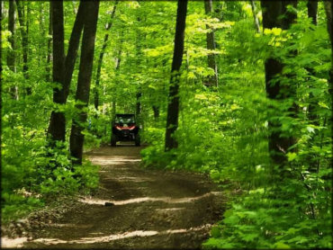
Photo Submitted 10/15/2021 (Thanks!)
UPM Trail Photo
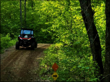
Photo Submitted 10/15/2021 (Thanks!)
UPM Trail Photo
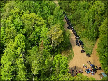
Photo Submitted 10/15/2021 (Thanks!)
UPM Trail Photo
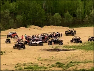
Photo Submitted 10/15/2021 (Thanks!)
UPM Trail Photo
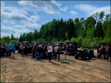
Photo Submitted 10/15/2021 (Thanks!)
UPM Trail Photo
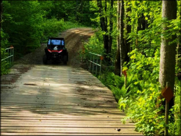
Photo Submitted 10/15/2021 (Thanks!)
RIDER COMMENTS & REVIEWS