 |
      |
| Home > Mississippi > Choctaw Trails |
Choctaw Trails
Saturday, May 10, 2025
| Other Names | Grenada Lake Bottom, Greys Port |
| Last Known Status | Open |
Overlooking the shores of Grenada Lake, this area offers about 18 miles of multiple-use trails that open to offroad use. There are four colored designated loops plus two miles of existing forest roads to explore.
The trails wind through a mixed hardwood forest with some light to moderate elevation changes. There are several shaded picnic shelters that offer some nice views of the lake.
All vehicle types are welcomed and there are no width restrictions, but helmets are required. The trails are open daily, year-round during daylight hours. Overnight parking is not permitted but Skuna-Turkey Campground is just a few miles north which has six primitive sites, water and restrooms.
REGULATIONS
| Permit Required | No | |
| Dates Open | Year-Round | |
| Other ATV Stickers Accepted | Unknown | |
| Spark Arrestor | Yes | A spark arresting exhaust silencer or end cap is required for all vehicles. |
| Noise Limit | ||
| Whip Flags | Not Required | |
| Maximum Vehicle Width | No Restriction | |
 Motorcycles & Dirt Bikes Motorcycles & Dirt Bikes | Permitted | |
 Four Wheelers Four Wheelers | Permitted | |
 UTV & SXS UTV & SXS | Permitted | |
 SUVs & Jeeps (registered) SUVs & Jeeps (registered) | Permitted | |
| Dune Buggy & Sand Rail 4x4 (unregistered) | Permitted | |
| 2 Stroke Engines | No Restriction | |
| MX Helmet Required | Yes | |
 Camping Camping | Prohibited | |
 Campfires Campfires | Prohibited | |
| Night Riding | No | |
| Trail Blazing | Prohibited | stay on the trail |
| Rule Enforcement |
TERRAIN
| Approx Size | 1,920 acres (3 sq mi) | |
| Miles Of Trail | 18 | |
| Climate Type | Forest | |
| Elevation | 215 to 300 ft. | |
| Trail Maintenance | Marked, Not Rated, Lightly Maintained | |
| Loose Dirt |  Little Little | |
| Hard Pack |  Mostly Mostly | |
| Sand |  Some Some | |
| Mud | Some | |
| Dust | Little | |
| Rocks | Little | |
| Trees |  Many Many | |
| Steep Hills |  Few Few | |
| Water Crossings |  None None | |
| Small Jumps | None | |
| Large Jumps | None | |
| Berms | None | |
| Sand/Gravel Pits | None | |
| Single Track | None | |
| Roads | Few | |
| Shade | Some | |
| Hazards | Few | (hazards assumed marked but use caution) |
 Novice Novice | Some | |
 Amateur Amateur | Mostly | |
 Expert Expert | Little |
TYPE OF AREA
| Area | Motorized Trails |
| Land | Army Corps of Engineers |


KEY SERVICES
 Gasoline Gasoline | 20-30 Miles (SW) | Grenada Best Stop (662) 307-2766 |
| Diesel | 20-30 Miles (SW) | Chevron (662) 227-9200 |
 Water Water | 1-5 Miles (N) | Skuna-Turkey Campground (662) 226-5911 |
 RV Hookup RV Hookup | 5-20 Miles (SE) | North Graysport Campground (662) 226-5911 |
 RV Disposal RV Disposal | 5-20 Miles (SE) | North Graysport Campground (662) 226-5911 |
| Campground | 1-5 Miles (N) | Skuna-Turkey Campground (662) 226-5911 |
 Conv Store Conv Store | 20-30 Miles (SW) | Grenada Best Stop (662) 307-2766 |
FEES & PASSES
| Parking | (None) |
| Entry | (None) |
| Riding | (None) |
| Camping | (None) |
RATINGS
| Our Rating |  Good Good |
| Recommended Stay | Full Day |
| Comments | (Scroll Down For Rider Reviews & Comments) |
DRIVING DIRECTIONS
| Nearest City | Coffeeville, MS | ||
| Address | Horton Road, Coffeeville, MS 38922 | ||
| From: Grenada, MS
1) Take Hwy 8 east about 12 miles 2) Turn left (north) onto County Road 143/Greysport Crossing Road, continue 6.3 miles 3) Turn left (north-west) onto Gums Crossing Road, continue 2.6 miles 4) Turn left (north) onto County Road 143, continue 2 miles 5) Turn left (west) onto County Road 229/Carver Point Road, continue 2.5 miles 6) Turn left (south) to stay on Carver Point Road, continue 1.2 miles 7) Turn right (south-west) onto Horton Road, continue 1 mile toward staging area. |


OFFICIAL CONTACTS
| Contact Info | US Army Corps of Engineers - Grenada Lake Field Office 2202 Scenic Loop 333 Grenada, MS 38901 (662) 226-5911 www.mvk.usace.army.mil |
Choctaw Trails Photo
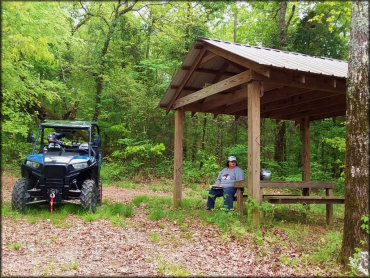
Photo Submitted 4/8/2020 (Thanks!)
Choctaw Trails Photo
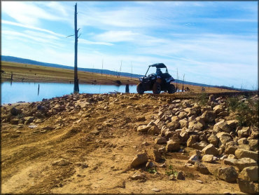
Photo Submitted 4/8/2020 (Thanks!)
Choctaw Trails Photo
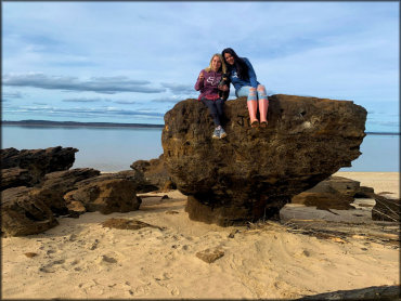
Photo Submitted 4/8/2020 (Thanks!)
Choctaw Trails Photo
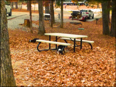
Photo Submitted 4/8/2020 (Thanks!)
Choctaw Trails Photo
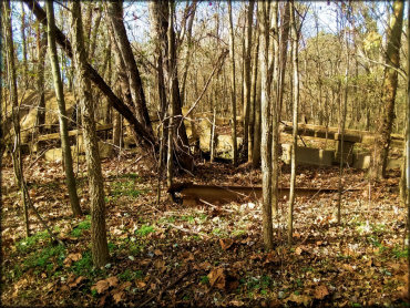
Photo Submitted 4/8/2020 (Thanks!)
Choctaw Trails Photo
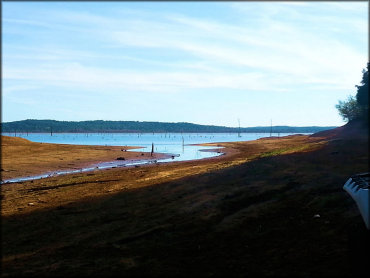
Photo Submitted 4/8/2020 (Thanks!)
Choctaw Trails Photo
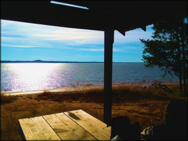
Photo Submitted 4/8/2020 (Thanks!)
Choctaw Trails Photo
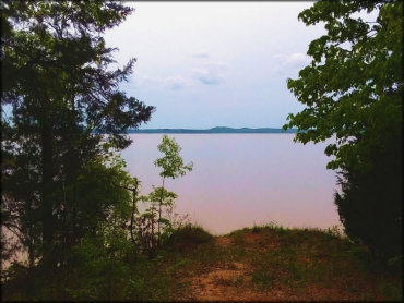
Photo Submitted 4/8/2020 (Thanks!)
Choctaw Trails Photo
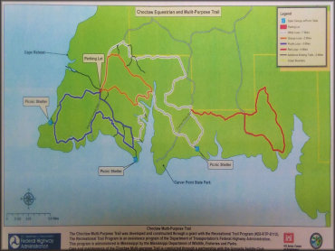
Photo Submitted 4/8/2020 (Thanks!)
RIDER COMMENTS & REVIEWS