 |
      |
| Home > Mississippi > Chickasaw |
Chickasaw ATV Trail
Tuesday, March 31, 2026
| Other Names | Tombigbee National Forest, Tombigbee Ranger District, Little Owl Creek |
| Last Known Status | Open |
Located in the Tombigbee National Forest, this 12 mile trail winds through a mixed pine and hardwood forest. The trail also loops around a couple lakes, providing some scenic views.
The trail is marked with blue blazes on the trees. The terrain is mostly smooth and hardpacked with light elevation climbs. Visitors should note that this trail is only open to machines that are 48 inches or less in width.
The staging area has a vault toilet, informational kiosk and a self service pay station (exact change only). Motorized use is permitted between April through the end of October but the area may also close on short notice due to poor weather conditions. Call before you haul.
REGULATIONS
| Permit Required | No | |
| Dates Open | April 1 - October 31 | |
| Other ATV Stickers Accepted | Unknown | |
| Spark Arrestor | Yes | A spark arresting exhaust silencer or end cap is required for all vehicles. |
| Noise Limit | Yes (96 dB) | |
| Whip Flags | Not Required | |
| Maximum Vehicle Width | Yes (48 inches) | has entrance gate or posts |
 Motorcycles & Dirt Bikes Motorcycles & Dirt Bikes | Permitted | |
 Four Wheelers Four Wheelers | Permitted | (maximum width 48 inches) |
 UTV & SXS UTV & SXS | Prohibited | |
 SUVs & Jeeps (registered) SUVs & Jeeps (registered) | Prohibited | |
| Dune Buggy & Sand Rail 4x4 (unregistered) | Prohibited | |
| 2 Stroke Engines | No Restriction | |
| MX Helmet Required | Yes | |
 Camping Camping | Prohibited | |
 Campfires Campfires | Prohibited | |
| Night Riding | No | |
| Trail Blazing | Prohibited | stay on trail |
| Rule Enforcement |
TERRAIN
| Approx Size | 432 acres (1 sq mi) | |
| Miles Of Trail | 12 | |
| Climate Type | Forest | |
| Elevation | 350 to 400 ft. | |
| Trail Maintenance | Marked, Not Rated, Lightly Maintained | |
| Loose Dirt |  Little Little | |
| Hard Pack |  Mostly Mostly | |
| Sand |  None None | |
| Mud | Little | |
| Dust | Little | |
| Rocks | None | |
| Trees |  All All | |
| Steep Hills | None | |
| Water Crossings |  Few Few | |
| Small Jumps | None | |
| Large Jumps | None | |
| Berms | Few | |
| Sand/Gravel Pits | None | |
| Single Track | None | |
| Roads | None | |
| Shade |  Many Many | |
| Hazards | Few | (hazards assumed marked but use caution) |
 Novice Novice | Mostly | |
 Amateur Amateur |  Some Some | |
 Expert Expert | None |
TYPE OF AREA
| Area | Motorized Trails |
| Land | National Forest |
GPS POINTS


KEY SERVICES
 Gasoline Gasoline | 1-5 Miles (W) | David's One-Stop (662) 568-7632 |
| Diesel | 1-5 Miles (W) | David's One-Stop (662) 568-7632 |
 Water Water | 5-20 Miles (NE) | Natchez Trace RV Park (662) 767-8609 |
 RV Hookup RV Hookup | 5-20 Miles (NE) | Natchez Trace RV Park (662) 767-8609 |
 RV Disposal RV Disposal | 5-20 Miles (NE) | Natchez Trace RV Park (662) 767-8609 |
| Campground | 1-5 Miles (W) | Lake Davis Campground (662) 285-3264 |
 Conv Store Conv Store | 1-5 Miles (W) | David's One-Stop (662) 568-7632 |
FEES & PASSES
| Parking | (None) |
| Entry | (None) |
| Riding | Yes ($10.00 per OHV) |
| Camping | (None) |
RATINGS
| Our Rating |  Good Good |
| Recommended Stay | Full Day |
| Comments | (Scroll Down For Rider Reviews & Comments) |
DRIVING DIRECTIONS
| Nearest City | New Houlka, MS | ||
| From: Tupelo, MS
1) Take the Natchez Trace Parkway south to the Davis Lake Recreation Area exit 2) Turn right (west) off the exit ramp onto Davis Lake Road, continue 1 mile 3) Look for trailhead entrance on the right (north). |


OFFICIAL CONTACTS
| Contact Info | Tombigbee National Forest - Tombigbee Ranger District 6052 MS Hwy 15 Ackerman, MS 39735 (622) 285-3264 mailroom_r8_mississippi@fs.fed.us www.fs.usda.gov |
Chickasaw Trail Photo
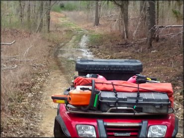
Photo Submitted 5/13/2015 (Thanks!)
Chickasaw Trail Photo
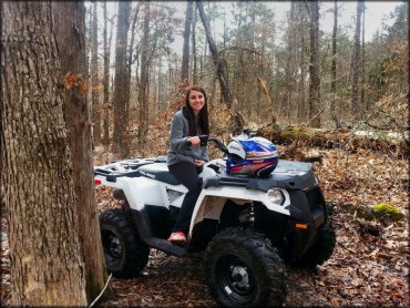
Photo Submitted 5/13/2015 (Thanks!)
Chickasaw Trail Photo
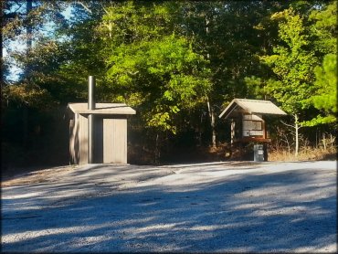
Photo Submitted 5/13/2015 (Thanks!)
Chickasaw Trail Photo
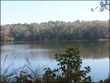
Photo Submitted 5/13/2015 (Thanks!)
Chickasaw Trail Photo
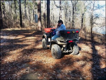
Photo Submitted 5/13/2015 (Thanks!)
Chickasaw Trail Photo
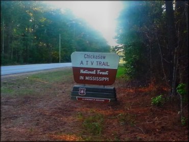
Photo Submitted 5/13/2015 (Thanks!)
RIDER COMMENTS & REVIEWS