 |
      |
| Home > Nevada > Shoshone OHV |
Shoshone OHV Trail System
Tuesday, March 31, 2026
| Other Names | Shoshone Range OHV Trail System, Red Rock Canyon, Red Rock Spring, Horse Mountain, Wilson Pass, Mill Creek Summit, Goat Canyon, Jacks Canyon, Smith Flat, The Outback, Lander County |
| Last Known Status | Open |
After years of planning, the BLM officially opened this trail system to the public in 2010. The main staging area has a vault toilet, a kiosk and direct access to designated beginner loops. The parking area is level and graveled but was a little overgrown due to lack of use.
Vegetation is sparse and is mostly sagebrush with the occasional juniper and pinion tree. There is no fee for camping or riding, making this a decent spot to boondock and ride for a couple days (just bring water and shade).
The main entrance road is hard packed with a couple steep but short climbs. The staging area (Red Rock) is located 3.5 miles past the cattle guard, and while there is room for long trailers, the main road has some turns that are narrow and twisty.
Cell phone and internet coverage is weak at Red Rock, but a turnoff/alt staging area is located about two miles in from the highway that has stronger connection through Verizon.
REGULATIONS
| Permit Required | Yes | NVOHV sticker required |
| Dates Open | Year-Round but use encouraged from July 1 through November 30. | |
| Other ATV Stickers Accepted | Yes | Nevada registration is not required if the vehicle is already registered in another state and will be located in Nevada for no more than 15 days. |
| Spark Arrestor | Yes | A spark arresting exhaust silencer or end cap is required for all vehicles. |
| Noise Limit | Yes (96 dB) | |
| Whip Flags | Not Required | |
| Maximum Vehicle Width | Yes (50 inches) | has entrance gate or posts |
 Motorcycles & Dirt Bikes Motorcycles & Dirt Bikes | Permitted | |
 ATVs ATVs | Permitted | (maximum width 50 inches) |
 UTV & SXS UTV & SXS | Permitted | (maximum width 50 inches) |
 SUVs & Jeeps (registered) SUVs & Jeeps (registered) | Prohibited | |
| Dune Buggy & Sand Rail 4x4 (unregistered) | Prohibited | |
| 2 Stroke Engines | No Restriction | |
 Camping Camping | No Restriction | (camp anywhere) |
 Campfires Campfires | Some Areas | small campfires permitted in non-combustible fire ring |
| Night Riding | Yes | headlights and taillights required for night riding |
| Trail Blazing | Prohibited | stay on trails |
| Rule Enforcement | None |
TERRAIN
| Approx Size | 9,500 acres (15 sq mi) | |
| Miles Of Trail | 60 | |
| Climate Type | Desert | |
| Elevation | 5000 to 8000 ft. | |
| Trail Maintenance | Marked, Rated, Lightly Maintained | |
| Loose Dirt |  None None | |
| Hard Pack |  Mostly Mostly | |
| Sand |  Some Some | |
| Mud | None | |
| Dust | Some | |
| Rocks | Some | |
| Trees | None | |
| Steep Hills |  Few Few | |
| Water Crossings | None | |
| Small Jumps | Few | |
| Large Jumps | None | |
| Berms | Some | |
| Sand/Gravel Pits | None | |
| Single Track | Few | |
| Roads | Some | |
| Intersections | Some | |
| Rider Traffic | None | |
| Shade | None | |
| Hazards | Few | (hazards not marked) |
 Novice Novice | Mostly | |
 Amateur Amateur | Some | |
 Expert Expert |  Little Little |
TYPE OF AREA
| Area | Motorized Trails |
| Land | BLM |


KEY SERVICES
 Gasoline Gasoline | 20-30 Miles (N) | Flying J Travel Plaza (775) 635-5424 |
| Diesel | 20-30 Miles (N) | Flying J Travel Plaza (775) 635-5424 |
 Water Water | 20-30 Miles (N) | Clark Park (775) 635-9600 or (775) 635-2280 |
 RV Hookup RV Hookup | 20-30 Miles (N) | Clark Park (775) 635-9600 or (775) 635-2280 |
 RV Disposal RV Disposal | 20-30 Miles (N) | Clark Park (775) 635-9600 or (775) 635-2280 |
| Campground | Battle Mountain, NV | Mill Creek Campground (775) 635-4000 |
 Conv Store Conv Store | 20-30 Miles (N) | Flying J Travel Plaza (775) 635-5424 |
FEES & PASSES
| Parking | (None) |
| Entry | (None) |
| Riding | (None) |
| Camping | (None) |
RATINGS
| Pros | free, remote, nice desert scenery |
| Cons | long entrance road, no water, weak cell and internet signal |
| Our Rating |  Fair Fair |
| Recommended Stay | Half Day |
| Comments | (Scroll Down For Rider Reviews & Comments) |
DRIVING DIRECTIONS
| Nearest City | Battle Mountain, NV | ||
| Address | Red Rock Road, Battle Mountain, NV 89820 | ||
| From: Battle Mountain, NV
1) Take SR-305 South about 25 miles 2) Turn left (east) on Red Rock Canyon Road (look for the only cottonwood tree on the left) 3) Proceed past cattle guard and continue on dirt/gravel road about 4 miles 4) Look for sign on the left for Shoshone OHV Area, turn here. **Note: The main entrance road is narrow and has a couple steep but short hill climbs - is possible to get a trailer in but 4WD recommended.** |


OFFICIAL CONTACTS
| Contact Info | BLM - Battle Mountain District Office 50 Bastian Road Battle Mountain, NV 89820 (775) 635-4000 bmfoweb@blm.gov www.blm.gov |
| Contact Info | Battle Mountain Chamber of Commerce 625 S. Broad Street Battle Mountain, NV 89820 (775) 635-8245 battlemtncommerce@gmail.com www.battlemountainchamber.com |
Shoshone OHV Trail Photo
This sign is located a few miles in off Red Rock Canyon Road. After this sign veer left at fork to enter the campground.
Shoshone OHV Trail Photo
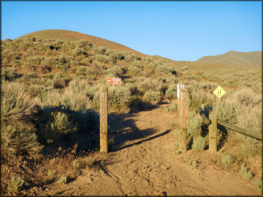
This is the entrance to the beginners area, which is a short but twisty loop designed for novice riders.
Shoshone OHV Trail Photo
This is the only cottonwood tree in the area which is located near the turnoff for Red Rock Canyon Road.
Shoshone OHV Trail Photo
The campground amenities include vault toilets that appear to be maintained regularly.
Shoshone OHV Trail Photo
The trail system is open year-round but the best time to visit is during the spring and fall months. Northern Nevada winters tend to be cold and windy.
Shoshone OHV Trail Photo
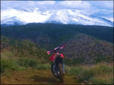
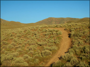
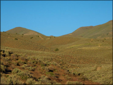
Some sections have gradual climbs up rolling hills.
Shoshone OHV Trail Photo
The ATV trails are surrounded by various sage and rabbit brush.
Shoshone OHV Trail Photo
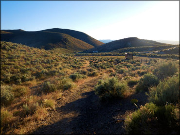
Another view of the campground taken from one of the trails. From here you can see the vault toilet and informational kiosk.
Shoshone OHV Trail Photo
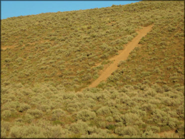
Most of the terrain consists of rolling hills covered with various sage and scrub brush. There are no trees in the campground so bring shade.
Shoshone OHV Trail Photo
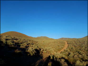
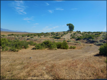
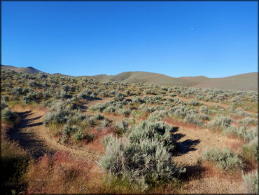
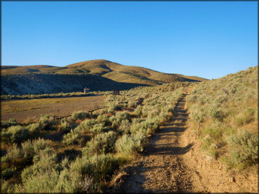
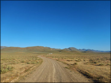
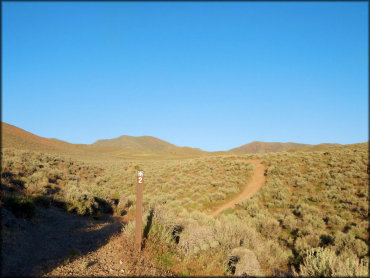
One of the trails leading from the campground. Most of the trails form long loops.
Shoshone OHV Trail Photo
Another view of the campground taken from the trail.
Shoshone OHV Trail Photo
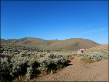
This is a view of the campground and staging area taken from a side trail. There is plenty of room to park but there is no shade or water, so bring supplies.
Shoshone OHV Trail Photo
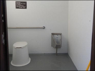
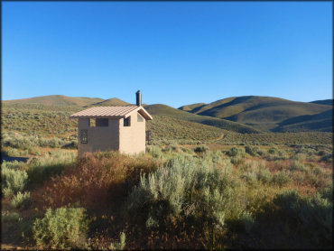
Photo of vault toilet at Shoshone OHV Campground.
Shoshone OHV Trail Photo
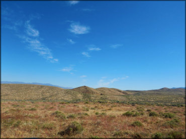
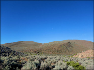
Most of the scenery looks like this.
Shoshone OHV Trail Photo
This is a view of the main entrance road about two miles in from the highway turnoff. The alternate staging area on the right has some internet coverage, but beyond this point expect little to no coverage.
Shoshone OHV Trail Photo
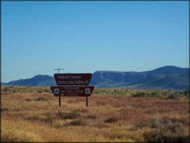
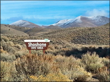
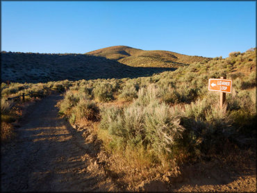
This is the signage for Shoshone OHV Trail System located on the west side of Hwy 305. From this turnoff it is 3.5 miles to the campground.
Shoshone OHV Trail Photo
The trails are limited to machines that are 50 inches or less in width.
Shoshone OHV Trail Photo
Most of the trails can be described as hard packed with some loose chunk rock.
Shoshone OHV Trail Photo
Another view of the beginners loop near the campground.
Shoshone OHV Trail Photo
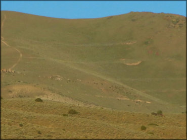
A view of the rolling hills.
Shoshone OHV Trail Photo
Some of the trails follow the ridgeline of the surrounding hills.
Shoshone OHV Trail Photo
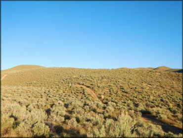
Since there are no trees to obstruct views, you can see clearly in all directions.
Shoshone OHV Trail Photo
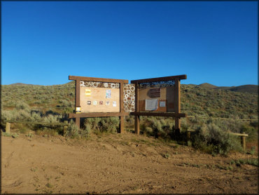
This is the informational kiosk which has some trail maps.
RIDER COMMENTS & REVIEWS