 |
      |
| Home > Nevada > Chief Mountain |
Chief Mountain OHV Area
Wednesday, September 17, 2025
| Other Names | White Pine County, Red Rhyolite Trail, Grey Dome Trail, Caliente, Silver State OHV Trail, Newman Canyon, Nelson Spring, Chief Mountain West, Chief Mountain South, Burnt Springs Range, Oak Springs Summit |
| Last Known Status | Open |
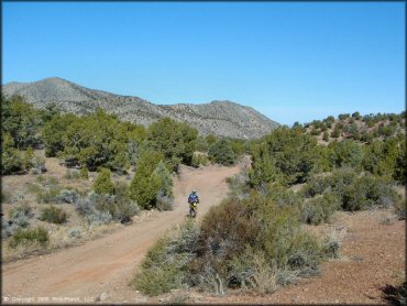
This area offers a large staging area, clean restrooms, picnic tables, fire rings, and an informative trailhead kiosk, and two main trail loops.
Loop R (left), is better for novices, and is wide and scenic, with a few deep sand washes, and rock formations. Loop G (right) is a very fun and challenging loop that starts out rocky, with a few sand washes, and eventually breaks into some great single-track.
Be sure to thank the Dunes And Trails ATV Club for these awesome trails.
REGULATIONS
| Permit Required | Yes | NVOHV sticker required |
| Dates Open | Year-Round | |
| Other ATV Stickers Accepted | Yes | Nevada registration is not required if the vehicle is already registered in another state and will be located in Nevada for no more than 15 days. |
| Spark Arrestor | Yes | A spark arresting exhaust silencer or end cap is required for all vehicles. |
| Noise Limit | Yes (96 dB) | |
| Whip Flags | Not Required | |
| Maximum Vehicle Width | No Restriction | |
 Motorcycles & Dirt Bikes Motorcycles & Dirt Bikes | Permitted | |
 ATVs ATVs | Permitted | a few of the trails are too narrow for quads |
 UTV & SXS UTV & SXS | Permitted | |
 SUVs & Jeeps (registered) SUVs & Jeeps (registered) | Permitted | |
| Dune Buggy & Sand Rail 4x4 (unregistered) | Permitted | |
| 2 Stroke Engines | No Restriction | |
 Camping Camping | Some Areas | (camp in developed sites only) |
 Campfires Campfires | Some Areas | (permitted in developed campsites only) |
| Night Riding | Unknown | Not Recommended |
| Trail Blazing | Prohibited | stay on the trail |
| Alcohol | No Restriction | |
| Rule Enforcement | Few/Periodic |
TERRAIN
| Approx Size | 104,960 acres (164 sq mi) | |
| Miles Of Trail | 50 | |
| Climate Type | Desert | |
| Elevation | 6000 to 6800 ft. | |
| Trail Maintenance | Marked, Rated, Lightly Maintained | |
| Loose Dirt |  Little Little | |
| Hard Pack |  Some Some | |
| Sand | Some | |
| Mud |  None None | |
| Dust | Little | |
| Rocks | Some | |
| Trees |  Many Many | |
| Steep Hills | Some | |
| Water Crossings | None | |
| Small Jumps | None | |
| Large Jumps | None | |
| Berms |  Few Few | |
| Sand/Gravel Pits | None | |
| Single Track | Some | |
| Roads |  Mostly Mostly | |
| Intersections | Some | |
| Rider Traffic | None | |
| Shade | Some | |
| Ranges/Gunfire | None | |
| Hazards | Some | (hazards not marked) deep ravines/washes |
 Novice Novice | Mostly | |
 Amateur Amateur | Some | |
 Expert Expert | Little | |
| Comment | G-loop is the best - starts off rocky, but gets better. | |
TYPE OF AREA
| Area | Motorized Trails |
| Land | BLM |
GPS POINTS


KEY SERVICES
 Gasoline Gasoline | 5-20 Miles (E) | Jerry's Sinclair (775) 726-3189 |
| Diesel | 5-20 Miles (E) | Jerry's Sinclair (775) 726-3189 |
 Water Water | 5-20 Miles (E) | Young's RV Park (775) 726-3418 |
 RV Hookup RV Hookup | 5-20 Miles (E) | Young's RV Park (775) 726-3418 |
 RV Disposal RV Disposal | 5-20 Miles (E) | Young's RV Park (775) 726-3418 |
| Campground | On Site | |
 Conv Store Conv Store | 5-20 Miles (E) | Jerry's Sinclair (775) 726-3189 |
FEES & PASSES
| Parking | (None) |
| Entry | (None) |
| Riding | (None) |
| Camping | (None) |
RATINGS
| Pros | good scenery, free, nice/clean facilities at staging area, good map at kiosk, some sections of great single track |
| Cons | some very tiresome rocky sections, trails a little hard to follow (loops are not clear enough) |
| Our Rating |  Good Good |
| Recommended Stay | Full Day spring/early summer |
| Comments | (Scroll Down For Rider Reviews & Comments) |
DRIVING DIRECTIONS
| Nearest City | Caliente, NV | ||
| From: Caliente, NV
For the Chief Mountain South Staging Area: 1) Take Hwy 93 approx. 9 miles west of Caliente 2) Turn right (north) on the dirt road at mile post 85 3) Follow dirt road to staging area, approx. 1/3 mile. For the Chief Mountain West Staging Area: 4) Continue west past the entrance for Chief Mountain South Staging Area about 8 miles 5) Turn right (north) onto Poleline Road, continue 3.2 miles 6) Look for Silver State Trail sign and turn right (east), continue .5 miles toward staging area. |


OFFICIAL CONTACTS
| Contact Info | BLM - Caliente Field Station US Hwy 93 P.O. Box 237 Caliente, NV 89008 (775) 726-8100 eyfoweb@blm.gov www.blm.gov |
| Contact Info | Dunes And Trails ATV Club dunesandtrailsatv@gmail.com dunesandtrailsutv.org |
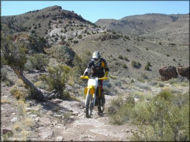
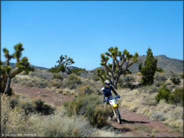
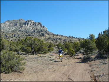
Chief Mountain Trail Photo
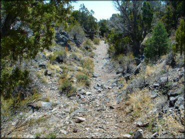
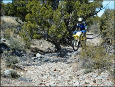
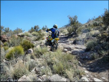
This is a section of the Grey Dome Trail. A little rocky but nothing too difficult.
Chief Mountain Trail Photo
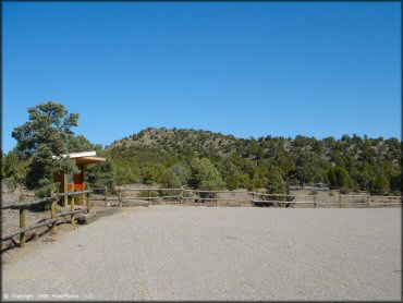
A kiosk can be found at the staging area.
Chief Mountain Trail Photo
Chief Mountain Trail Photo
Chief Mountain Trail Photo
Chief Mountain Trail Photo
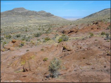
A view of the Red Rhyolite Trail.
Chief Mountain Trail Photo
Chief Mountain Trail Photo
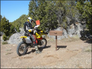
This guestbook can be found along the Red Rhyolite Trail (don't forget to sign it!).
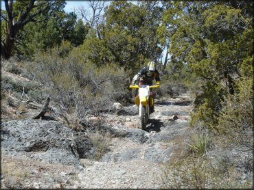
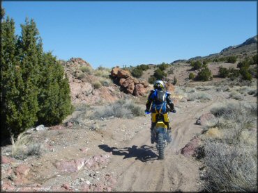
Chief Mountain Trail Photo
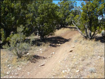
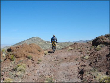
Another slightly rocky section.
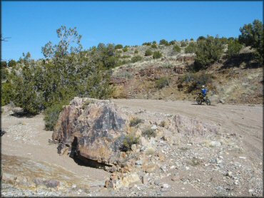
Chief Mountain Trail Photo
Chief Mountain Trail Photo
Chief Mountain Trail Photo
Chief Mountain Trail Photo
Chief Mountain Trail Photo
Chief Mountain Trail Photo
Chief Mountain Trail Photo
Chief Mountain Trail Photo
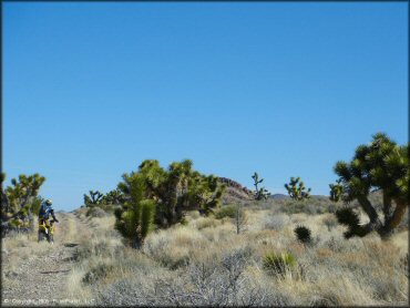
Chief Mountain Trail Photo
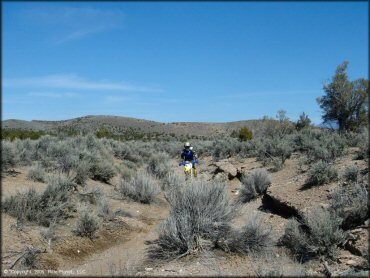
A section of the Red Rhyolite Trail that is surrounded by Joshua Trees and scrub brush. Most of the area has sparse vegetation but is still very scenic.
Chief Mountain Trail Photo
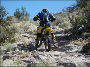
Some sections consists of fun sandy washes. The two-strokes handle this well.
Chief Mountain Trail Photo
Chief Mountain Trail Photo
Chief Mountain Trail Photo
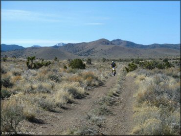
Chief Mountain Trail Photo
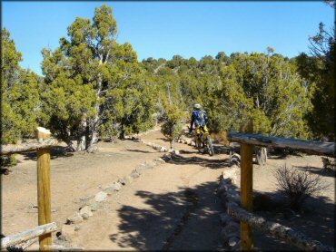
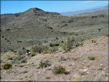
This trail starts at the Chief Mountain South Staging Area and connects to the rest of the trail system.
Chief Mountain Trail Photo
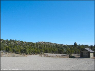
The Chief Mountain South Staging Area offers plenty of room for large trailers. The staging area is flat and has a vault toilet, several picnic tables, trash cans and a map kiosk. There is no fee to camp or ride but stays are limited to 14 days.
Chief Mountain Trail Photo
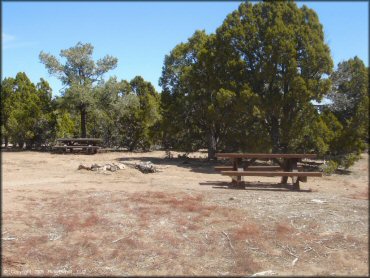
A couple of picnic tables at the Chief Mountain South Staging Area. The area is surrounded by various juniper trees and is well maintained.
Chief Mountain Trail Photo
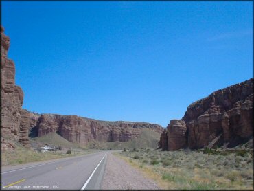
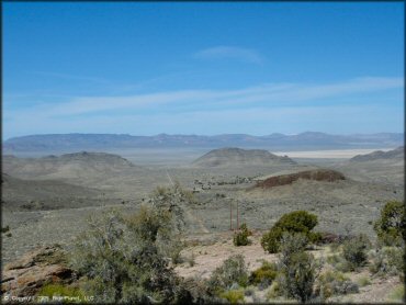
Some scenic canyons on the way into Caliente, Nevada.
RIDER COMMENTS & REVIEWS