 |
      |
| Home > Nevada > Jarbidge |
Jarbidge
Friday, August 22, 2025
| Other Names | Humboldt Toiyabe National Forest, Jarbridge |
| Last Known Status | Open |
Once a bustling gold mining town from 1909-1932 and home of last stagecoach robbery in 1916, Jarbidge provides visitors a rare glimpse into the Wild West. The town is surrounded by the Humboldt-Toiyabe National Forest and the Jarbidge Wilderness, providing scenery that is a cut above the typical desert scrub brush that is usually found throughout Nevada.
The trails are mostly hard packed and rocky 4x4 roads that wind through mixed pine and cottonwood trees, rugged mountains, streams and rivers. Most of the routes are open to motorized use except in the wilderness area (hiking or horseback riding only).
Big Cottonwood, Juniper Grove and The Forks campgrounds are located on the way in (if coming from the east via Rogerson, Idaho) and are ideal for RVs since the main road progressively gets narrower and twisty as you head up in elevation.
Restaurants, saloons, lodging, gas (debit or credit card only) and a general store is also available in town. Holiday weekends, especially Jarbidge Days (second weekend every August) are very popular.
REGULATIONS
| Permit Required | Yes | NVOHV sticker required |
| Dates Open | Year-Round | |
| Other ATV Stickers Accepted | Yes | Nevada registration is not required if the vehicle is already registered in another state and will be located in Nevada for no more than 15 days. |
| Spark Arrestor | Yes | A spark arresting exhaust silencer or end cap is required for all vehicles. |
| Noise Limit | Yes (96 dB) | |
| Whip Flags | Not Required | |
| Maximum Vehicle Width | No Restriction | |
 Motorcycles & Dirt Bikes Motorcycles & Dirt Bikes | Some Areas | Prohibited in Jarbidge Wilderness Area |
 ATVs ATVs | Some Areas | Prohibited in Jarbidge Wilderness Area |
 UTV & SXS UTV & SXS | Some Areas | Prohibited in Jarbidge Wilderness Area |
 SUVs & Jeeps (registered) SUVs & Jeeps (registered) | Some Areas | Prohibited in Jarbidge Wilderness Area |
| Dune Buggy & Sand Rail 4x4 (unregistered) | Some Areas | Prohibited in Jarbidge Wilderness Area |
| 2 Stroke Engines | Some Areas | Prohibited in Jarbidge Wilderness Area |
 Camping Camping | Some Areas | (camp in developed sites only) |
 Campfires Campfires | Some Areas | (permitted in developed campsites only) |
| Night Riding | Yes | Not Recommended |
| Trail Blazing | Prohibited | stay on trail |
| Rule Enforcement | Some | Dedicated Rangers/Officers Jeep/SUV Patrol |
TERRAIN
| Approx Size | 10,000 acres (16 sq mi) | |
| Miles Of Trail | 20 | |
| Climate Type | Forest | |
| Elevation | 5000 to 10000 ft. | |
| Trail Maintenance | Marked, Not Rated, Lightly Maintained | |
| Loose Dirt |  Little Little | |
| Hard Pack |  Mostly Mostly | |
| Sand |  None None | |
| Mud | None | |
| Dust |  Some Some | |
| Rocks | Some | |
| Trees |  All All | |
| Steep Hills |  Many Many | |
| Water Crossings |  Few Few | |
| Small Jumps | None | |
| Large Jumps | None | |
| Berms | None | |
| Sand/Gravel Pits | None | |
| Single Track | None | |
| Roads | Mostly | |
| Intersections | Few | |
| Rider Traffic | Some | |
| Shade | Many | |
| Hazards | Few | (hazards not marked) Beware of open mine shafts, cliffs. |
 Novice Novice | Some | |
 Amateur Amateur | Mostly | |
 Expert Expert | Little |
TYPE OF AREA
| Area | Motorized Trails |
| Land | BLM, National Forest |
GPS POINTS


KEY SERVICES
 Gasoline Gasoline | On Site | Outdoor Inn (775) 488-2311 (debit or credit card only) |
| Diesel | 30+ Miles (NE) | Rogerson Service Station (208) 655-4277 |
 Water Water | On Site | |
 RV Hookup RV Hookup | On Site | Outdoor Inn (775) 488-2311 (call for details) |
 RV Disposal RV Disposal | On Site | Outdoor Inn (775) 488-2311 (call for details) |
| Campground | On Site | |
 Conv Store Conv Store | On Site |
FEES & PASSES
| Parking | (None) |
| Entry | (None) |
| Riding | (None) |
| Camping | (None) |
| Comment | Camping is free at Forest Service and BLM campgrounds - stay limited to 14 days. |
RATINGS
| Pros | very scenic, remote, some decent primitive campsites |
| Cons | mostly 4x4 trails |
| Our Rating |  Very Good Very Good |
| Recommended Stay | 3-5 Days |
| Comments | (Scroll Down For Rider Reviews & Comments) |
DRIVING DIRECTIONS
| Nearest City | Jarbidge, NV | ||
| Address | Jarbidge, NV 89826 | ||
| From: Twin Falls, ID
1) Take Hwy 93 south about 28 miles 2) Turn right (west) onto 3 Creek Road, continue about 50 miles (road eventually turns to dirt) 3) The Forks Campground is on the left. Stage here or continue about 15 miles toward Jarbidge. From Elko, NV 1) Take NV-225 north about 55 miles 2) Turn right (east) onto Eco Road 746, continue about 20 miles 3) Turn left (north) onto Jarbidge-Charleston County Road, continue about 25 miles toward town of Jarbidge. **Note: Both routes may be inaccessible during winter months. Call before heading out. |


OFFICIAL CONTACTS
| Contact Info | Humboldt Toiyabe National Forest - Jarbidge Ranger District 140 Pacific Avenue Wells, NV 89835 (775) 752-3357 mailroom_r4_humboldt_toiyabe@fs.fed.us www.fs.usda.gov |
| Contact Info | BLM - Jarbidge Field Office 2878 Addison Avenue East Twin Falls, ID 83301 (208) 735-2060 blm_id_jarbidgeoffice@blm.gov www.blm.gov |
| Contact Info | Outdoor Inn Jarbidge, NV 89826 (775) 488-2311 jarbidgearts@rtci.net |
| Comment | Lodging and general information. |
Jarbidge Trail Photo
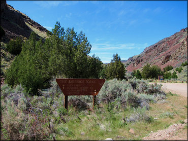
On the way to Jarbidge you will go past the river recreation site. A shore distance away is the Forks campground, which has a few shady but secluded sites overlooking the river.
Jarbidge Trail Photo
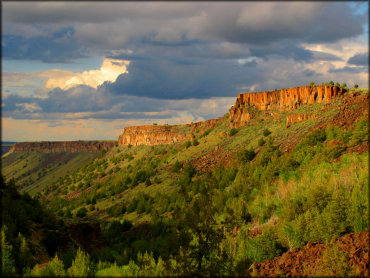
The scenery is unique to Nevada. Colorful mesas, hoodoos and rugged rock formations surrounded by various aspen, pine and sage brush makes this a must visit destination.
Jarbidge Trail Photo
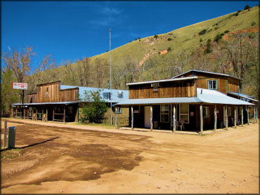
Jarbidge has a few motels, saloons and restaurants and is offroad friendly. During the winter months snowmobiles are welcomed.
Jarbidge Trail Photo
Juniper Grove is located between The Forks and Big Cottonwood campgrounds. This area also has a couple small but shady sites overlooking the East Fork Jarbidge River.
Jarbidge Trail Photo
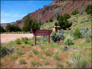
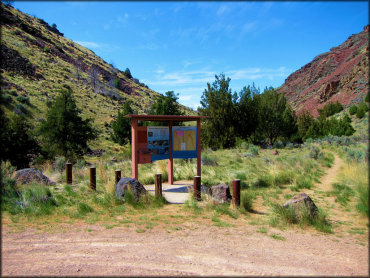
The Jarbidge River Recreation Site has an informational kiosk, dirt parking lot and vault toilet. Adjacent from the parking lot is the Forks Campground, which has a couple secluded but nicely maintained campsites.
Jarbidge Trail Photo
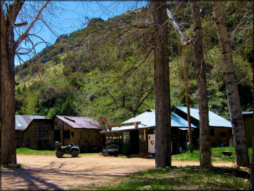
The Trading Post is a small general store stocked with some basic items, cold drinks and bagged ice. To the left is the Jarbidge Jail, where you can go in for a quick tour.
Jarbidge Trail Photo
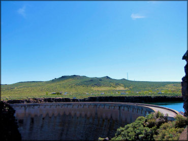
If coming from Hwy 93 you need to cross the Salmon Falls Dam. After crossing the dam there is still 55 miles to go until you reach Jarbidge. The campground in the background is Lud Drexler Park, which has 20 campsites, water spigots and dump station.
Jarbidge Trail Photo
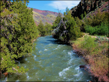
This view of the river was taken between the Jarbidge River Recreation Site and The Forks Campground.
Jarbidge Trail Photo
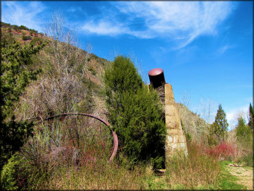
Remnants of old mining equipment can be found throughout the area.
Jarbidge Trail Photo
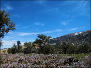
The views near the top of the forest service roads provide panoramic views of open meadows, snow capped hills and mountains and clear blue skies.
Jarbidge Trail Photo
According to an old Shoshone legend, a man-eating giant called Tsawhawbitts used to roam the canyons and caves looking for a victim to take away. Miners incorrectly heard the name as Jahabich, which over time turned into Jarbidge.
Jarbidge Trail Photo
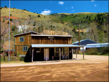
There are several motels to choose from that offer comfortable rooms in a rustic setting.
Jarbidge Trail Photo
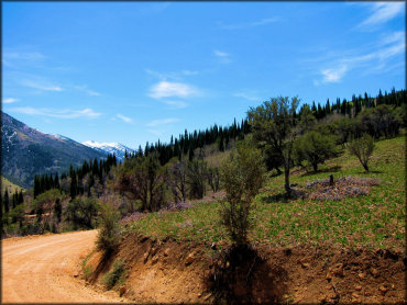
This forest service road gradually climbs in elevation. Expect to encounter some snow the higher you go.
Jarbidge Trail Photo
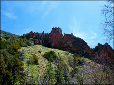
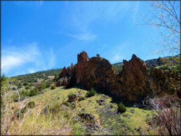
Colorful rugged boulders are common throughout the area. Bring the camera!
Jarbidge Trail Photo
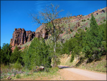
The main entrance road (Three Creek Road) is mostly smooth and hardpacked but becomes very twisty and narrow the closer you get to Jarbdige. Big RVs and long trailers are not advised.
Jarbidge Trail Photo
From this point Jarbidge is only 13 miles away.
Jarbidge Trail Photo
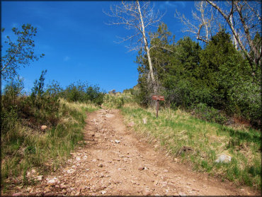
Most of the trails are old mining roads. ATVs and UTVs are permitted on designated routes.
Jarbidge Trail Photo
This is the boat launch ramps at the Jarbidge River Recreation Site.
Jarbidge Trail Photo
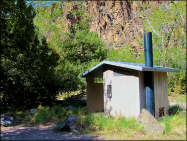
This vault toilet is located at the Juniper Grove campground. All of the campgrounds are regularly maintained.
Jarbidge Trail Photo
This is another campsite tucked away at the The Forks Campground, which is perfect for a popup trailer or tent. There is no fee charged to camp at The Forks, Big Cottonwood or Juniper Grove but stays are limited to 14 days.
Jarbidge Trail Photo
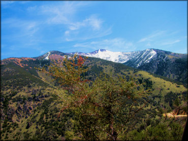
The mountains are often snow capped well into late spring.
Jarbidge Trail Photo
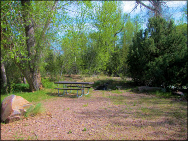
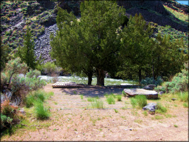
Big Cottonwood Campground has a couple small but shady sites that overlook the East Fork Jarbidge River.
Jarbidge Trail Photo
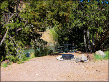
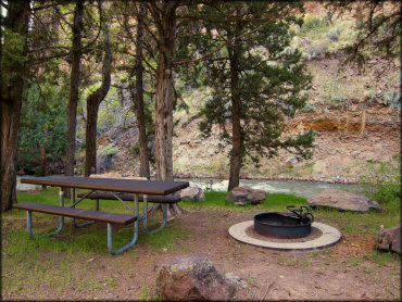
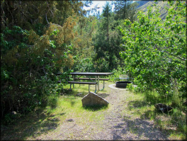
The Forks Campground has a couple secluded sites that overlook the East Fork Jarbidge River. Each site comes with a picnic table, fire ring and BBQ grill.
RIDER COMMENTS & REVIEWS