 |
      |
| Home > Oregon > Low Pass |
Low Pass
Saturday, May 10, 2025
| Other Names | Low Pass Landfill, Blachly Mountain Forest Wayside, Long Tom Station, Burp Hollow, Long Tom River |
| Last Known Status | Closed |
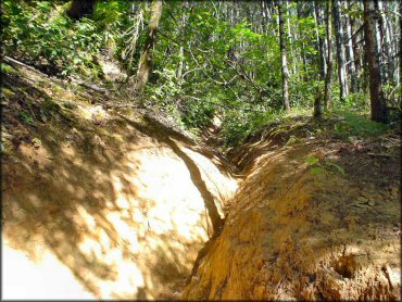
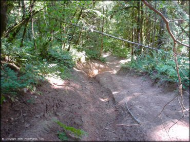
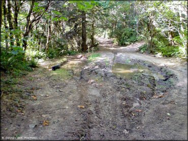
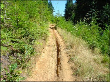
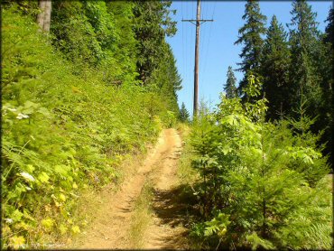
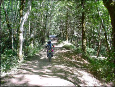
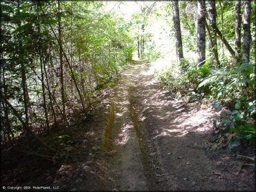
These trails consist of a landfill and the surrounding land, with some trails that go along Hwy 36, and back into the woods. These trails are not marked, and only lightly maintained, but they are fast, smooth and a lot of fun. There are a couple mud holes, and some rutted sections, and some steeper climbs, and a lot of quick up and down single track through the trees. The front gate is always closed, but it is only locked at night. The best place to stage, however, is in the parking lot outside the gate.
REGULATIONS
| Permit Required | Yes | Oregon ATV Permit stickers required |
| Dates Open | Closed | |
| Other ATV Stickers Accepted | Yes | An operating permit issued for another state will be honored, but only if the issuing state also honors Oregon operating permits. (As of October 1, 2021, Oregon no longer honors stickers from Washington.) (AZ, CA, ID, IN, MO, NV, PA, SC, UT, VT) |
| Spark Arrestor | Yes | A spark arresting exhaust silencer or end cap is required for all vehicles. |
| Noise Limit | Yes (99 dB) | Oregon ATV noise limits apply (all vehicles limit 99 dB) |
| Whip Flags | Not Required | |
| Maximum Vehicle Width | ||
 Motorcycles & Dirt Bikes Motorcycles & Dirt Bikes | Prohibited | |
 ATVs ATVs | Prohibited | many trails are very narrow, with deep ruts and sharp cuts |
 UTV & SXS UTV & SXS | Prohibited | |
 4x4 & Jeeps (registered) 4x4 & Jeeps (registered) | Prohibited | |
| Dune Buggy & Sand Rail 4x4 (unregistered) | Prohibited | Oregon ATV Permit stickers required |
| 2 Stroke Engines | Prohibited | |
| MX Helmet Required | Youth Only | required for persons under 18 by state law (RiderPlanet strongly recommends helmets for all riders.) |
 Camping Camping | Prohibited | |
 Campfires Campfires | Prohibited | |
| Night Riding | No | |
| Trail Blazing | Prohibited | keep vehicle on trail |
| Alcohol | No Restriction | |
| Rule Enforcement | Some | On-Site Office/Station |
TERRAIN
| Approx Size | 16,000 acres (25 sq mi) | |
| Miles Of Trail | 30 | |
| Climate Type | Forest | |
| Elevation | 650 to 1700 ft. | |
| Trail Maintenance | Not Marked, Not Rated, Not Maintained | |
| Loose Dirt |  Some Some | |
| Hard Pack | Some | |
| Sand |  None None | |
| Mud | Some | |
| Dust |  Little Little | |
| Rocks | Little | |
| Trees |  All All | |
| Steep Hills |  Many Many | |
| Water Crossings |  Few Few | |
| Small Jumps | Few | |
| Large Jumps | None | |
| Berms | Many | |
| Sand/Gravel Pits | None | |
| Single Track | Many | |
| Roads | Some | |
| Intersections | Many | |
| Rider Traffic | None | |
| Shade | All | |
| Ranges/Gunfire | None | |
| Hazards | Some | (hazards not marked) Beware of cliffs. steep banks & trails, trails not marked |
 Novice Novice | Little | |
 Amateur Amateur |  Mostly Mostly | |
 Expert Expert | Little | |
| Comment | deep ruts | |
TYPE OF AREA
| Area | Motorized Trails |
| Land | Private, County Land, Landfill |


KEY SERVICES
 Gasoline Gasoline | Eugene, OR | |
| Diesel | Eugene, OR | |
 Water Water | Eugene, OR | |
 RV Hookup RV Hookup | Eugene, OR | Triangle Lake (west) |
 RV Disposal RV Disposal | Eugene, OR | |
| Campground | Eugene, OR | (west) |
 Conv Store Conv Store | Eugene, OR |
FEES & PASSES
| Parking | (None) |
| Entry | (None) |
| Riding | (None) |
| Camping | (None) |
RATINGS
| Pros | secluded, low traffic, fun trails for motorcycles, very few rocks, lots of shade |
| Cons | deep ruts, trails are not maintained or marked, gate only open during specific hours, staging area right next to highway |
| Our Rating |  Very Good Very Good |
| Recommended Stay | Full Day Summer |
| Comments | (Scroll Down For Rider Reviews & Comments) |
DRIVING DIRECTIONS
| Nearest City | Eugene, OR | ||
| From: Eugene, OR
1) Take Hwy 99 N from Eugene, turn west on State Hwy 36 2) Drive 18 miles to the town of Low Pass 3) Staging area is a flat gravel parking lot on the north side (right) of the road about 1/2 mile past the gas station in Low Pass 4) There is an additional access road with gate which leads into the area, but gate is locked overnight. |

OFFICIAL CONTACTS
| Contact Info | BLM - Eugene District P.O. Box 10226 Eugene, OR 97440 (541) 683-6600 or_eugene_mail@blm.gov www.blm.gov |
| Contact Info | Emerald Trail Riders Association, Inc. P.O. Box 41617 Eugene, OR 97404 jared@etra.net |
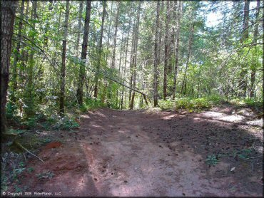
Low Pass Trail Photo
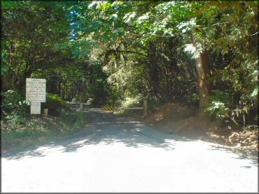
Trails can be accessed from either the left or right side of the fence.
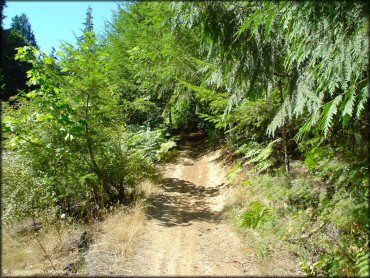
Low Pass Trail Photo
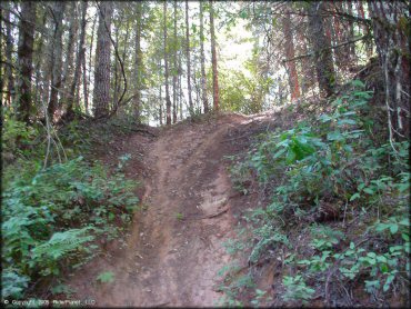
Low Pass Trail Photo
Low Pass Trail Photo
Low Pass Trail Photo
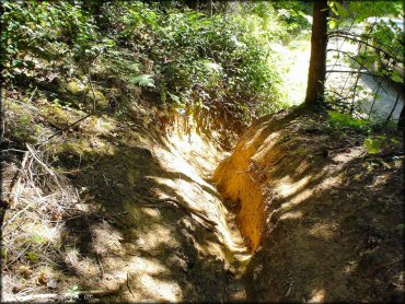
Low Pass Trail Photo
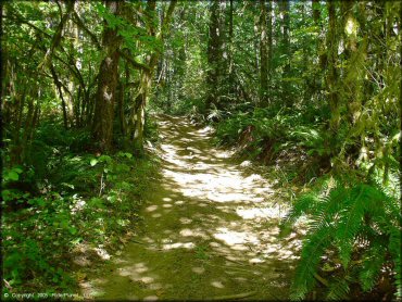
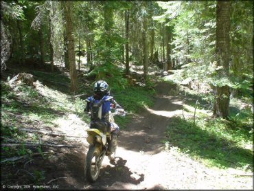
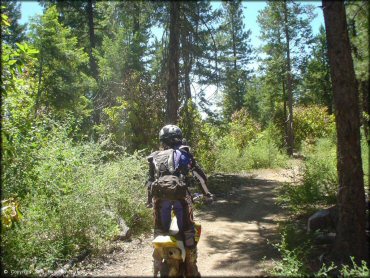
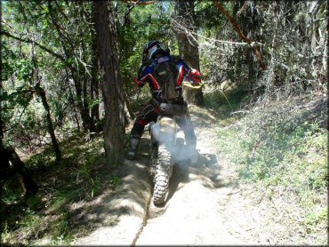
Fun, tight and windy single track is what you will find here.
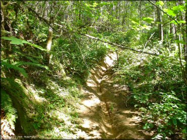
Low Pass Trail Photo
Fun, tight and windy single track is what you will find here.
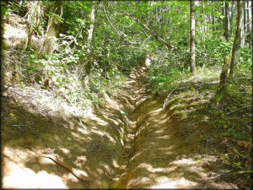
Low Pass Trail Photo
Low Pass Trail Photo
Low Pass Trail Photo
Low Pass Trail Photo
Low Pass Trail Photo
Low Pass Trail Photo
Low Pass Trail Photo
Low Pass Trail Photo
Low Pass Trail Photo
Low Pass Trail Photo
Low Pass Trail Photo
RIDER COMMENTS & REVIEWS