 |
      |
| Home > Oregon > Upper Nestucca |
Upper Nestucca Motorcycle Trail System
Wednesday, October 1, 2025
| Other Names | Upper Nestucca OHV Area, Upper Nestucca Motorcycle Trail, Elk Flat, Grassy Flat, Whip Up Flat, Camp Cooper, Upper Nestucca Trail System, Sheriden Peak, Bald Mountain Road, Bible Creek Road, Niagara Falls, Nestucca River, Mcguire Reservoir |
| Last Known Status | Open |
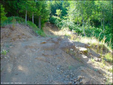
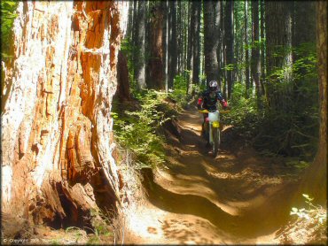
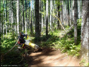
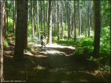
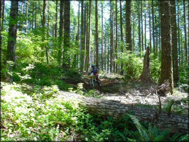
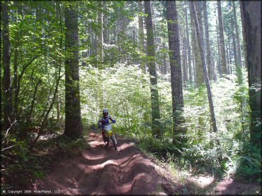
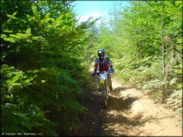
Upper Nestucca features about 25 miles of tight and twisty forest trails with a wide range of difficulty, from smooth and flat, to steep and crusty. Many of the trails are marked, rated and narrow, making the area perfect for dirt bikes. The area has four staging areas, and maps are available in a tube on the sign posts. OHVs are permitted on the connecting roadway (Bald Mountain Road) and you can ride from one staging area to another.
The area is not very crowded but there are no developed campsites within the OHV area, so no fires are permitted during burn season. The developed campgrounds (Alder Glen, Dovre, Fan Creek and Elk Bend) are 5-10 miles away to the north and offer picnic tables, fire rings, vault toilets and potable water but don't allow OHV direct trail access.
The trails are open year-round but may close temporarily during fire season, which is usually around late summer. The pictures speak for themselves on this one. Simply put, this is a great place to ride for all skill levels. Be sure to say thanks to the Applegate Roughriders for maintaining this trail system.
REGULATIONS
| Permit Required | Yes | Oregon ATV Permit stickers required |
| Dates Open | Year-Round except during fire season. | |
| Other ATV Stickers Accepted | Yes | An operating permit issued for another state will be honored, but only if the issuing state also honors Oregon operating permits. (As of October 1, 2021, Oregon no longer honors stickers from Washington.) (AZ, CA, ID, IN, MO, NV, PA, SC, UT, VT) |
| Spark Arrestor | Yes | A spark arresting exhaust silencer or end cap is required for all vehicles. |
| Noise Limit | Yes (99 dB) | Oregon ATV noise limits apply (all vehicles limit 99 dB) |
| Whip Flags | Not Required | |
| Maximum Vehicle Width | Yes (50 inches) | narrow terrain |
 Motorcycles & Dirt Bikes Motorcycles & Dirt Bikes | Permitted | |
 ATVs ATVs | Some Areas | (maximum width 50 inches) |
 UTV & SXS UTV & SXS | Prohibited | |
 4x4 & Jeeps (registered) 4x4 & Jeeps (registered) | Prohibited | |
| Dune Buggy & Sand Rail 4x4 (unregistered) | Prohibited | Oregon ATV Permit stickers required |
| 2 Stroke Engines | No Restriction | |
| MX Helmet Required | Youth Only | required for persons under 18 by state law (RiderPlanet strongly recommends helmets for all riders.) |
 Camping Camping | Some Areas | (camp in developed sites only) |
 Campfires Campfires | Some Areas | (permitted in developed campsites only) during fire season Aug 1 - Oct |
| Night Riding | Some Areas | 4/1-9/15 permitted 2 hrs after sunrise to 2 hrs before sunset |
| Trail Blazing | Prohibited | stay on designated trails |
| Alcohol | No Restriction | |
| Rule Enforcement | Few/Periodic | Dedicated Rangers/Officers Jeep/SUV Patrol |
| Comment | OHVs permitted on paved Bald Mountain Road. OHVs are prohibited at Camp Cooper. | |
TERRAIN
| Approx Size | 9,579 acres (15 sq mi) | |
| Miles Of Trail | 25 | |
| Climate Type | Forest | |
| Elevation | 2000 to 2900 ft. | |
| Trail Maintenance | Marked, Rated, Heavily Maintained | trails are well marked with signs at each end of the trail |
| Loose Dirt |  Some Some | |
| Hard Pack | Some | |
| Sand |  None None | |
| Mud |  Little Little | |
| Dust |  Mostly Mostly | |
| Rocks | Little | |
| Trees |  All All | |
| Steep Hills | Some | |
| Water Crossings |  Few Few | |
| Small Jumps | Few | |
| Large Jumps | None | |
| Berms | Some | |
| Sand/Gravel Pits | Few | |
| Single Track | Some | |
| Roads | Some | |
| Intersections |  Many Many | |
| Rider Traffic | Some | |
| Shade | All | |
| Ranges/Gunfire | Few | |
| Hazards | Some | (hazards are marked) |
 Novice Novice | Some | |
 Amateur Amateur | Mostly | |
 Expert Expert | Little | |
| Comment | some steep trails, watch out for rider traffic on street roads and road crossings | |
TYPE OF AREA
| Area | Motorized Trails |
| Land | BLM |
GPS POINTS


KEY SERVICES
 Gasoline Gasoline | 5-20 Miles (NW) | Shell (503) 398-2828 |
| Diesel | 5-20 Miles (NW) | Shell (503) 398-2828 |
 Water Water | 5-20 Miles (S) | Wandering Spirit RV Park (503) 879-5700 |
 RV Hookup RV Hookup | 5-20 Miles (S) | Wandering Spirit RV Park (503) 879-5700 |
 RV Disposal RV Disposal | 5-20 Miles (S) | Wandering Spirit RV Park (503) 879-5700 |
| Campground | On Site | |
 Conv Store Conv Store | 5-20 Miles (NW) | Shell (503) 398-2828 |
FEES & PASSES
| Parking | (None) |
| Entry | (None) |
| Riding | (None) |
| Camping | (None) |
RATINGS
| Pros | tight twisted trails, wide range of difficulty, not crowded, OHV's permitted on road way |
| Cons | no developed campsites in OHV area, developed sites are 5-10 miles away that don't allow OHV's (don't have direct trail access) |
| Our Rating |  Excellent Excellent |
| Recommended Stay | 1-2 Days Spring |
| Comments | (Scroll Down For Rider Reviews & Comments) |
DRIVING DIRECTIONS
| Nearest City | Willamina, OR | ||
| Address | Bald Mountain Road, Willamina, OR 97396 | ||
| From: Tillamook, OR
For Whip Up Flat Staging Area: 1) Take 101 South about 20 miles to Hwy 22 2) Take Hwy 22 south about 25 miles toward Willamina 3) Take exit for Willamina/Sheridan 4) Merge onto Yamhill River Road, continue 2.25 miles 5) Turn left (north-west) onto Willamina Creek Road, continue 6 miles 6) Turn left onto Coast Creek Road, continue 1.3 miles 7) Turn right onto Gilbert Creek Road, continue 3 miles 8) Turn right (north) onto Bald Mountain Road, continue .75 miles 9) Whip Up Flat Staging Area is on the right (east). For Eastline Quarry Staging Area: 10) Continue north on Bald Mountain Road past Whip Up Flat about 4 miles 11) Staging area will be on the right (east). For Elk Flat Staging Area: 12) Continue north on Bald Mountain Road past Eastline Quarry 2.5 miles 13) Staging area is on the right (east). For Grassy Flat Staging Area: 14) Continue north on Bald Mountain Road past Elk Flat 5.3 miles 15) Staging area is on the left (west). |


OFFICIAL CONTACTS
| Contact Info | BLM - Salem Field Office 1717 Fabry Road SE Salem, OR 97306 (503) 375-5646 (503) 815-1134 blm_or_no_mail@blm.gov www.blm.gov |
| Contact Info | Applegate Rough Riders Motorcycle Club P.O. Box 13674 Salem, OR 97309 (503) 835-1093 info@arrmc.com |
| Contact Info | Oregon ATV Safety Education Card (877) 772-3359 atv.info@state.or.us www.oregon.gov |
| Contact Info | Oregon State Parks Online Store 725 Summer Street NE, Suite C Salem, OR 97301 (800) 551-6949 park.info@oregon.gov store.oregonstateparks.org |
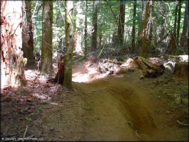
Upper Nestucca Trail Photo
Upper Nestucca Trail Photo
Upper Nestucca Trail Photo
Upper Nestucca Trail Photo
Upper Nestucca Trail Photo
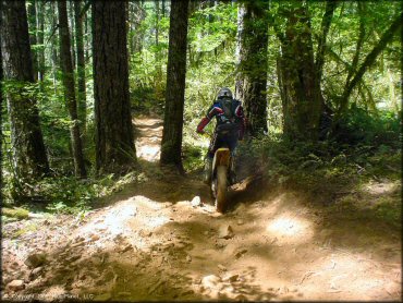
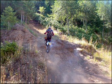
Most of the trails are smooth and fast.
Upper Nestucca Trail Photo
Upper Nestucca Trail Photo
Upper Nestucca Trail Photo
Upper Nestucca Trail Photo
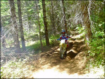
Upper Nestucca Trail Photo
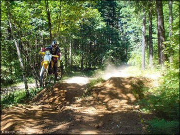
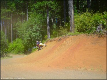
Catching a little air!
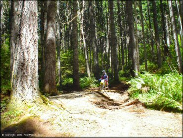
Upper Nestucca Trail Photo
Upper Nestucca Trail Photo
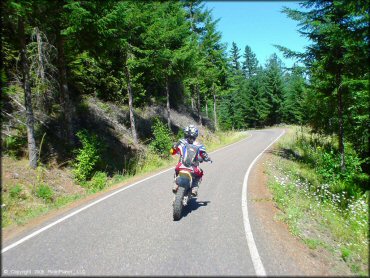
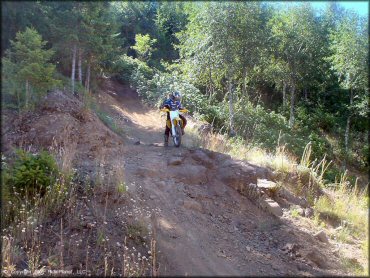
Yes, it is legal to ride on the paved road (Bald Mountain Rd.).
Upper Nestucca Trail Photo
Upper Nestucca Trail Photo
Upper Nestucca Trail Photo
Upper Nestucca Trail Photo
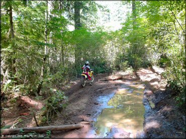
There can be large mud puddles however most are avoidable.
Upper Nestucca Trail Photo
Upper Nestucca Trail Photo
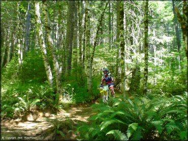
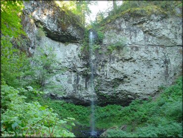
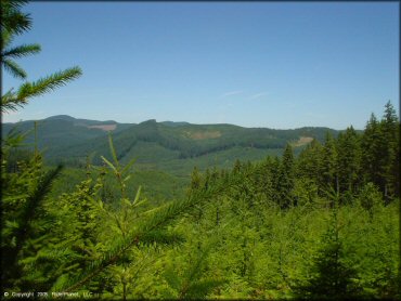
The lush vegetation gives this place a tropical feel.
Upper Nestucca Trail Photo
Upper Nestucca Trail Photo
Upper Nestucca Trail Photo
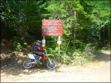
Grassy Flat staging area.
RIDER COMMENTS & REVIEWS