 |
      |
| Home > Oregon > Prairie Peak |
Prairie Peak
Saturday, May 10, 2025
| Other Names | Prairie City, Prairie Mountain, Horton Road, Hult Reservoir, High Pass, Villiage Creek Spring, Hult Log Storage Reservoir |
| Last Known Status | Open |
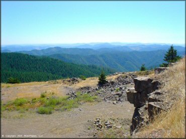
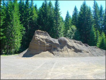
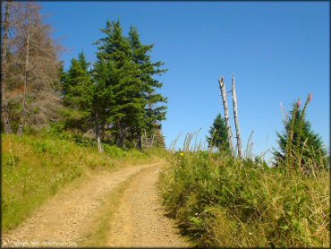
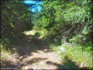
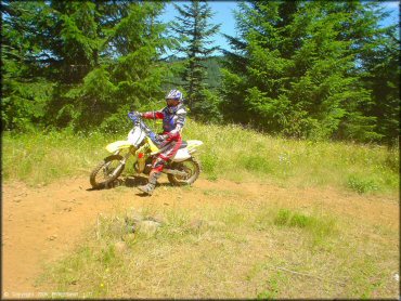
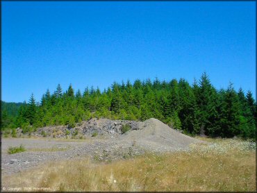
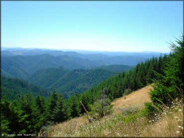
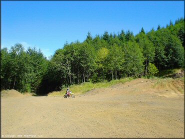
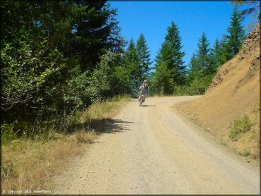
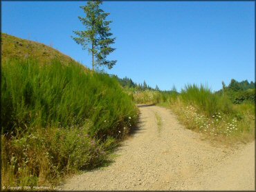
This system of jeep trails and dirt roads that wind their way up to a broadcast tower at the peak make for some easy riding and great scenic views. There are very few actual OHV trails in this area and the roads are not well marked. Hult reservoir, which sits at the base of the mountain, offers primitive camping and day use areas at the water's edge. Hand drawn maps and snacks are available at the very friendly Horton Corner Market.
REGULATIONS
| Permit Required | Yes | Oregon ATV Permit stickers required |
| Dates Open | Year-Round | |
| Other ATV Stickers Accepted | Yes | An operating permit issued for another state will be honored, but only if the issuing state also honors Oregon operating permits. (As of October 1, 2021, Oregon no longer honors stickers from Washington.) (AZ, CA, ID, IN, MO, NV, PA, SC, UT, VT) |
| Spark Arrestor | Yes | A spark arresting exhaust silencer or end cap is required for all vehicles. |
| Noise Limit | Yes (99 dB) | Oregon ATV noise limits apply (all vehicles limit 99 dB) |
| Whip Flags | Not Required | |
| Maximum Vehicle Width | No Restriction | |
 Motorcycles & Dirt Bikes Motorcycles & Dirt Bikes | Permitted | |
 ATVs ATVs | Permitted | |
 UTV & SXS UTV & SXS | Permitted | |
 4x4 & Jeeps (registered) 4x4 & Jeeps (registered) | Permitted | |
| Dune Buggy & Sand Rail 4x4 (unregistered) | Some Areas | Oregon ATV Permit stickers required |
| 2 Stroke Engines | No Restriction | |
| MX Helmet Required | Youth Only | required for persons under 18 by state law (RiderPlanet strongly recommends helmets for all riders.) |
 Camping Camping | No Restriction | (camp anywhere) |
 Campfires Campfires | No Restriction | |
| Night Riding | Yes | Not Recommended |
| Trail Blazing | Prohibited | stay on trails |
| Alcohol | No Restriction | |
| Rule Enforcement | Few/Periodic | Jeep/SUV Patrol |
Advertisement
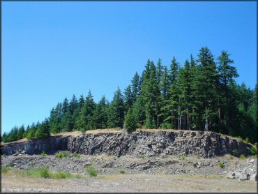
TERRAIN
| Approx Size | 22,400 acres (35 sq mi) | |
| Miles Of Trail | 10 | |
| Climate Type | Forest | |
| Elevation | 750 to 3400 ft. | |
| Trail Maintenance | Not Marked, Not Rated, Not Maintained | |
| Loose Dirt |  Little Little | |
| Hard Pack |  Mostly Mostly | |
| Sand |  None None | |
| Mud | None | |
| Dust |  Some Some | |
| Rocks | Some | |
| Trees |  All All | |
| Steep Hills |  Many Many | |
| Water Crossings | None | |
| Small Jumps |  Few Few | |
| Large Jumps | Few | |
| Berms | None | |
| Sand/Gravel Pits | Some | |
| Single Track | None | |
| Roads | All | |
| Intersections | Few | |
| Rider Traffic | None | |
| Shade | Many | |
| Ranges/Gunfire | Many | |
| Hazards | Some | (hazards not marked) Beware of cliffs. trails not marked |
 Novice Novice | Mostly | |
 Amateur Amateur | Little | |
 Expert Expert | None |
TYPE OF AREA
| Area | Motorized Trails |
| Land | BLM |


KEY SERVICES
 Gasoline Gasoline | 20-30 Miles (SE) | Alvadore Gas & Super Mart (541) 689-3551 |
| Diesel | 20-30 Miles (SE) | Alvadore Gas & Super Mart (541) 689-3551 |
 Water Water | 5-20 Miles (SW) | Triangle Lake Park (541) 927-6189 |
 RV Hookup RV Hookup | 5-20 Miles (SW) | Triangle Lake Park (541) 927-6189 |
 RV Disposal RV Disposal | 30+ Miles (SE) | Fern Ridge Shore RV Park (541) 935-2335 |
| Campground | 5-20 Miles (SW) | Triangle Lake Park (541) 927-6189 |
 Conv Store Conv Store | 1-5 Miles (SE) | Horton Market (541) 925-3290 |
FEES & PASSES
| Parking | (None) |
| Entry | (None) |
| Riding | (None) |
| Camping | (None) |
RATINGS
| Pros | secluded, low rider traffic, good scenery & mountain views |
| Cons | no real trails, all paved roads |
| Our Rating |  Fair Fair |
| Recommended Stay | Half Day |
| Comments | (Scroll Down For Rider Reviews & Comments) |
DRIVING DIRECTIONS
| Nearest City | Triangle Lake, OR | ||
| From: Florence, OR
1) Take 126 E to 36 E past Triangle Lake (about 30 miles) 2) Turn left on Horton Road after mile post #31 3) Go 3.6 miles 4) Veer right in front of Horton Market, pavement ends 100 yards 5) Go 2.2 miles (go past reservoir) 6) Veer left (take highroad the leftest of the three) 7) Go 3.5 miles 8) Stay to the right at fork 9) Continue 2.1 miles 10) Veer left, take upper road 11) Staging area on left. |


OFFICIAL CONTACTS
| Contact Info | BLM - Eugene Field Office 2890 Chad Drive P.O. Box 10226 Eugene, OR 97440 (541) 683-6600 www.blm.gov |
| Contact Info | Oregon State Parks Online Store 725 Summer Street NE, Suite C Salem, OR 97301 (800) 551-6949 park.info@oregon.gov store.oregonstateparks.org |
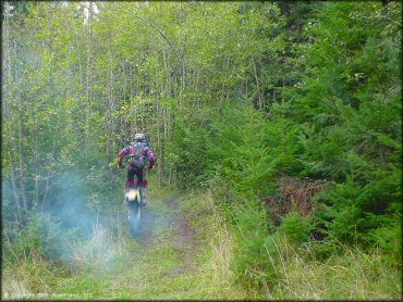
Prairie Peak Trail Photo
Prairie Peak Trail Photo
Prairie Peak Trail Photo
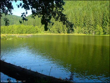
Hult Reservoir.
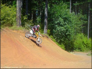
Prairie Peak Trail Photo
Prairie Peak Trail Photo
Prairie Peak Trail Photo
Prairie Peak Trail Photo
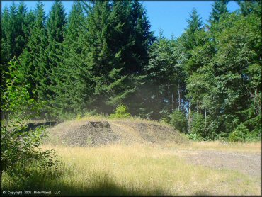
Prairie Peak Trail Photo
Prairie Peak Trail Photo
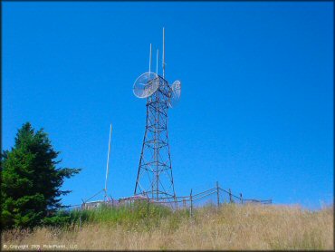
Broadcast tower.
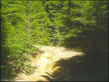
Prairie Peak Trail Photo
Prairie Peak Trail Photo
Prairie Peak Trail Photo
Advertisement
Prairie Peak Trail Photo
Prairie Peak Trail Photo
Prairie Peak Trail Photo
Main staging area.
Prairie Peak Trail Photo
Prairie Peak Trail Photo
Prairie Peak Trail Photo
RIDER COMMENTS & REVIEWS