 |
      |
| Home > Oregon > Crane Mountain |
Crane Mountain OHV
Sunday, June 14, 2026
| Other Names | Crane Mountain National Recreation Trail, Crane Mountain Trailhead, Crane Mountain Trail, Fremont National Forest, Lakeview, Gooselake, Crane Mountain Nrt #161, Crane Mountain National Recreation Trail #161 |
| Last Known Status | Open |
Fire roads and logging trails make up most of this area. There are not as many trails as you might expect, because many are dead ends or are blocked by snow well into the summer. If you wait until late summer this place offers some short sections of expert level single track, mountain top views of Goose Lake, remote camping, cool temps, no crowds and some wildlife (including some ferocious insects!). The peak is a popular hang gliding spot and the nearby town of Lakeview is tourist friendly.
REGULATIONS
| Permit Required | Yes | Oregon ATV Permit stickers required |
| Dates Open | June 15 - September 15 | |
| Other ATV Stickers Accepted | Yes | An operating permit issued for another state will be honored, but only if the issuing state also honors Oregon operating permits. (As of October 1, 2021, Oregon no longer honors stickers from Washington.) (AZ, CA, ID, IN, MO, NV, PA, SC, UT, VT) |
| Spark Arrestor | Yes | A spark arresting exhaust silencer or end cap is required for all vehicles. |
| Noise Limit | Yes (99 dB) | Oregon ATV noise limits apply (all vehicles limit 99 dB) |
| Whip Flags | Not Required | |
| Maximum Vehicle Width | Yes (50 inches) | narrow terrain |
 Motorcycles & Dirt Bikes Motorcycles & Dirt Bikes | Permitted | |
 ATVs ATVs | Permitted | (maximum width 50 inches) |
 UTV & SXS UTV & SXS | Permitted | Not Recommended (maximum width 50 inches) |
 4x4 & Jeeps (registered) 4x4 & Jeeps (registered) | Some Areas | Not Recommended permitted on designated forest service roads |
| Dune Buggy & Sand Rail 4x4 (unregistered) | Some Areas | Oregon ATV Permit stickers required (maximum width 50 inches) permitted on designated forest service roads |
| 2 Stroke Engines | No Restriction | |
| MX Helmet Required | Youth Only | required for persons under 18 by state law (RiderPlanet strongly recommends helmets for all riders.) |
 Camping Camping | No Restriction | (camp anywhere) |
 Campfires Campfires | No Restriction | burn season permitting |
| Night Riding | Unknown | |
| Trail Blazing | Prohibited | keep vehicle on trail |
| Alcohol | No Restriction | |
| Rule Enforcement | None |
TERRAIN
| Approx Size | 96,000 acres (150 sq mi) | |
| Miles Of Trail | 15 | |
| Climate Type | Forest | |
| Elevation | 5000 to 8400 ft. | |
| Trail Maintenance | Not Marked, Not Rated, Not Maintained | |
| Loose Dirt |  Some Some | |
| Hard Pack | Some | |
| Sand |  None None | |
| Mud | Some | |
| Dust | Some | |
| Rocks | Some | |
| Trees |  All All | |
| Steep Hills |  Few Few | |
| Water Crossings | None | |
| Small Jumps | None | |
| Large Jumps | None | |
| Berms | None | |
| Sand/Gravel Pits | None | |
| Single Track | Few | |
| Roads | Few | |
| Intersections | Few | |
| Rider Traffic | None | |
| Shade | All | |
| Ranges/Gunfire | Few | |
| Hazards | Few | (hazards not marked) |
 Novice Novice |  Mostly Mostly | |
 Amateur Amateur |  Little Little | |
 Expert Expert | None | |
| Comment | upper trails & single track trails have snow mounds on them, even in July | |
TYPE OF AREA
| Area | Motorized Trails |
| Land | National Forest |


KEY SERVICES
 Gasoline Gasoline | 5-20 Miles (NW) | Shell (541) 947-4899 |
| Diesel | 5-20 Miles (NW) | Shell (541) 947-4899 |
 Water Water | 20-30 Miles (NW) | potable water Junipers Reservoir RV Resort (541) 947-2050 |
 RV Hookup RV Hookup | 20-30 Miles (NW) | Junipers Reservoir RV Resort (541) 947-2050 |
 RV Disposal RV Disposal | 20-30 Miles (NW) | Junipers Reservoir RV Resort (541) 947-2050 |
| Campground | On Site | Willowcreek Campground |
 Conv Store Conv Store | 5-20 Miles (NW) | Westside Country Store (541) 947-3606 |
FEES & PASSES
| Parking | (None) |
| Entry | (None) |
| Riding | (None) |
| Camping | (None) |
RATINGS
| Pros | good scenery, no crowds, privacy, easy trails, copol temps in summer |
| Cons | bugs!! little ? terrain, most trails are short (1-2 miles thend) |
| Our Rating |  Fair Fair |
| Recommended Stay | Full Day |
| Comments | (Scroll Down For Rider Reviews & Comments) |
DRIVING DIRECTIONS
| Nearest City | Lakeview, OR | ||
| From: Lakeview, OR
1) Take 395 North about 5 miles 2) Turn right (east) on Hwy 140/Warner Hwy, continue 8 miles 3) Turn right (south) on Warner Road, follow pavement (bearing sharp right) until it ends (aprox 5-6 miles) 4) Continue straight on FSRD 3915, approx 6 miles. (Willow Creek Campground) 5) Right on 4011. Campground is on right 1 mile, staging area 2 miles. |

OFFICIAL CONTACTS
| Contact Info | Fremont - Winema National Forests - Lakeview Ranger District 1301 South G Street Lakeview, OR 97630 (541) 947-2151 mailroom_r6_fremont@fs.fed.us www.fs.usda.gov |
| Contact Info | Oregon ATV Safety Education Card (877) 772-3359 atv.info@state.or.us www.oregon.gov |
| Contact Info | Oregon State Parks Online Store 725 Summer Street NE, Suite C Salem, OR 97301 (800) 551-6949 park.info@oregon.gov store.oregonstateparks.org |
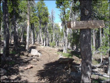
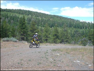
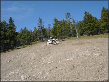
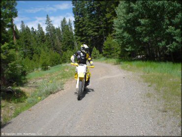
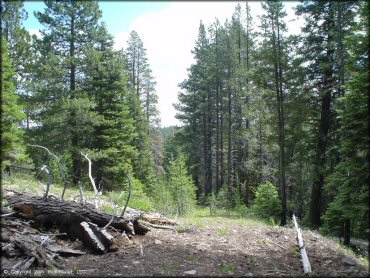
Crane Mountain Trail Photo
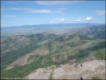
Scenic views like this can be found throughout the area.
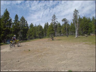
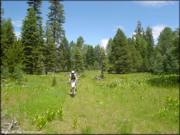
Crane Mountain Trail Photo
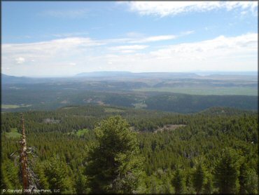
Crane Mountain Trail Photo
Crane Mountain Trail Photo
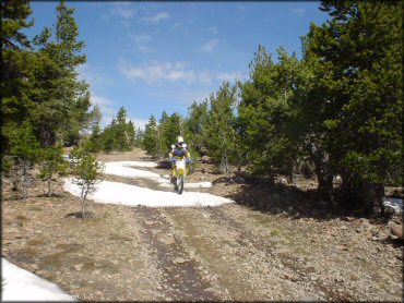
We visited this area in July and some portions were still snow covered.
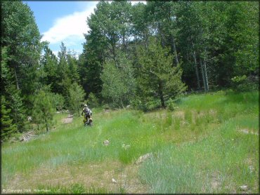
Crane Mountain Trail Photo
Trails like this are often closed due to snow well until late summer
Crane Mountain Trail Photo
Crane Mountain Trail Photo
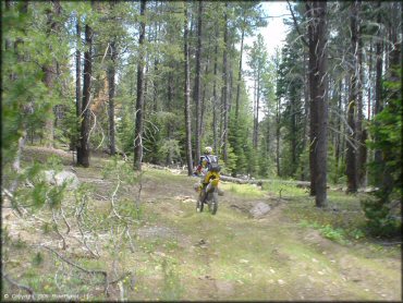
Crane Mountain Trail Photo
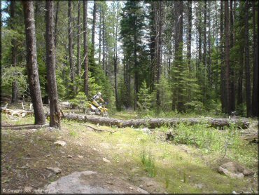
Fallen timber is plentiful in this area.
Crane Mountain Trail Photo
Crane Mountain Trail Photo
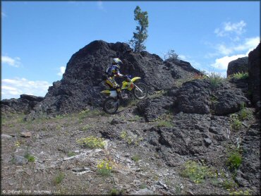
Doing a little rock crawling.
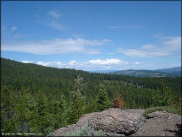
Crane Mountain Trail Photo
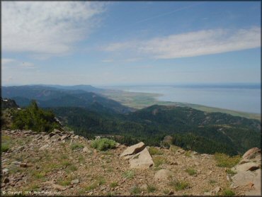
From here you can see the northern portion of Goose Lake. Most of the lake extends into California.
Crane Mountain Trail Photo
Crane Mountain Trail Photo
Crane Mountain Trail Photo
Crane Mountain Trail Photo
Crane Mountain Trail Photo
RIDER COMMENTS & REVIEWS