 |
      |
| Home > South Dakota > Baja ORV |
Baja ORV Area
Saturday, May 10, 2025
| Other Names | Buffalo Gap National Grasslands, Wall Ranger District, Hurley Butte, White River, Badlands |
| Last Known Status | Open |
This remote location offers about 480 acres of open play areas and several smooth, designated hardpacked 4x4 trails to explore. The terrain primarily consists of flat, open prairie grasslands but there are some steep and rugged hillclimbs if you are looking for a challenge.
The area is open year-round but during spring thaw or wet weather the soil can get very muddy and should be avoided since there are no trees or large rocks to attach a winch should you get stuck.
Camping is permitted and there is plenty of turnaround room for large trailers. There is no fee charged for camping or riding but there are no amenities except for an informational kiosk located near the main entrance. Bring shade and water.
Badlands Grocery is located about 6 miles east in the town of Interior. The town also has a couple cafes that include the Wagon Wheel, Cowboy Corner (lunch on weekdays, dinner on Friday and Saturday), and the Horseshoe Bar. Badlands/White River KOA is just 10 miles away and offers a full service campground with RV sites, cabins, pool, store, food service for breakfast and dinner, and propane sales.
REGULATIONS
| Permit Required | No | |
| Dates Open | Year-Round | |
| Other ATV Stickers Accepted | Unknown | |
| Spark Arrestor | Yes | A spark arresting exhaust silencer or end cap is required for all vehicles. |
| Noise Limit | Yes | |
| Whip Flags | Not Required | |
| Maximum Vehicle Width | No Restriction | |
 Motorcycles & Dirt Bikes Motorcycles & Dirt Bikes | Permitted | |
 ATVs ATVs | Permitted | |
 UTV & SXS UTV & SXS | Permitted | |
 SUVs & Jeeps (registered) SUVs & Jeeps (registered) | Permitted | |
| Dune Buggy & Sand Rail 4x4 (unregistered) | Permitted | |
| 2 Stroke Engines | No Restriction | |
 Camping Camping | No Restriction | (camp anywhere) |
 Campfires Campfires | ||
| Night Riding | Unknown | |
| Trail Blazing | Permitted | |
| Rule Enforcement |
TERRAIN
| Approx Size | 480 acres (1 sq mi) | |
| Climate Type | Plains | |
| Elevation | 2400 to 2450 ft. | |
| Trail Maintenance | Marked, Not Rated, Lightly Maintained | |
| Loose Dirt |  Little Little | |
| Hard Pack |  Mostly Mostly | |
| Sand |  None None | |
| Mud | Little | |
| Dust |  Some Some | |
| Rocks | Some | |
| Trees | None | |
| Steep Hills | Some | |
| Water Crossings | None | |
| Small Jumps | None | |
| Large Jumps | None | |
| Single Track | None | |
| Hazards |  Few Few | (hazards assumed marked but use caution) |
 Novice Novice | Mostly | |
 Amateur Amateur | Some | |
 Expert Expert | Little |
TYPE OF AREA
| Area | Motorized Trails |
| Land | National Forest |
GPS POINTS


KEY SERVICES
 Gasoline Gasoline | 1-5 Miles (E) | Cowboy Corner (605) 433-5333 |
| Diesel | 1-5 Miles (E) | Cowboy Corner (605) 433-5333 |
 Water Water | 1-5 Miles (E) | Badlands Motel and Campground (800) 388-4643 |
 RV Hookup RV Hookup | 1-5 Miles (E) | Badlands Motel and Campground (800) 388-4643 |
 RV Disposal RV Disposal | 1-5 Miles (E) | Badlands Motel and Campground (800) 388-4643 |
| Campground | 5-20 Miles (E) | Cedar Pass Campground (605) 433-5460 |
 Conv Store Conv Store | 1-5 Miles (E) | Cowboy Corner (605) 433-5333 |
FEES & PASSES
| Parking | (None) |
| Entry | (None) |
| Riding | (None) |
| Camping | (None) |
RATINGS
| Our Rating |  Good Good |
| Recommended Stay | Full Day |
| Comments | (Scroll Down For Rider Reviews & Comments) |
DRIVING DIRECTIONS
| Nearest City | Interior, SD | ||
| From: Rapid City, SD
1) Take I-90 East to Exit 110 2) Turn right (south) off the exit ramp onto SR-240, continue about 11 miles 3) Turn right (south) onto CR-C509/Conta Road, continue about 9 miles 4) Turn left (east) onto SR-44, continue about 5 miles 5) Staging area is on the left (north). |


OFFICIAL CONTACTS
| Contact Info | Buffalo Gap National Grasslands - Wall Ranger District 708 Main Street Wall, SD 57790 (605) 279-2125 nnf_info@usda.gov www.fs.usda.gov |
Baja ORV Trail Photo
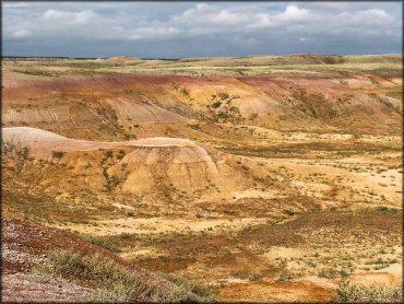
Photo Submitted 8/4/2018 (Thanks!)
Baja ORV Trail Photo
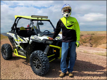
Photo Submitted 8/4/2018 (Thanks!)
Baja ORV Trail Photo
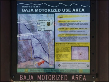
Photo Submitted 7/16/2019 (Thanks!)
Baja ORV Trail Photo
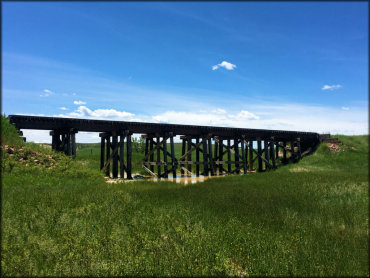
Photo Submitted 7/16/2019 (Thanks!)
Baja ORV Trail Photo
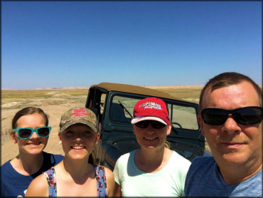
Photo Submitted 7/30/2016 (Thanks!)
RIDER COMMENTS & REVIEWS