 |
      |
| Home > Virginia > Pocahontas |
Pocahontas OHV Trail
Saturday, May 10, 2025
| Other Names | Spearhead Trails, OP Trail, Original Pocahontas OHV Trail System |
| Last Known Status | Open |
The Pocahontas Trail (not to be confused with the Pocahontas Trail System in West Virginia) is part of five new trail systems in Virginia that cater to ATVs and UTVs. This trail system offers miles of long loops to explore, plus 10 miles of pure single track for dirt bikes.
All trails are marked and rated and offer a good mix of rugged to easy terrain, mud puddles and light to moderate elevation changes. There are many scenic viewpoints throughout this trail system that offer some spectacular views of rolling wooded hills and mountains.
Camping with direct access can be found at Trailhead ATV Resort, which also features cabin and cottage rentals, a coin operated laundromat and camp store stocked with cold drinks, ice, groceries, firewood, snacks, apparel and trail permits.
Free day use parking with restooms and gazebos can be found near the resort at Boissevain Park. A smaller parking area can be found a few miles east near the town of Pocahontas.
A permit is required to ride this trail system which can be picked up at Trailhead ATV Resort, online or at nearby vendors.
REGULATIONS
| Permit Required | Yes | Spearhead Trails User Permit Sticker |
| Dates Open | Daily sunrise to sunset. | |
| Other ATV Stickers Accepted | Unknown | |
| Spark Arrestor | Yes | A spark arresting exhaust silencer or end cap is required for all vehicles. |
| Noise Limit | Yes | |
| Whip Flags | Not Required | |
| Maximum Vehicle Width | No Restriction | |
 Motorcycles & Dirt Bikes Motorcycles & Dirt Bikes | Permitted | |
 ATVs ATVs | Permitted | |
 UTV & SXS UTV & SXS | Permitted | |
 SUVs & Jeeps (registered) SUVs & Jeeps (registered) | Prohibited | |
| Dune Buggy & Sand Rail 4x4 (unregistered) | Prohibited | |
| 2 Stroke Engines | No Restriction | |
| MX Helmet Required | Yes | |
 Camping Camping | Prohibited | |
 Campfires Campfires | Prohibited | |
| Night Riding | No | riding permitted from dawn to dusk |
| Trail Blazing | Prohibited | stay on trail |
| Alcohol | Prohibited | |
| Rule Enforcement | ||
| Comment | No doubling up - No passengers on any ATV unless the ATV is manufactured for the driver and a passenger. Blaze orange vests encouraged during hunting season. | |
TYPE OF AREA
| Area | Motorized Trails |
| Land | County Land |
FEES & PASSES
| Parking | (None) |
| Entry | (None) |
| Riding | Yes ($30.00 per rider) Annual Pass - $60 (if purchased online add $3). Resident Annual Pass - $30; Day Pass - $30, Youth 12 and under - $33 |
| Camping | Yes Tent: $60.00 RV: $60.00 Addtl. Vehicle: $0.00 Trailhead ATV Resort Camping Fee - Sun through Wednesday $50/night; Thurs through Sat $60/night, Holidays - $70/night. Call for weekly rates. |
| Comment | All riders, drivers, passengers and bicyclists must have a valid Spearhead Trails sticker affixed to the left side of helmet. |
RATINGS
| Our Rating |  Good Good |
| Recommended Stay | Full Day |
| Comments | (Scroll Down For Rider Reviews & Comments) |
DRIVING DIRECTIONS
| Nearest City | Pocahontas, VA | ||
| Address | Miners Park Lane, Bluefield, VA 24605 | ||
| From: Roanoke, VA
1) Take I-81 South to Exit 72 2) Merge onto I-77 North to Exit 1 3) Merge onto US-52 north/Cumberland Road, continue 8.7 miles 4) Take exit for College Ave, continue about 6 miles 5) Turn left (west) onto Big Branch Road, continue 4.2 miles 6) Turn right (north-east) onto SR-644, continue 1.3 miles 7) Staging area is on the left (north). |


OFFICIAL CONTACTS
| Contact Info | Spearhead Trails P.O. Box 1594 Coeburn, VA 24230 (276) 807-7581 (276) 220-9875 info@spearheadtrails.com spearheadtrails.com |
| Contact Info | Trailhead ATV Resort 65 Miners Park Lane Bluefield, VA 24605 (276) 945-3089 info@trailheadatvresort.com trailheadatvresort.com |
| Comment | Campground with direct trail access and UTV rentals. |
Pocahontas Trail Photo
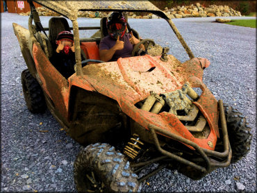
Photo Submitted 11/20/2017 (Thanks!)
ADD PHOTOS
TERRAIN
| Approx Size | 1,800 acres (3 sq mi) | |
| Miles Of Trail | 94 | |
| Climate Type | Forest | |
| Elevation | 2500 to 2800 ft. | |
| Trail Maintenance | Marked, Rated, Heavily Maintained | |
| Loose Dirt |  Little Little | |
| Hard Pack |  Mostly Mostly | |
| Sand | Little | |
| Mud |  Some Some | |
| Dust | Some | |
| Rocks | Little | |
| Trees |  Many Many | |
| Steep Hills |  Few Few | |
| Water Crossings | Some | |
| Small Jumps |  None None | |
| Large Jumps | None | |
| Berms | Some | |
| Sand/Gravel Pits | None | |
| Single Track | Some | |
| Roads | Few | |
| Intersections | Some | |
| Shade | Many | |
| Hazards | Few | (hazards assumed marked but use caution) |
 Novice Novice | Some | |
 Amateur Amateur | Mostly | |
 Expert Expert | Little |
GPS POINTS


KEY SERVICES
 Gasoline Gasoline | 1-5 Miles (S) | Crazy Horse Gas Station (276) 945-2671 |
| Diesel | 1-5 Miles (S) | Crazy Horse Gas Station (276) 945-2671 |
 Water Water | 1-5 Miles (E) | Real McCoy Cabins (276) 945-3106 |
 RV Hookup RV Hookup | Pocahontas, VA | |
 RV Disposal RV Disposal | Pocahontas, VA | |
| Campground | 1-5 Miles (E) | Real McCoy Cabins (276) 945-3106 |
 Conv Store Conv Store | Pocahontas, VA |
RIDER COMMENTS & REVIEWS