 |
      |
| Home > Washington > Mission Ridge |
Mission Ridge
Saturday, May 10, 2025
| Other Names | Okanogan–wenatchee National Forest, Wenatchee River Ranger District, Devil's Gulch, Devils Gulch, Tronsen Ridge, Horse Lake Mountain, Sand Creek, Red Hill, Ruby Creek, Beehive Reservoir, Blewett Pass |
| Last Known Status | Open |
This trail system offers about 50 miles of challenging single track trails. The trails are mostly smooth and hardpacked but are geared for the advanced rider due to steep climbs and narrow ridge tops with long dropoffs.
Most of trails follow creeks and offer some nice mountain and forest views. Some of the trails are open year-round but Red Hill, Tronsen Ridge and Tronsen Meadow trails close seasonally beginning October 15 through June 15 for elk calving season.
REGULATIONS
| Permit Required | Yes | WA ORV Tab and Northwest Forest Pass or Day Pass |
| Dates Open | Year-Round | |
| Other ATV Stickers Accepted | Unknown | |
| Spark Arrestor | Yes | A spark arresting exhaust silencer or end cap is required for all vehicles. |
| Noise Limit | Yes (105 dB) | |
| Whip Flags | Not Required | |
| Maximum Vehicle Width | ||
 Motorcycles & Dirt Bikes Motorcycles & Dirt Bikes | Permitted | |
 ATVs ATVs | Prohibited | |
 UTV & SXS UTV & SXS | Prohibited | |
 4x4 & Jeeps (registered) 4x4 & Jeeps (registered) | Prohibited | |
| Dune Buggy & Sand Rail 4x4 (unregistered) | Prohibited | |
| 2 Stroke Engines | No Restriction | |
| MX Helmet Required | Yes | |
 Camping Camping | Some Areas | (camp in developed sites only) |
 Campfires Campfires | Some Areas | (permitted in developed campsites only) |
| Night Riding | Unknown | Not Recommended |
| Trail Blazing | Prohibited | stay on trail |
| Rule Enforcement |
Advertisement
TYPE OF AREA
| Area | Motorized Trails |
| Land | National Forest |
FEES & PASSES
| Parking | (None) |
| Entry | (None) |
| Riding | (None) |
| Camping | (None) |
RATINGS
| Our Rating |  Good Good |
| Recommended Stay | Full Day |
| Comments | (Scroll Down For Rider Reviews & Comments) |
DRIVING DIRECTIONS
| Nearest City | Cashmere, WA | ||
| Address | Mission Creek Road, Cashmere, WA 98815 | ||
| From: Cashmere, WA
1) Take Mission Creek Road south about 10 miles 2) Devil's Gulch Staging Area is on the right (west). For Beehive Staging Area: 3) Continue south past Devil's Gulch Staging Area 7.5 miles 4) Turn right (south) to stay on Mission Creek Road, continue .7 miles 5) Turn left onto Liberty Beehive Road, continue .2 miles 6) Turn right (south) onto Beehive Road, continue .4 miles 7) Staging area is on the right (west). |


OFFICIAL CONTACTS
| Contact Info | Okanogan–wenatchee National Forest 215 Melody Lane Wenatchee, WA 98801 (509) 664-9200 mailroom_r6_okanogan@fs.fed.us mailroom_r6_wenatchee@fs.fed.us www.fs.usda.gov |
| Contact Info | Washington State Department of Licensing (360) 902-3770 titles@dol.wa.gov www.dol.wa.gov |
| Comment | WA ORV Tab Info |
Mission Ridge Trail Photo
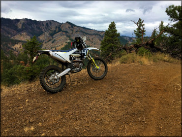
Photo Submitted 9/26/2017 (Thanks!)
ADD PHOTOS
TERRAIN
| Miles Of Trail | 50 | |
| Climate Type | Forest | |
| Elevation | 2600 to 4300 ft. | |
| Trail Maintenance | Marked, Not Rated, Lightly Maintained | |
| Loose Dirt |  Little Little | |
| Hard Pack |  Mostly Mostly | |
| Sand | Little | |
| Mud | Little | |
| Dust | Little | |
| Rocks |  Some Some | |
| Trees |  All All | |
| Steep Hills |  Many Many | |
| Water Crossings |  Few Few | |
| Small Jumps |  None None | |
| Large Jumps | None | |
| Berms | Some | |
| Sand/Gravel Pits | None | |
| Single Track | All | |
| Roads | Few | |
| Shade | Many | |
| Hazards | Few | (hazards assumed marked but use caution) |
 Novice Novice | Little | |
 Amateur Amateur | Mostly | |
 Expert Expert | Some |
GPS POINTS

KEY SERVICES
 Gasoline Gasoline | 30+ Miles (NE) | Shell (509) 664-3821 |
| Diesel | 30+ Miles (NE) | Shell (509) 664-3821 |
 Water Water | 30+ Miles (S) | Ellensburg KOA (509) 925-9319 |
 RV Hookup RV Hookup | 30+ Miles (S) | Ellensburg KOA (509) 925-9319 |
 RV Disposal RV Disposal | 30+ Miles (S) | Ellensburg KOA (509) 925-9319 |
| Campground | On Site | |
 Conv Store Conv Store | 30+ Miles (NE) | Shell (509) 664-3821 |
RIDER COMMENTS & REVIEWS