 |
      |
| Home > Washington > Gifford Pinchot |
Gifford Pinchot
Sunday, November 30, 2025
| Other Names | High Lakes and Blue Lake Trail System, Gifford Pinchot OHV Area, Gifford Pinchot National Forest, Cowlitz Valley Ranger District, Blue Lake, Bishop Mountain, Juniper Ridge, Burley Mountain, Jumbo Peak, Sunrise Peak, Chain of Lakes Campground, Horsehoe Lake Campground, Table Mountain, Badger Peak, Craggy Peak, Adams Fork Campground, Dark Divide, Cispus River Valley, Tongue Mountain. |
| Last Known Status | Closed For Season |
This large trail system primarily consists hundreds of miles of designated single track motorcycle trails and while it is mainly geared for the experienced rider there are some spots that have some beginner friendly trails that are wide enough for ATVs.
There are numerous campgrounds with direct trail access but the North Fork Campground provides access to the beginner friendly Valley Trail, a 16.7 mile long hard packed single track motorcycle trail that follows Forest Service Road 23 and heads south, eventually tying into Cat Creek Campground, which has a small trail loop.
Overall, this place is best explored on dirt bikes. The trail that is open to ATVs begins at the Blue Lake ORV Trailhead and ends at Forest Road 78.
REGULATIONS
| Permit Required | Yes | WA ORV Tab and Northwest Forest Pass** |
| Dates Open | April through November, weather permitting | |
| Other ATV Stickers Accepted | Unknown | |
| Spark Arrestor | Yes | A spark arresting exhaust silencer or end cap is required for all vehicles. |
| Noise Limit | Yes (105 dB) | |
| Whip Flags | Not Required | |
| Maximum Vehicle Width | Yes (50 inches) | has entrance gate and narrow terrain designated ATV trails limited to 50" or less in width |
 Motorcycles & Dirt Bikes Motorcycles & Dirt Bikes | Permitted | street legal motorcycles permitted on Forest Service Roads |
 ATVs ATVs | Some Areas | (maximum width 50 inches) permitted at Blue Lake ORV Trailhead and ends at Forest Road 78 |
 UTV & SXS UTV & SXS | Some Areas | Not Recommended (maximum width 50 inches) permitted at Blue Lake ORV Trailhead and ends at Forest Road 78 |
 4x4 & Jeeps (registered) 4x4 & Jeeps (registered) | Prohibited | |
| Dune Buggy & Sand Rail 4x4 (unregistered) | Prohibited | |
| 2 Stroke Engines | No Restriction | |
| MX Helmet Required | Yes | |
 Camping Camping | Some Areas | (camp in developed sites only) |
 Campfires Campfires | Some Areas | (permitted in developed campsites only) |
| Night Riding | Unknown | Not Recommended |
| Trail Blazing | Prohibited | stay on trail |
| Rule Enforcement | ||
| Comment | ATVs are not allowed to ride from the North Fork Campground to the Valley Trail, only street legal motorcycles are. ATVs are generally not permitted on Forest Service Roads in the Gifford Pinchot National Forest. Most trails are very rugged and narrow. | |
TERRAIN
| Approx Size | 64,000 acres (100 sq mi) | |
| Miles Of Trail | 200 | |
| Climate Type | Forest | |
| Elevation | 1400 to 5000 ft. | |
| Trail Maintenance | Marked, Not Rated, Lightly Maintained | |
| Loose Dirt |  Mostly Mostly | |
| Hard Pack |  Some Some | |
| Sand |  None None | |
| Mud | Some | |
| Dust |  Little Little | |
| Rocks | Some | |
| Trees |  All All | |
| Steep Hills |  Many Many | |
| Water Crossings | Many | |
| Small Jumps |  Few Few | |
| Large Jumps | None | |
| Berms | Many | |
| Sand/Gravel Pits | None | |
| Single Track | Many | |
| Roads | Some | |
| Shade | Many | |
| Hazards | Few | (hazards assumed marked but use caution) |
 Novice Novice | Little | |
 Amateur Amateur | Mostly | |
 Expert Expert | Some |
TYPE OF AREA
| Area | Motorized Trails |
| Land | National Forest |
GPS POINTS

KEY SERVICES
 Gasoline Gasoline | 5-20 Miles (NW) | Chevron (360) 497-3256 |
| Diesel | 5-20 Miles (NW) | Chevron (360) 497-3256 |
 Water Water | On Site | North Fork, Blue Lake Creek, Adams Fork Campground have water |
 RV Hookup RV Hookup | 5-20 Miles (NW) | U-Fish RV Park (360) 497-7680 or (888) 830-7089 |
 RV Disposal RV Disposal | 5-20 Miles (NW) | U-Fish RV Park (360) 497-7680 or (888) 830-7089 |
| Campground | On Site | |
 Conv Store Conv Store | 5-20 Miles (NW) | Chevron (360) 497-3256 |
FEES & PASSES
| Parking | (None) |
| Entry | (None) |
| Riding | (None) |
| Camping | Yes Tent: $25.00 RV: $25.00 Addtl. Vehicle: $8.00 North Fork Campground Fee |
| Comment | Blue Lake Campground Fee - $20/night, $8/extra vehicle. Adams Fork Campground Fee - $25/night, $8/extra vehicle. Cat Creek Campground - $20/night, $8/extra vehicle |
RATINGS
| Our Rating |  Very Good Very Good |
| Recommended Stay | 3-5 Days |
| Comments | (Scroll Down For Rider Reviews & Comments) |
DRIVING DIRECTIONS
| Nearest City | Randle, WA | ||
| From: Olympia, WA
For North Fork Campground: 1) Take I-5 South to Exit 68 2) Turn left (east) off the exit ramp onto US-12, continue about 48 miles 3) Turn right (south) onto WA-131, continue 1 mile 4) Turn left (east) onto Woods Way, continue .25 miles 5) Veer left onto Cispus Road, continue about 11 miles (road name will change to NF-23) 6) Campground entrance is on the left (north). For Blue Lake Creek Campground: 7) Continue past the entrance for North Fork Campground on NF-23 about 4.5 miles 8) Campground entrance is on the left (east). For Adams Fork Campground: 9) Continue south past Blue Lake Creek Campground on NF-23 about 2.5 miles 10) Continue straight onto NF-21, continue 4.6 miles 11) Campground entrance is on the right (south). For Cat Creek Campground: 12) Continue east on NF-121 past Blue Lake Creek Campground 1.5 miles 13) Campground entrance is on the right. |


OFFICIAL CONTACTS
| Contact Info | Gifford Pinchot National Forest - Cowlitz Valley Ranger District 10024 US Hwy 12 Randle, WA 98377 (360) 497-1103 sm.fs.r6_gp_forest@usda.gov www.fs.usda.gov |
Gifford Pinchot Trail Photo
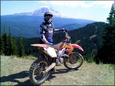
Photo Submitted 8/25/2015 (Thanks!)
Gifford Pinchot Trail Photo
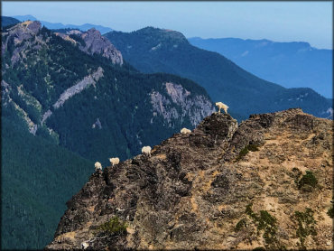
Photo Submitted 2/5/2023 (Thanks!)
Gifford Pinchot Trail Photo
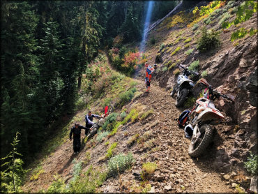
Photo Submitted 2/5/2023 (Thanks!)
Gifford Pinchot Trail Photo
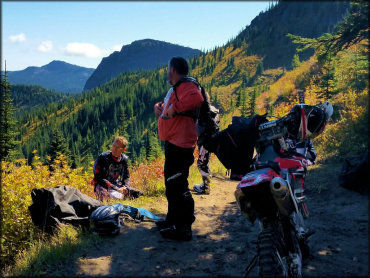
Photo Submitted 9/27/2016 (Thanks!)
Gifford Pinchot Trail Photo
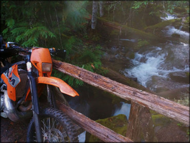
Photo Submitted 9/1/2015 (Thanks!)
Gifford Pinchot Trail Photo
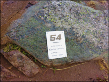
Photo Submitted 9/1/2015 (Thanks!)
RIDER COMMENTS & REVIEWS