 |
      |
| Home > Washington > Owl Mountain Trail |
Owl Mountain Trail
Wednesday, September 3, 2025
| Other Names | Colville National Forest, Three Rivers Ranger District, Owl Creek, Kerry Creek, Grouse Mountain, Onion Creek, Huckleberry Ridge, Little Boulder Creek |
| Last Known Status | Open |
Located close to the Canadian and Washington border, this offroad trail is about 7 miles long but offers numerous scenic views of mountains, creeks and deep woods vegetation. Expect to take at least 3-4 hours to complete the loop.
The trail is a mix of hardpack with some rugged sections, moderate to steep climbs, descends. The trails also winds through a short swampy section and there are a couple rocky climbs that have bypass routes. There is a nice scenic viewpoint at the northern part of the trail that makes for a good spot to take a break and the panoramic views.
Riders are advised to bring a chainsaw and shovel since the trail is not maintained by the Forest Service. Local clubs and volunteers clear the trail as needed, but the route is likely to be overgrown with tree branches and dense vegetation.
REGULATIONS
| Permit Required | Yes | WA ORV Tab |
| Dates Open | Year-Round | |
| Other ATV Stickers Accepted | Unknown | |
| Spark Arrestor | Yes | A spark arresting exhaust silencer or end cap is required for all vehicles. |
| Noise Limit | Yes | |
| Whip Flags | Not Required | |
| Maximum Vehicle Width | Yes (64 inches) | narrow terrain |
 Motorcycles & Dirt Bikes Motorcycles & Dirt Bikes | Permitted | |
 ATVs ATVs | Permitted | |
 UTV & SXS UTV & SXS | Permitted | (maximum width 64 inches) |
 4x4 & Jeeps (registered) 4x4 & Jeeps (registered) | Prohibited | |
| Dune Buggy & Sand Rail 4x4 (unregistered) | Prohibited | |
| 2 Stroke Engines | No Restriction | |
 Camping Camping | Some Areas | (camp in developed sites only) |
 Campfires Campfires | ||
| Night Riding | Unknown | |
| Trail Blazing | Prohibited | riders must stay on trail |
| Rule Enforcement |
TERRAIN
| Approx Size | 9,600 acres (15 sq mi) | |
| Miles Of Trail | 7 | |
| Climate Type | Forest | |
| Elevation | 3220 to 4600 ft. | |
| Trail Maintenance | Marked, Not Rated, Lightly Maintained | |
| Loose Dirt |  Little Little | |
| Hard Pack |  Mostly Mostly | |
| Sand |  None None | |
| Mud |  Some Some | |
| Dust | Little | |
| Rocks | Some | |
| Trees |  All All | |
| Steep Hills | Some | |
| Small Jumps | None | |
| Large Jumps | None | |
| Berms | None | |
| Sand/Gravel Pits | None | |
| Single Track | None | |
| Roads | Some | |
| Shade | All | |
| Hazards |  Few Few | (hazards assumed marked but use caution) |
 Novice Novice | Little | |
 Amateur Amateur | Mostly | |
 Expert Expert | Some |
TYPE OF AREA
| Area | Motorized Trails |
| Land | National Forest |
GPS POINTS


KEY SERVICES
 Gasoline Gasoline | Orient, WA | |
| Diesel | Orient, WA | |
 Water Water | Orient, WA | |
 RV Hookup RV Hookup | Orient, WA | |
 RV Disposal RV Disposal | Orient, WA | |
| Campground | Orient, WA | |
 Conv Store Conv Store | Orient, WA |
FEES & PASSES
| Parking | (None) |
| Entry | (None) |
| Riding | (None) |
| Camping | (None) |
RATINGS
| Our Rating |  Good Good |
| Recommended Stay | Full Day |
| Comments | (Scroll Down For Rider Reviews & Comments) |
DRIVING DIRECTIONS
| Nearest City | Orient, WA | ||
| Address | Little Boulder Creek Road, Kettle Falls, WA 99141 | ||
| From: Kettle Falls, WA
For the Eastern Trailhead: 1) Take Hwy 395 West across the Columbia River Bridge 2) Turn right to stay on Hwy 395, continue about 20 miles 3) Turn left (west) onto Eslick Road, continue 1.2 miles 4) Turn left (west) onto Little Boulder Creek Road, continue 2.6 miles 5) Continue straight onto FS Road 160, continue about 1 mile 6) Turn right (east) onto FS Road 150 (Kerry Creek Road), continue 5.15 miles 7) Turn left on FS Road 215, continue .7 miles 8) Turn left on FS Road 220, continue .9 miles 9) Look for small clearing on the left with faint tracks into the trees and small pile of rocks. This is the trailhead. For the Western Trailhead: 1) Continue on FS Road 160 for about 2 miles (go past Kerry Creek Road) 2) Look for trail forking to the right off main road into the trees. This is the trailhead. |


OFFICIAL CONTACTS
| Contact Info | Colville National Forest - Three Rivers Ranger District 255 W. 11th Avenue Kettle Falls, WA 99141 (509) 738-7700 mailroom_r6_colville@fs.fed.us www.fs.usda.gov |
| Contact Info | Tri-county Motorized Recreation Association 1675 Marble Valley Basin Road Addy, WA 99101 anneott@gmail.com anneott@centurytel.net |
| Comment | Local offroad club that maintains trails and hosts group rides. |
Owl Mountain Trail Photo
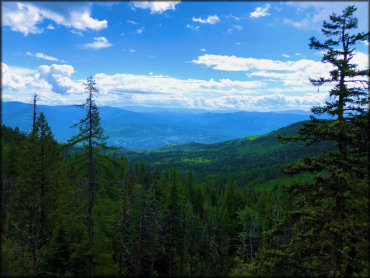
Photo Submitted 3/12/2020 (Thanks!)
Owl Mountain Trail Photo
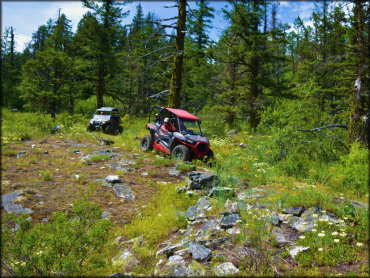
Photo Submitted 3/12/2020 (Thanks!)
Owl Mountain Trail Photo
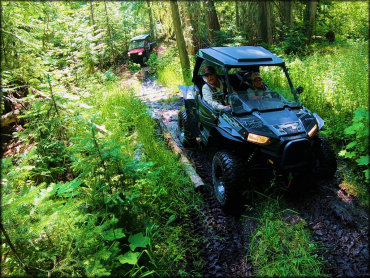
Photo Submitted 3/12/2020 (Thanks!)
Owl Mountain Trail Photo
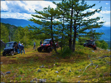
Photo Submitted 3/12/2020 (Thanks!)
Owl Mountain Trail Photo
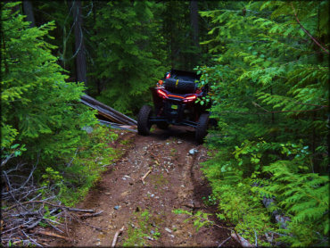
Photo Submitted 3/12/2020 (Thanks!)
Owl Mountain Trail Photo
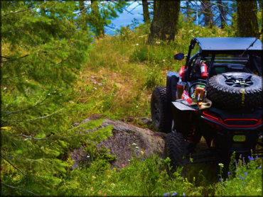
Photo Submitted 3/12/2020 (Thanks!)
Owl Mountain Trail Photo
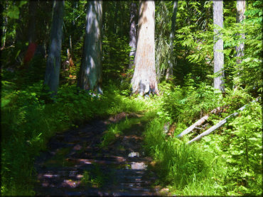
Photo Submitted 3/12/2020 (Thanks!)
Owl Mountain Trail Photo
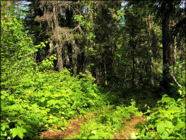
Photo Submitted 3/12/2020 (Thanks!)
Owl Mountain Trail Photo
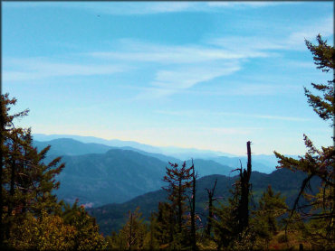
Photo Submitted 3/12/2020 (Thanks!)
Owl Mountain Trail Photo
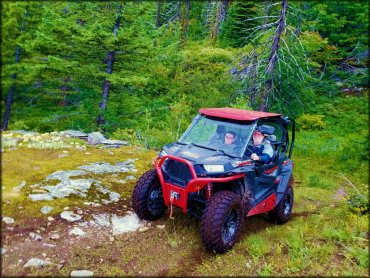
Photo Submitted 3/12/2020 (Thanks!)
Owl Mountain Trail Photo
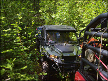
Photo Submitted 3/12/2020 (Thanks!)
RIDER COMMENTS & REVIEWS