 |
      |
| Home > Washington > Twin Sisters and Mack King |
Twin Sisters and Mack King Trails
Monday, August 11, 2025
| Other Names | Colville National Forest, Three Rivers Ranger District, King Mountain, Mack Mountain, Deadman Creek, Jackknife Mountain, Davis Lake, Cow Camp |
| Last Known Status | Open |
This part of the Colville National Forest consists of two 4x4 trails that can be used to form a long loop. The Twin Sisters Trail is about 10 miles long and is the northern route. This trail is described as moderately difficult with some obstacles that can be bypassed. Most of the trail winds through the trees but has several open areas offering nice viewpoints. This trail is occasionally maintained by the Forest Service however chainsaws are recommended as there may be tree branches and dense vegetation blocking the route.
The Mack King Trail is the southern route and is rated as more difficult due to steep hillside crossings that require advanced driver skills. The eastern half of the trail is most difficult, compared to the western portion. To avoid the most difficult portions, it is suggested that beginners start the Mack King Trail from the western trailhead off Albian Hill Road and proceed to the view point and return.
Both trails offers scenic vistas with panoramic views. If traveling the Twin Sisters Trail from the east go 4.4 miles in (or 4.7 miles from the west) and look for a turn off that heads north. Roughly a mile in there will be a parking area below the peak. This is where the Twin Sisters Lookout used to be located (do not drive to the top due to the large number of nails still on the ground). Park and hike to the old lookout site which has excellent views.
If riding the Mack King Trail from the eastern trailhead go 4.8 miles (or from the west 3.2 miles) there is a turn off that leads in an easterly direction for approximately 400 feet to a parking area. Park here, and hike approximately 200 feet further east, uphill toward the rock outcrop. Approaching the outcrop from the northern side, climb to the top for outstanding views of the region.
REGULATIONS
| Permit Required | Yes | WA ORV Tab |
| Dates Open | Year-Round | |
| Other ATV Stickers Accepted | Unknown | |
| Spark Arrestor | Yes | A spark arresting exhaust silencer or end cap is required for all vehicles. |
| Noise Limit | Yes | |
| Whip Flags | Not Required | |
| Maximum Vehicle Width | No Restriction | |
 Motorcycles & Dirt Bikes Motorcycles & Dirt Bikes | Permitted | |
 ATVs ATVs | Permitted | |
 UTV & SXS UTV & SXS | Permitted | |
 4x4 & Jeeps (registered) 4x4 & Jeeps (registered) | Permitted | |
| Dune Buggy & Sand Rail 4x4 (unregistered) | Permitted | |
| 2 Stroke Engines | No Restriction | |
 Camping Camping | Some Areas | (camp in developed sites only) |
 Campfires Campfires | ||
| Night Riding | Unknown | |
| Trail Blazing | Prohibited | stay on trails |
| Rule Enforcement |
TERRAIN
| Miles Of Trail | 18 | |
| Climate Type | Forest | |
| Elevation | 4300 to 6000 ft. | |
| Trail Maintenance | Marked, Not Rated, Lightly Maintained | |
| Loose Dirt |  Little Little | |
| Hard Pack |  Mostly Mostly | |
| Sand |  None None | |
| Mud |  Some Some | |
| Dust | Little | |
| Rocks | Some | |
| Trees |  All All | |
| Steep Hills | Some | |
| Water Crossings |  Few Few | |
| Small Jumps | None | |
| Large Jumps | None | |
| Berms | None | |
| Sand/Gravel Pits | None | |
| Single Track | None | |
| Roads | Some | |
| Shade | All | |
| Hazards | Few | (hazards assumed marked but use caution) |
 Novice Novice | Little | |
 Amateur Amateur | Mostly | |
 Expert Expert | Some |
TYPE OF AREA
| Area | Motorized Trails |
| Land | National Forest |
GPS POINTS


KEY SERVICES
 Gasoline Gasoline | Kettle Falls, WA | |
| Diesel | Kettle Falls, WA | |
 Water Water | Kettle Falls, WA | |
 RV Hookup RV Hookup | Kettle Falls, WA | |
 RV Disposal RV Disposal | Kettle Falls, WA | |
| Campground | Kettle Falls, WA | |
 Conv Store Conv Store | Kettle Falls, WA |
FEES & PASSES
| Parking | (None) |
| Entry | (None) |
| Riding | (None) |
| Camping | (None) |
RATINGS
| Our Rating |  Good Good |
| Recommended Stay | Full Day |
| Comments | (Scroll Down For Rider Reviews & Comments) |
DRIVING DIRECTIONS
| Nearest City | Kettle Falls, WA | ||
| Address | Deadman Creek Road, Kettle Falls, WA 99141 | ||
| From: Kettle Falls, WA
1) Take Hwy 395 West across the Columbia River Bridge 2) Turn right to stay on Hwy 395, continue about 6 miles 3) Turn left (west) onto Deadman Creek Road, continue about 4 miles 4) Veer left to stay on Deadman Creek Road, continue 2.3 miles 5) Park and unload at Cow Camp. For Northern Trailhead: 6) From Cow Camp continue on Deadman Creek Road 2.3 miles 7) Turn right (north-west) on FS Road, #800, continue 8.5 miles 8) Turn left (west) onto FS Road #822, continue about .25 miles toward quarry. For Eastern Trailhead: 6) Continue west past Cow Camp 4.9 miles 7) Turn right (north) onto FS Road #520, continue 2.5 miles toward trailhead. For Western Trailhead: 8) Continue west past FS Road #520 7.2 miles 9) Trailhead is on the right (east). |


OFFICIAL CONTACTS
| Contact Info | Colville National Forest - Three Rivers Ranger District 255 W. 11th Avenue Kettle Falls, WA 99141 (509) 738-7700 mailroom_r6_colville@fs.fed.us www.fs.usda.gov |
| Contact Info | Tri-county Motorized Recreation Association 1675 Marble Valley Basin Road Addy, WA 99101 anneott@gmail.com anneott@centurytel.net |
| Comment | Local offroad club that maintains trails and hosts group rides. |
Twin Sisters and Mack King Trail Photo
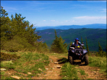
Photo Submitted 3/12/2020 (Thanks!)
Twin Sisters and Mack King Trail Photo
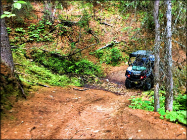
Photo Submitted 3/12/2020 (Thanks!)
Twin Sisters and Mack King Trail Photo
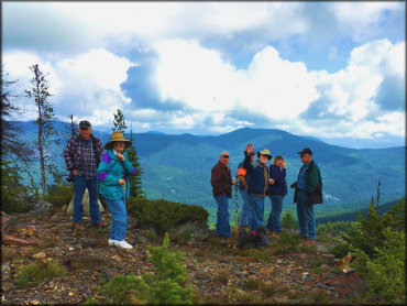
Photo Submitted 3/12/2020 (Thanks!)
Twin Sisters and Mack King Trail Photo
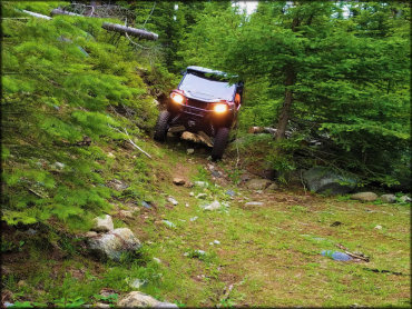
Photo Submitted 3/12/2020 (Thanks!)
Twin Sisters and Mack King Trail Photo
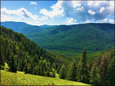
Photo Submitted 3/12/2020 (Thanks!)
Twin Sisters and Mack King Trail Photo
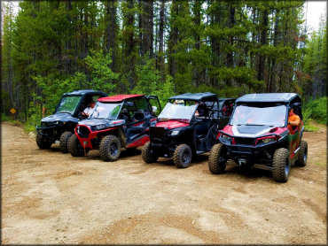
Photo Submitted 3/12/2020 (Thanks!)
Twin Sisters and Mack King Trail Photo
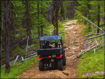
Photo Submitted 3/12/2020 (Thanks!)
Twin Sisters and Mack King Trail Photo
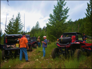
Photo Submitted 3/12/2020 (Thanks!)
Twin Sisters and Mack King Trail Photo
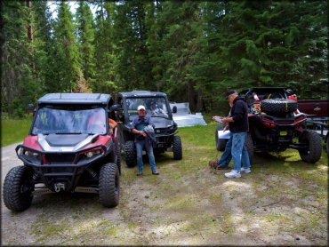
Photo Submitted 3/12/2020 (Thanks!)
Twin Sisters and Mack King Trail Photo
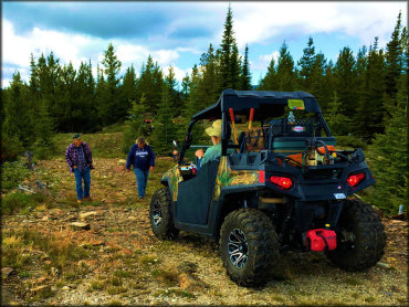
Photo Submitted 3/12/2020 (Thanks!)
Twin Sisters and Mack King Trail Photo
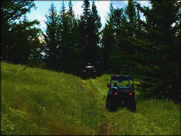
Photo Submitted 3/12/2020 (Thanks!)
Twin Sisters and Mack King Trail Photo
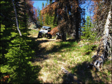
Photo Submitted 3/12/2020 (Thanks!)
Twin Sisters and Mack King Trail Photo
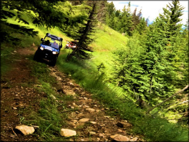
Photo Submitted 3/12/2020 (Thanks!)
Twin Sisters and Mack King Trail Photo
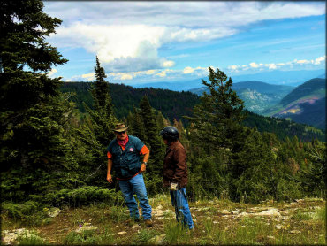
Photo Submitted 3/12/2020 (Thanks!)
RIDER COMMENTS & REVIEWS