 |
      |
| Home > West Virginia > Indian Ridge |
Indian Ridge ATV Trails
Saturday, May 10, 2025
| Other Names | Windmill Gap Branch, Ashland, Greenbrier Hollow, Hatfield McCoy, McDowell County |
| Last Known Status | Open |
One of the newest additions to the Hatfield McCoy Trail System, this area has about 63 miles of trails. Unlike the other trail systems, permits are not available for purchase at the trailhead but must be obtained prior to arrival. This trail system has some moderately challenging trails but nothing too difficult.
Camping is not permitted at the staging area but nearby Ashland Resort offers direct trail access plus sells Hatfield-McCoy trail permits. The resort also has plenty of cabins, cottages, lodges, RV and tent sites plus a general store that carries basic groceries and some ATV supplies.
REGULATIONS
| Permit Required | Yes | Hatfield-McCoy Trail Permit |
| Dates Open | Daily Year-Round | |
| Other ATV Stickers Accepted | No | All riders, drivers and passengers must have a valid Hatfield McCoy Trails Permit affixed to the helmet. |
| Spark Arrestor | Yes | A spark arresting exhaust silencer or end cap is required for all vehicles. |
| Noise Limit | Yes | |
| Whip Flags | Not Required | |
| Maximum Vehicle Width | No Restriction | |
 Motorcycles & Dirt Bikes Motorcycles & Dirt Bikes | Permitted | |
 Four Wheelers Four Wheelers | Permitted | |
 UTV & SXS UTV & SXS | Permitted | |
 4x4 & Jeeps (registered) 4x4 & Jeeps (registered) | Prohibited | |
| Dune Buggy & Sand Rail 4x4 (unregistered) | Prohibited | |
| 2 Stroke Engines | No Restriction | |
| MX Helmet Required | Yes | |
 Camping Camping | Prohibited | camping not permitted on trail system or at staging areas |
 Campfires Campfires | Prohibited | |
| Night Riding | No | riding hours are from sunrise to sunset |
| Trail Blazing | Prohibited | no trailblazing |
| Alcohol | Prohibited | |
| Rule Enforcement | Yes | Dedicated Rangers/Officers Armed OfficersJeep/SUV Patrol Trails patrolled by WV DNR Police Officers. |
TERRAIN
| Miles Of Trail | 63 | |
| Climate Type | Forest | |
| Elevation | 2000 to 2800 ft. | |
| Trail Maintenance | Marked, Rated, Heavily Maintained | |
| Loose Dirt |  Little Little | |
| Hard Pack |  Some Some | |
| Sand |  None None | |
| Mud | Some | |
| Dust | Little | |
| Rocks | Little | |
| Trees |  All All | |
| Steep Hills |  Few Few | |
| Small Jumps | None | |
| Large Jumps | Few | |
| Berms | None | |
| Single Track | Few | |
| Hazards | Few | (hazards assumed marked but use caution) |
 Novice Novice | Some | |
 Amateur Amateur |  Mostly Mostly | |
 Expert Expert | Little |
TYPE OF AREA
| Area | Motorized Trails |
| Land | County Land |
GPS POINTS


KEY SERVICES
 Gasoline Gasoline | 1-5 Miles (W) | Maybeury Food Mart (304) 827-5885 |
| Diesel | 1-5 Miles (W) | Maybeury Food Mart (304) 827-5885 |
 Water Water | On Site | Ashland Resort (304) 862-2322 |
 RV Hookup RV Hookup | On Site | Ashland Resort (304) 862-2322 |
 RV Disposal RV Disposal | On Site | Ashland Resort (304) 862-2322 |
| Campground | On Site | Ashland Resort (304) 862-2322 |
 Conv Store Conv Store | On Site | Ashland Resort (304) 862-2322 |
FEES & PASSES
| Parking | (None) |
| Entry | (None) |
| Riding | Yes ($26.50 per rider) Non-Residents - $50/rider. If purchased online add $4/shipping and handling. |
| Camping | (None) |
| Comment | Permits are valid through December 31 of the year purchased. All riders, drivers and passengers must have a valid Hatfield McCoy Trails Permit affixed to the helmet. |
RATINGS
| Our Rating |  Excellent Excellent |
| Recommended Stay | Multi Week |
| Comments | (Scroll Down For Rider Reviews & Comments) |
DRIVING DIRECTIONS
| Nearest City | Bluefield, WV | ||
| From: Bluefield, WV
1) Take US-52 north about 18 mile 2) Make hard right onto CR-17, continue 6.5 miles to trailhead. |


OFFICIAL CONTACTS
| Contact Info | Hatfield Mccoy Trails Welcome Center P.O. Box 146 Man, WV 25635 (800) 592-2217 info@trailsheaven.com trailsheaven.com |
| Comment | Mailing Address |
| Contact Info | Hatfield Mccoy Trails Welcome Center 179 Rita Mall Road Man, WV 25635 |
| Comment | Physical Address |
| Contact Info | Ashland Resort HC 76, Box 681 Northfork, WV 24868 (800) 562-5141 (304) 862-2322 managers@atvresort.com atvresort.com |
Indian Ridge Trail Photo
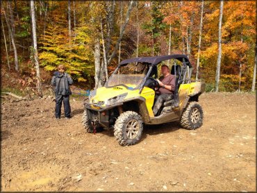
Photo Submitted 3/3/2015 (Thanks!)
Indian Ridge Trail Photo
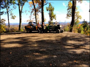
Photo Submitted 3/3/2015 (Thanks!)
Indian Ridge Trail Photo
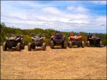
Photo Submitted 2/18/2014 (Thanks!)
Indian Ridge Trail Photo
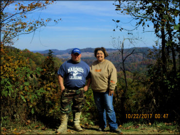
Photo Submitted 10/29/2017 (Thanks!)
RIDER COMMENTS & REVIEWS